ARIZONA INTERACTIVE FIELD MAP
Inspect places, geology, access evidence and nearby context
The map keeps collecting leads, protected places and research occurrences visually distinct.
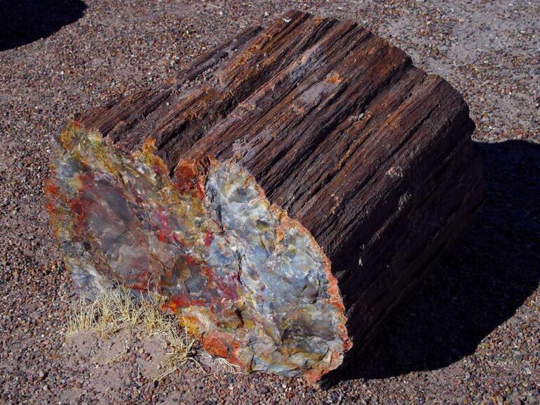
Rock and mineral reference images for Arizona
These are real reference photographs from the site media library, not photographs of the exact mapped sites. Always confirm mineral identity and collection permissions separately.

EXPLORE ARIZONA LOCALLY
Rockhounding near Arizona cities
Move from statewide discovery into nearby field regions and then into individual location guides. City pages rank nearby records by evidence status and distance instead of treating every geological occurrence as an open collecting site.
Arizona rockhounding regions and local areas
Regional pages group related geology and field opportunities without turning every mineral occurrence into a separate destination page.
Arizona location directory preview
Start with the current inventory, then open the complete searchable directory for all 243 records.
Bear Springs Badlands
Material or interest not verified in the available evidence · Graham
Black Hills Rockhound Area
Fire Agate · Graham
Round Mountain Rockhound Area
Material or interest not verified in the available evidence · Greenlee
La Posa Long Term Visitor Area
Material or interest not verified in the available evidence · La Paz
Signal Mountain Wilderness
Material or interest not verified in the available evidence · Maricopa
Burro Creek Recreation Site
Material or interest not verified in the available evidence · Mohave
Parker Canyon Lake
Material or interest not verified in the available evidence · Santa Cruz
Lynx Creek Gold Pan Day Use Area
Gold · Yavapai
Upper Burro Creek Wilderness
Material or interest not verified in the available evidence · Yavapai / Mohave
La Colorado Mine
Lead, Silver, Fluorite, Barite, Molybdenum, Copper
Bridal Veil Claim
Vanadium, Lead, Zinc, Copper
Aurora Mine
Vanadium, Lead, Silver
Lincoln Claim
Vanadium, Lead, Zinc, Copper
Cochrane Property
Vanadium, Lead, Zinc, Copper
Doyle Property
Vanadium, Lead, Zinc, Copper
Hieroglyphic Mountains Area
Vanadium, Lead, Zinc, Copper
Defiance Mine Apache Mine
Vanadium, Lead, Gold, Silver
Irene Or Liberty Deposit
Vanadium, Lead, Zinc, Copper
Palmer Property
Vanadium, Lead, Zinc, Copper
C and B Group Bywater Mine?
Lead, Zinc, Copper, Vanadium
Diana Railroad Claim
Vanadium, Lead, Zinc, Copper, Silver, Fluorite
Chocolate Mountains
Vanadium, Lead, Zinc, Copper
Cash Entry Claim
Vanadium, Lead, Zinc, Copper
St. Anthony Mine
Gold, Silver, Lead, Zinc, Copper, Vanadium
TRIP-READY SHORTLIST
Best-supported rockhounding sites in Arizona
This ranking favors current evidence, usable coordinates, navigation context and field readiness. It is not a popularity ranking and Conditional records still require verification.
Black Hills Rockhound Area
Fire Agate
Bear Springs Badlands
Material or interest not verified in the available evidence
Burro Creek Recreation Site
Material or interest not verified in the available evidence
La Posa Long Term Visitor Area
Material or interest not verified in the available evidence
Lynx Creek Gold Pan Day Use Area
Gold
Round Mountain Rockhound Area
Material or interest not verified in the available evidence
Signal Mountain Wilderness
Material or interest not verified in the available evidence
Upper Burro Creek Wilderness
Material or interest not verified in the available evidence
ARIZONA MATERIAL DISCOVERY
What can you find rockhounding in Arizona?
Counts come from the live state inventory. They describe records mentioning a material, not guaranteed legal collecting sites.
Copper
59 recordsCompare the strongest current examples, then open the individual guide for access and evidence status.
Gold
24 recordsCompare the strongest current examples, then open the individual guide for access and evidence status.
Fire Agate
3 recordsCompare the strongest current examples, then open the individual guide for access and evidence status.
Quartz & Crystals
2 recordsCompare the strongest current examples, then open the individual guide for access and evidence status.
Fossils
1 recordsCompare the strongest current examples, then open the individual guide for access and evidence status.
Turquoise
0 recordsCompare the strongest current examples, then open the individual guide for access and evidence status.
No strong examples are currently surfaced for this material.
Jasper & Chalcedony
0 recordsCompare the strongest current examples, then open the individual guide for access and evidence status.
No strong examples are currently surfaced for this material.
Petrified Wood
0 recordsCompare the strongest current examples, then open the individual guide for access and evidence status.
No strong examples are currently surfaced for this material.
LAND, CLAIMS & PERMISSION
Who controls the land matters more than the mineral pin
The state map’s land-status and claim layers are planning aids. Exact ownership, claims, protected-resource rules and current manager guidance still control field use.
BLM rockhound areas
Some Arizona BLM sites are specifically promoted for rockhounding, but posted boundaries, closures, quantity limits and current field-office guidance still control.
Mining claims
A public-land map does not cancel active mining claims or mineral rights. Check the exact parcel and claim situation before prospecting or removing material.
Wilderness and protected resources
Wilderness designation, vertebrate fossils, archaeological material and other protected resources can sharply limit or prohibit collection even where access is public.
National Forest land
Forest Service rules vary by district, material, method and claim status. Lynx Creek-type recreation areas should be treated as place-specific programs, not statewide permission.
Arizona State Trust Land
Recreation access and mineral collection are separate questions. Verify the current permit, parcel and mineral-rights rules before field use.
Desert travel
Heat, flash floods, rough roads and remote terrain are practical constraints. Route and weather planning belong in the same decision as collecting legality.
WHEN TO GO
Arizona rockhounding seasonal planner
Best desert window
Cooler temperatures make low-desert fieldwork more practical, though winter storms can affect higher elevations.
Spring transition
Excellent temperatures in many desert districts; watch wind and rising heat.
Heat management
Low-desert trips can become hazardous; favor higher elevations and short field windows.
Monsoon season
Extreme heat, lightning and flash flooding can make washes and remote roads dangerous.
Return to desert season
Cooling temperatures reopen many lower-elevation field options while higher country may already be cold.
ARIZONA FIELD KIT
A practical field kit for Arizona
Match equipment to the site and collecting method rather than carrying heavy tools by default.
Identification kit
Hand lens, magnet, notebook, scale, specimen bags and labels help preserve context and reduce guesswork.
River / gravel kit
Use sturdy footwear, gloves and eye protection. Check water level, access and disturbance rules before entering a stream or shoreline.
Geode / hard-rock kit
Eye protection and small hand tools are more useful than heavy equipment. Never enter mine workings or unstable cuts.
Fossil kit
Camera, scale, notebook and protective wrapping allow documentation without assuming removal is legal.
Panning kit
A basic pan, classifier and vial are enough for many recreational contexts; powered equipment can trigger different rules.
Navigation & safety
Carry offline mapping, water, weather layers and an emergency plan appropriate to remoteness and season.
COMMUNITY FIELD INTELLIGENCE
Recent Arizona field reports
Approved visitor reports add current observations without automatically changing a location’s legal or access status.
Open any location guide and use Share Your Story & Photos. Reports remain pending until admin approval.
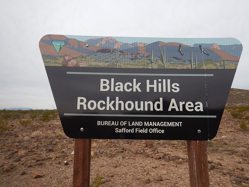
Arizona: two BLM rockhound areas versus recreational access landmarks
Arizona’s strongest publicly documented rockhounding starting points are named federal rockhound areas rather than random county-wide mineral pins. Desert climate, rough approach roads, claims and park restrictions still determine what is practical on the day of travel.
Black Hills: documented fire agate collecting
Black Hills Rockhound Area, north of Safford, is identified by the BLM Safford Field Office as a public rockhounding area for fire agate with no site fee or permit for the described recreational collecting. Follow signed boundaries and current BLM guidance. In summer the temperature can exceed 100°F; bring adequate drinking water and do not enter old workings.
Round Mountain: a separate BLM destination
Round Mountain Rockhound Area near Duncan is separately listed by BLM for rockhounding. The described approach involves a long dirt-road drive from Highway 70; validate road condition and the exact designated area before leaving pavement. Its permission cannot be transferred to neighboring land or mineral claims.
Access points are not mineral guarantees
Burro Creek Recreation Site and La Posa LTVA are recreation-management contexts. Paid camping, a trail, or a road-access marker does not establish collecting permission. Signal Mountain Wilderness adds wilderness-specific restrictions.
BLM collecting limits and protected materials
The BLM’s Arizona rockhounding guidance describes reasonable noncommercial hand collection and states a 25-pound daily and 250-pound annual general specimen limit; restrictions, claims, closures and special land designations take precedence. Vertebrate fossils and archaeological objects are not casual souvenirs. An orange-brown agate is not necessarily precious fire agate: compare Arizona identification guidance before describing a find.