PENNSYLVANIA INTERACTIVE FIELD MAP
Inspect places, geology, access evidence and nearby context
The map keeps collecting leads, protected places and research occurrences visually distinct.
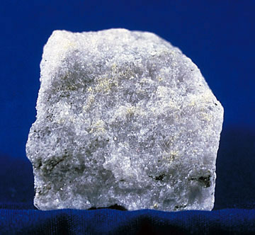
Rock and mineral reference images for Pennsylvania
These are real reference photographs from the site media library, not photographs of the exact mapped sites. Always confirm mineral identity and collection permissions separately.



TRIP-READY SHORTLIST
Best-supported rockhounding sites in Pennsylvania
This ranking favors current evidence, usable coordinates, navigation context and field readiness. It is not a popularity ranking and Conditional records still require verification.
Montour Preserve Fossil Pit
Devonian Mahantango Formation fossils including brachiopods, trilobites, corals and mollusks
Allegheny National Forest Casual Rock & Mineral Collection
common rocks and minerals for limited personal use
Bald Eagle State Forest Stone Permit Program
loose stone under district stone-sales permit
Forbes State Forest Loose Stone Permit Program
loose stone for personal collection under district permit
Swatara State Park Mahantango Fossil Site
Middle Devonian marine fossils including Phacops rana
PENNSYLVANIA MINERAL DISCOVERY
What can you find rockhounding in Pennsylvania?
The atlas mixes visitor programs, stronger collecting leads, protected environments and geological research. Material record counts are not promises that collecting is allowed. Verify the exact location and manager before taking anything.
Identify Pennsylvania rocks, minerals and fossils →
LAND, CLAIMS & PERMISSION
Who controls the land matters more than the mineral pin
The state map’s land-status and claim layers are planning aids. Exact ownership, claims, protected-resource rules and current manager guidance still control field use.
Montour fossil pit
Follow current manager rules; collecting permissions do not extend to all Mahantango exposures.
State forest stones
Bald Eagle and Forbes districts can require specific permits and limits.
Allegheny National Forest
Check federal land parcel, mineral estate, special designation and current orders.
Protected state parks
Presque Isle, Hickory Run and other natural sites restrict resource removal; Swatara requires current permission.
Mine hazards
Abandoned coal, iron and slate operations may be unsafe, contaminated or private.
WHEN TO GO
Pennsylvania rockhounding seasonal planner
Winter research
Icy shale and snow can close field access.
Spring fossil season
Cooler weather helps visits; monitor flood-prone streams.
Managed park season
Follow fossil pit opening schedules and protect against heat and ticks.
Fall field window
Reduced foliage improves identification of exposed stratigraphy.
PENNSYLVANIA FIELD KIT
A practical field kit for Pennsylvania
Match equipment to the site and collecting method rather than carrying heavy tools by default.
Identification kit
Hand lens, magnet, notebook, scale, specimen bags and labels help preserve context and reduce guesswork.
River / gravel kit
Use sturdy footwear, gloves and eye protection. Check water level, access and disturbance rules before entering a stream or shoreline.
Geode / hard-rock kit
Eye protection and small hand tools are more useful than heavy equipment. Never enter mine workings or unstable cuts.
Fossil kit
Camera, scale, notebook and protective wrapping allow documentation without assuming removal is legal.
Panning kit
A basic pan, classifier and vial are enough for many recreational contexts; powered equipment can trigger different rules.
Navigation & safety
Carry offline mapping, water, weather layers and an emergency plan appropriate to remoteness and season.
COMMUNITY FIELD INTELLIGENCE
Recent Pennsylvania field reports
Approved visitor reports add current observations without automatically changing a location’s legal or access status.
Open any location guide and use Share Your Story & Photos. Reports remain pending until admin approval.
EXPLORE PENNSYLVANIA LOCALLY
Rockhounding near Pennsylvania cities
Move from statewide discovery into nearby field regions and then into individual location guides. City pages rank nearby records by evidence status and distance instead of treating every geological occurrence as an open collecting site.
Pennsylvania rockhounding regions and local areas
Regional pages group related geology and field opportunities without turning every mineral occurrence into a separate destination page.
Pennsylvania location directory preview
Start with the current inventory, then open the complete searchable directory for all 384 records.
Gettysburg National Military Park Natural Resource Protection
rocks, minerals and fossils · Adams
Adams County Geology and Rockhounding Research
county bedrock, surficial deposits, minerals, fossils and historical extraction contexts · Adams
South Mountain Metavolcanic Geology Research
metavolcanic rocks, quartz and associated minerals · Adams / Cumberland / Franklin
Allegheny County Geology and Rockhounding Research
county bedrock, surficial deposits, minerals, fossils and historical extraction contexts · Allegheny
Pittsburgh Coal and Fossil Research
coal, plant fossils, shale and pyrite · Allegheny / Greene / Washington / Westmoreland
Armstrong County Geology and Rockhounding Research
county bedrock, surficial deposits, minerals, fossils and historical extraction contexts · Armstrong
Beaver County Geology and Rockhounding Research
county bedrock, surficial deposits, minerals, fossils and historical extraction contexts · Beaver
Bedford County Geology and Rockhounding Research
county bedrock, surficial deposits, minerals, fossils and historical extraction contexts · Bedford
Bedford–Fulton Fossil Research
Paleozoic marine fossils and carbonate rocks · Bedford / Fulton
Berks County Geology and Rockhounding Research
county bedrock, surficial deposits, minerals, fossils and historical extraction contexts · Berks
Grace Mine Mineral Research
magnetite and associated metamorphic/skarn minerals · Berks
Blair County Geology and Rockhounding Research
county bedrock, surficial deposits, minerals, fossils and historical extraction contexts · Blair
Allegheny Portage Railroad NHS Protection
rocks, minerals, fossils and cultural resources · Blair / Cambria
Bradford County Geology and Rockhounding Research
county bedrock, surficial deposits, minerals, fossils and historical extraction contexts · Bradford
Pennsylvania Bluestone Research
Pennsylvania bluestone sandstone · Bradford / Susquehanna / Wayne / Pike
Bucks County Geology and Rockhounding Research
county bedrock, surficial deposits, minerals, fossils and historical extraction contexts · Bucks
Butler County Geology and Rockhounding Research
county bedrock, surficial deposits, minerals, fossils and historical extraction contexts · Butler
Cambria County Geology and Rockhounding Research
county bedrock, surficial deposits, minerals, fossils and historical extraction contexts · Cambria
Cameron County Geology and Rockhounding Research
county bedrock, surficial deposits, minerals, fossils and historical extraction contexts · Cameron
Hickory Run State Park Boulder Field Protection
boulder field and sandstone geology · Carbon
Carbon County Geology and Rockhounding Research
county bedrock, surficial deposits, minerals, fossils and historical extraction contexts · Carbon
Pennsylvania Anthracite Coal Region Geology
anthracite, plant fossils, associated minerals and mine geology · Carbon / Columbia / Lackawanna / Luzerne / Northumberland / Schuylkill
Pennsylvania Cave and Karst Mineral Research
limestone karst, cave formations and carbonate minerals · Central / Southeastern Pennsylvania
Pennsylvania Limestone Fossil Research
marine fossils in Paleozoic limestone · Central / Western Pennsylvania
Pennsylvania: fossils, mineral districts and state-park protections
The Pennsylvania Geological Survey describes more than 275 verified minerals and a substantial marine and plant fossil record. This geological diversity does not itself create collecting permission. Club-authorized quarries, regulated state forest programs and protected state park geological features require different decisions.
Fossil-bearing limestone and shale
Devonian brachiopods, trilobites, corals, crinoids and plant fossils occur in Pennsylvania sedimentary units. A mapped formation or roadcut can be private, protected or dangerous. The Montour Preserve fossil pit has its own management terms; the Swatara/Mahantango record must be evaluated under specific park permissions and conditions. Do not assume all public park fossil exposures allow removal.
State parks versus forest stone-permit programs
DCNR’s 2026 Bald Eagle State Park fossil outing explicitly instructed visitors to leave found fossils on the park grounds. In contrast, named Bald Eagle State Forest or Forbes State Forest stone programs concern different land-management permissions, materials and quantities. Confirm current written permits before use; forest stone removal is not automatically authority to take fossils or minerals.
Mineral-history and protected landscapes
Historic Phoenixville/French Creek and Cornwall are useful mineralogy research regions but old mines and industrial properties may be private or unsafe. Hickory Run’s Boulder Field is for interpretation, not removing boulders. Centralia has subsurface fire and mine-related hazards and should not be promoted for recreational collecting.
Identification: use the Pennsylvania fossils and minerals guide and check land-manager authorization, safe access and the permitted specimen class before collecting.