Best Handheld GPS for Rockhounding: Battery, Maps, Remoteness
Choose a handheld GPS from trip consequence, battery strategy, map needs and remoteness—not because a GPS can determine land permission.
Choose equipment from the material and job first—not from the retailer first.
What handheld GPS is best for rockhounding?
Choose a handheld GPS from the consequences of navigation failure, trip length, battery strategy and mapping needs. Entry eTrex-class devices emphasize simple waypoint/track navigation and endurance, while GPSMAP-class devices add richer mapping and multi-band positioning. Neither device proves legal access or collecting rights.
Source-checked handheld GPS shortlist
eTrex SE
Best for: Budget waypoint/track navigation with exceptional AA-battery endurance
- Capacity/class
- 2.2 in high-contrast display; 5.5 oz with batteries
- Power
- 2 AA batteries; up to 168 h standard / 1,800 h expedition
- Availability
- Check Amazon for current availability
- Long battery life
- IPX7 water rating
- Multi-GNSS and digital compass
- Simpler mapping/display than premium GPSMAP class
- Navigation device does not replace permission/land-boundary verification
Garmin inReach Mini 2 Satellite Communicator
Best for: Backcountry communication and location sharing where cellular coverage is unreliable
- Capacity/class
- Satellite communicator / GPS companion
- Power
- Rechargeable
- Availability
- Check Amazon for current availability
- Exact model/ASIN is mapped to the relevant Gear Hub workflow
- Direct Amazon purchase path is separated from editorial recommendation logic
- Confirm the exact current variant, included accessories and seller on Amazon before purchase
- Amazon price and availability can change at any time
Garmin eTrex 22x Handheld GPS
Best for: Dedicated handheld navigation with physical controls and offline mapping
- Capacity/class
- Handheld GPS navigator
- Power
- Battery powered
- Availability
- Check Amazon for current availability
- Exact model/ASIN is mapped to the relevant Gear Hub workflow
- Direct Amazon purchase path is separated from editorial recommendation logic
- Confirm the exact current variant, included accessories and seller on Amazon before purchase
- Amazon price and availability can change at any time
eTrex class
Strong when waypoint/track navigation and long battery life matter more than a large color map display.
GPSMAP class
Useful when preloaded maps, multi-band positioning and richer route context justify the higher cost.
Check the source, model and buying conditions.
Manufacturer pages and manuals support the specifications identified in a guide. Check the exact model and current instructions before purchase; similarly named variants can differ.
A product card’s check date applies to that record. The page revision date does not mean every product was rechecked. Confirm current price, seller, package contents and availability on Amazon.
These guides use published information and editorial selection criteria. Hands-on testing is not claimed unless a guide describes the actual test.
Shopping cards show products with a direct Amazon purchase link. This limits the displayed selection; it is not a comprehensive market comparison. Use the tool-class guidance and current manufacturer instructions to assess other options.
- Garmin GPSMAP 67 / eTrex SE announcement
- eTrex SE 2026 specifications
- GPSMAP 67 specifications
These references support product specifications or procedures, not independent proof of performance. Follow the instructions for the exact equipment you use.
Editorial method: read the Gear Review Methodology & Evidence Policy. Affiliate relationships: read the disclosure.
Actual handheld GPS navigator: eTrex SE
The eTrex SE shown here is a dedicated waypoint and track-oriented handheld GPS navigator. Unlike the satellite messenger listed elsewhere on this page, it does not depend on a paid satellite-message subscription for its basic positioning functions. The handheld’s mapping is relatively simple; use Garmin Explore and independent navigation backups as appropriate.
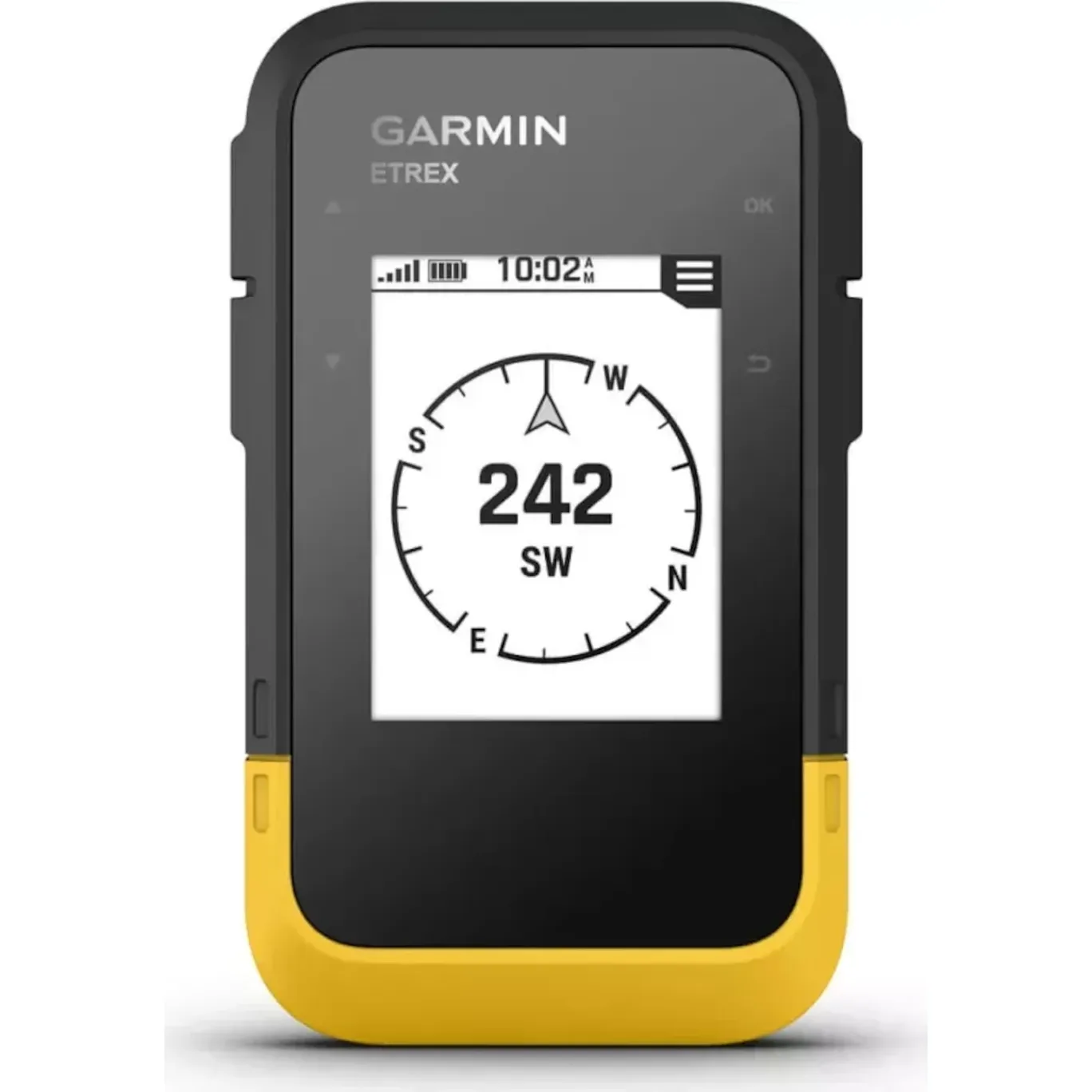
Garmin eTrex SE GPS Handheld Navigator
2.2-inch sunlight-readable screen, multi-GNSS support, digital compass, and two replaceable AA batteries. Manufacturer advertises up to 168 hours in standard mode; actual life depends on use. Verify basic mapping needs before buying.
Check exact listing on Amazon ↗
Amazon price, seller and stock may change.
Affiliate disclosure: As an Amazon Associate, USA Rockhounding earns from qualifying purchases. Confirm the exact variant, current price and seller before buying. These are model-matched product photographs, not independent hands-on reviews.
Navigation devices and field backups
Garmin inReach Mini 2 is a satellite communicator, not a full map-first handheld GPS. A baseplate compass and weatherproof notebook are separately useful analog backups. Check inReach service subscription and exact navigation functions.

Garmin inReach Mini 2 Satellite Communicator
Best for: Backcountry communication and location sharing where cellular coverage is unreliable
Before buying: Confirm the exact current variant, included accessories and seller on Amazon before purchase

Brunton TruArc 3 Baseplate Compass
Best for: A non-electronic navigation backup and map-orientation aid on remote collecting trips.
Before buying: Learn local magnetic declination and carry a paper map; a compass cannot replace route planning.
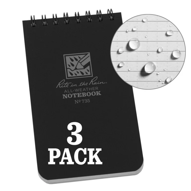
Rite in the Rain 735-3X Weatherproof Notebook 3 Pack
Best for: Recording GPS waypoints, specimen details and field observations in damp conditions.
Before buying: 3 x 5 inch top-spiral universal-pattern notebooks; use pencil or suitable all-weather pen when wet.
Affiliate disclosure: As an Amazon Associate, USA Rockhounding earns from qualifying purchases. Verify the exact product, current price and availability with the seller.
More model-specific gear comparisons
These additions use model-matched photographs already in the USA Rockhounding Media Library. Compare the technical fit, package contents and field requirements rather than relying on rankings alone.
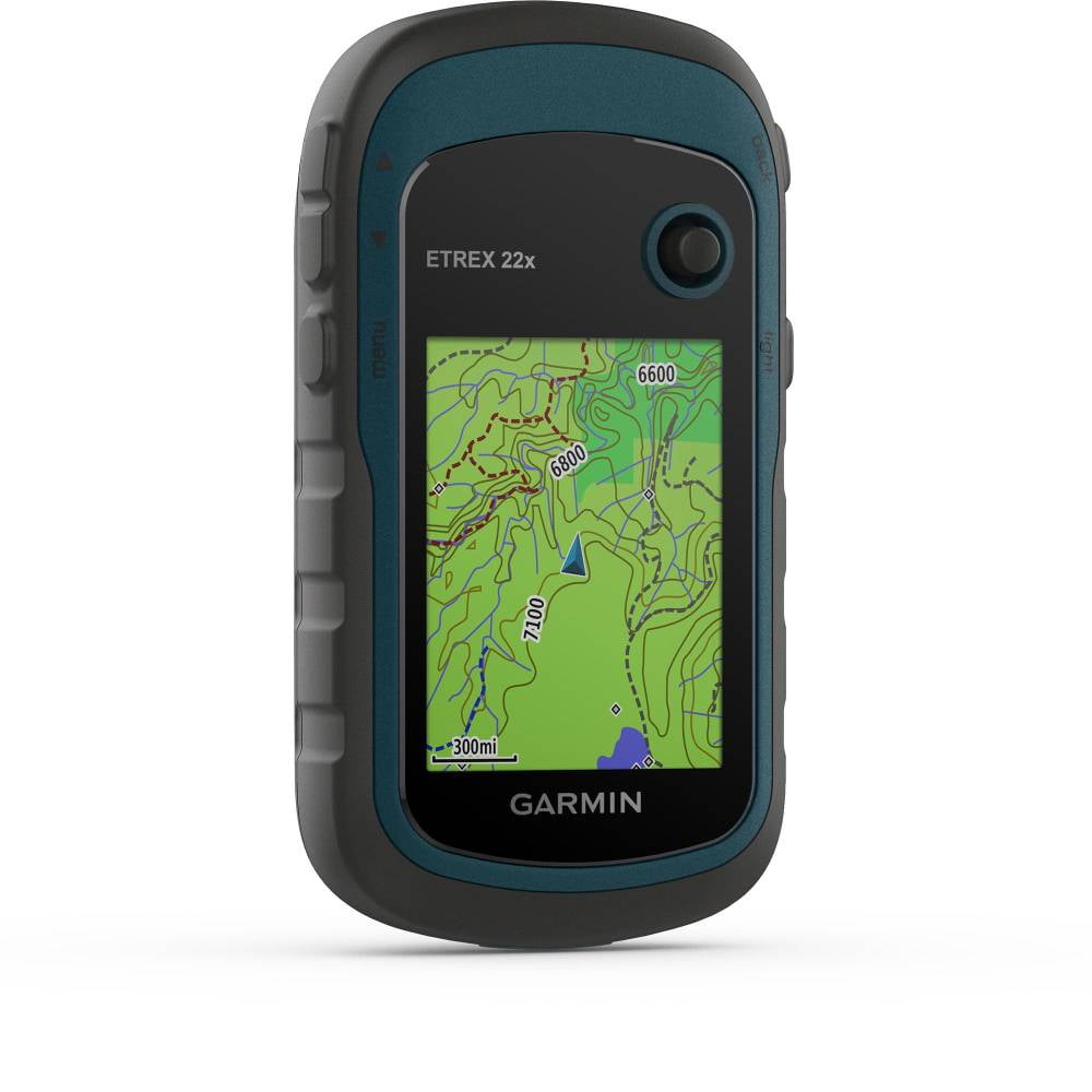
Garmin eTrex 22x handheld GPS — 010-02256-00
Best for: Offline trail navigation and saving rockhounding waypoints.
Verified specifications: Garmin specifies a 2.2-inch color screen, GPS and GLONASS reception, 8 GB internal storage with microSD support, and up to 25 hours in GPS mode using two AA batteries. The 22x does not have the 32x model’s three-axis electronic compass or barometric altimeter.
Comparison and buying checks: Compared with the simpler eTrex SE, the 22x provides a color display and preloaded TopoActive mapping. Check the exact regional map coverage, seller, firmware and condition before purchase.
ASIN B07RTD2PMT · Image: existing WordPress Media Library #37867. Price, stock and seller may change.
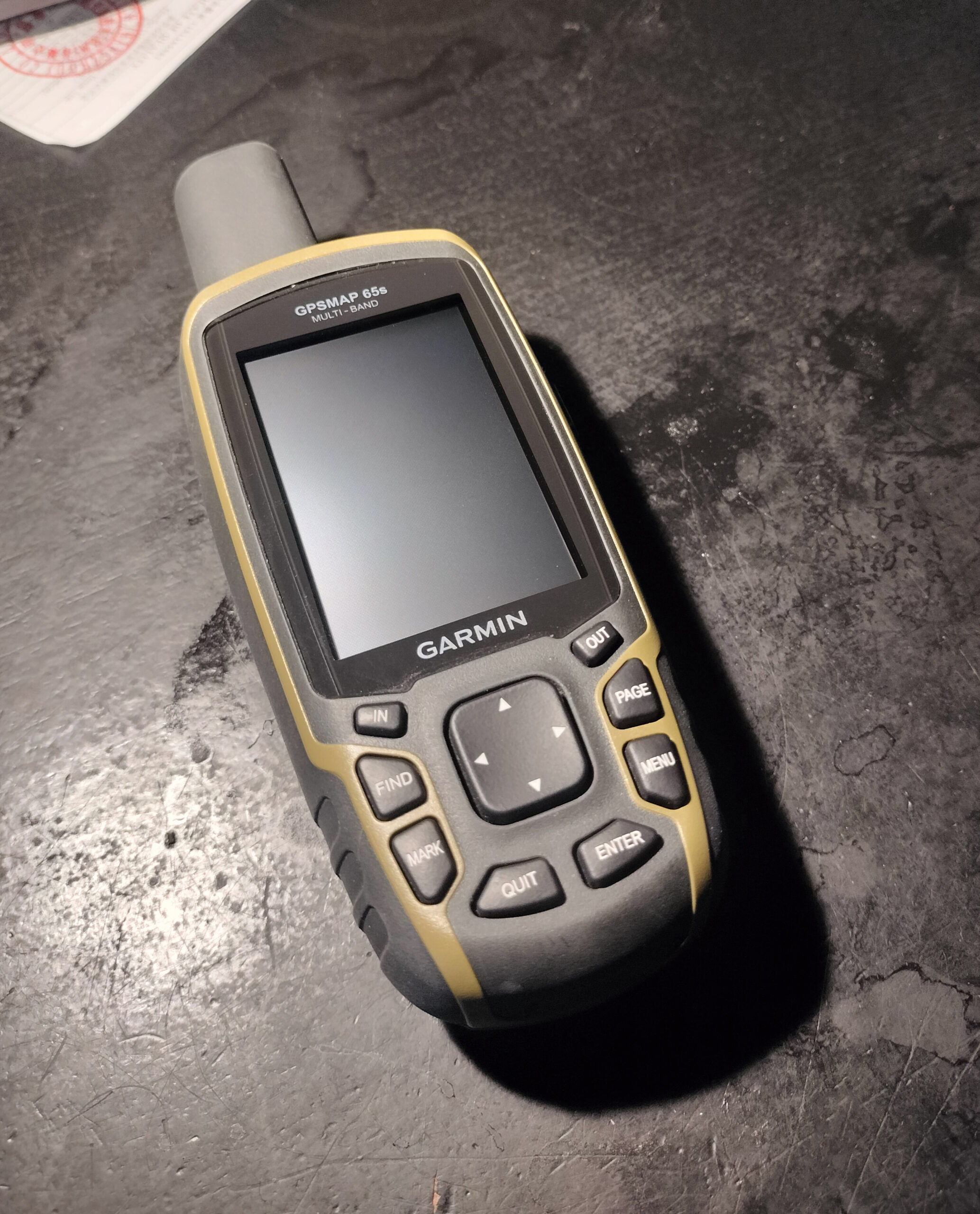

Garmin GPSMAP 65s — Multi-Band Handheld GPS
Best for: Rockhounds who need offline waypoint navigation, topographic maps and a dedicated handheld receiver for wooded or steep terrain.
Manufacturer specifications: 2.6-inch sunlight-readable color display, multi-band GNSS, barometric altimeter, tilt-compensated three-axis compass, TopoActive maps, two replaceable AA batteries, IPX7 water resistance and up to 16 hours of battery life under Garmin’s stated conditions.
Compared with eTrex 22x and eTrex SE: The GPSMAP 65s adds multi-band satellite reception and built-in compass/altimeter sensors over the 22x, but Garmin rates the 22x for longer battery life (up to 25 hours). The eTrex SE is a simpler waypoint-focused choice; the GPSMAP 65s is better suited when detailed on-device topographic maps and navigation sensors are priorities. Check regional map coverage and whether the larger unit suits your pack.
ASIN B08HR5CXCK · Model GPSMAP 65s, not GPSMAP 65 · Local Media Library image #69394 · Manufacturer specifications, not hands-on test results.
Affiliate disclosure: As an Amazon Associate, USA Rockhounding earns from qualifying purchases. These are specifications-based comparisons, not independent field tests. Confirm current seller, exact model, price, availability and collecting permissions.
Legacy GPS option: Garmin GPSMAP 64s
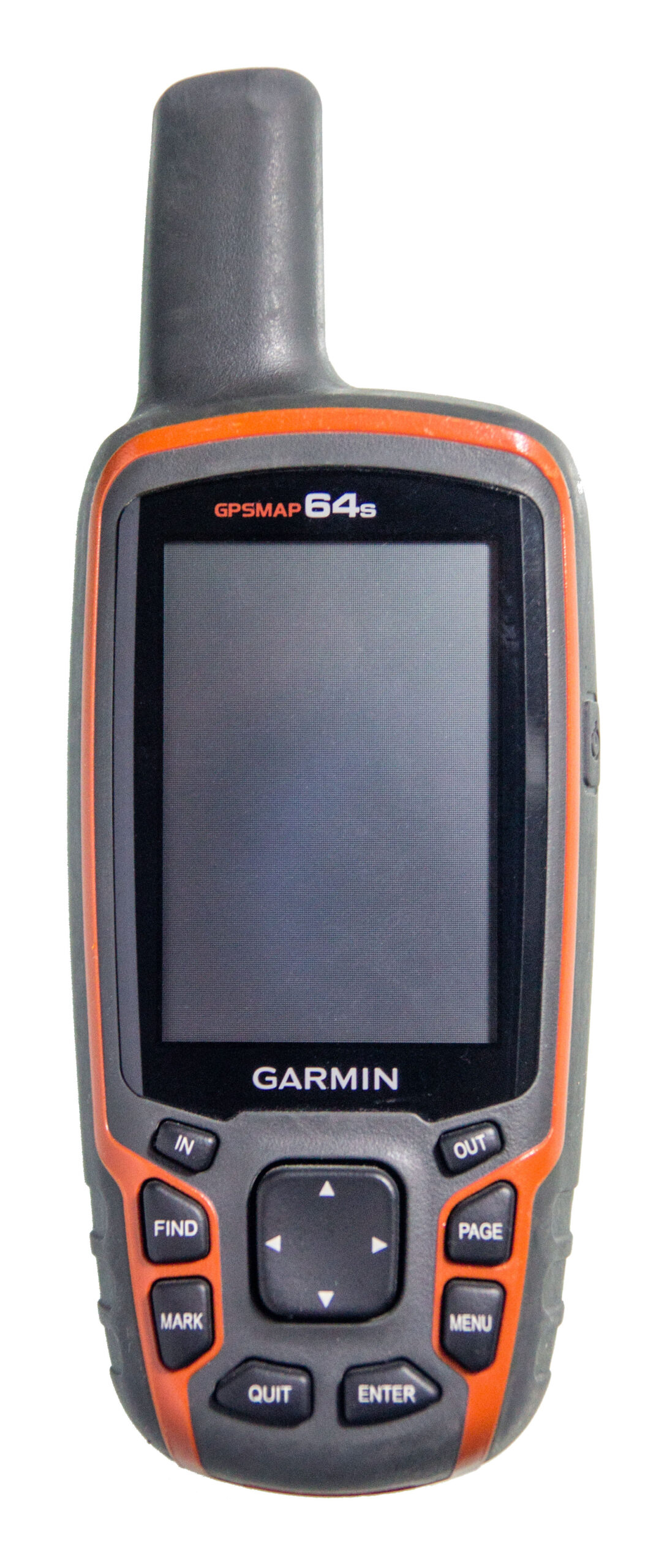

Garmin GPSMAP 64s (010-01199-10)
Use case: A button-operated, older-generation handheld for saving rockhounding waypoints and following routes without relying on a phone screen. Garmin lists a 2.6-inch color display, GPS/GLONASS reception, three-axis compass, barometric altimeter, 4 GB internal storage with microSD support, IPX7 rating and two AA batteries (up to 16 hours under stated conditions).
Compared with GPSMAP 65s: The newer 65s adds multi-band GNSS reception. The 64s lacks that feature and is discontinued by Garmin; consider it primarily when evaluating a verified older or secondhand listing. Check battery contacts, mapping support, included accessories and seller before buying. Neither receiver substitutes for paper-map navigation skills or permission to enter collecting land.
Check exact GPSMAP 64s listing on Amazon
ASIN B00HWL9AS8 · Media Library #69399 · Manufacturer specifications; no hands-on testing or stock verification.
Affiliate disclosure: As an Amazon Associate, USA Rockhounding earns from qualifying purchases.
Legacy Garmin eTrex 10 versus original eTrex 30
These older models can be relevant when comparing a verified secondhand or remaining-stock listing. Neither is a current-generation multi-band GPS. The eTrex 10 is a basic monochrome waypoint receiver; the original eTrex 30 adds color mapping, compass and altimeter. Always bring offline backup navigation.
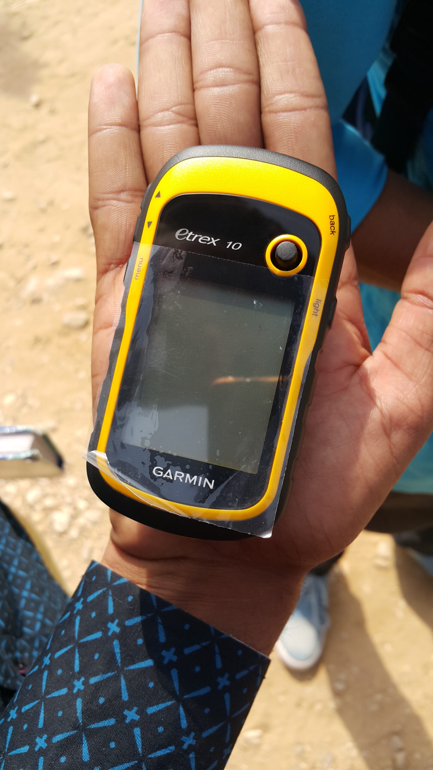

Garmin eTrex 10 (010-00970-00) — legacy handheld
Best for: Recording coordinates and retracing waypoints with a dedicated GPS when detailed on-device topo maps are not essential.
Manufacturer specifications: Garmin lists a 2.2-inch monochrome display, GPS/GLONASS support, worldwide basemap, 1,000 waypoints, IPX7 rating and up to 25 hours on two AA batteries under its stated conditions.
Buyer comparison: Unlike eTrex 30, eTrex 10 does not support adding detailed maps and lacks a barometric altimeter and three-axis electronic compass. This is an older-generation device; verify the exact used or remaining-stock offer.
ASIN B00542NV32 · Media Library #69408 · Manufacturer information; not hands-on tested. Price, seller, stock and package are not verified.
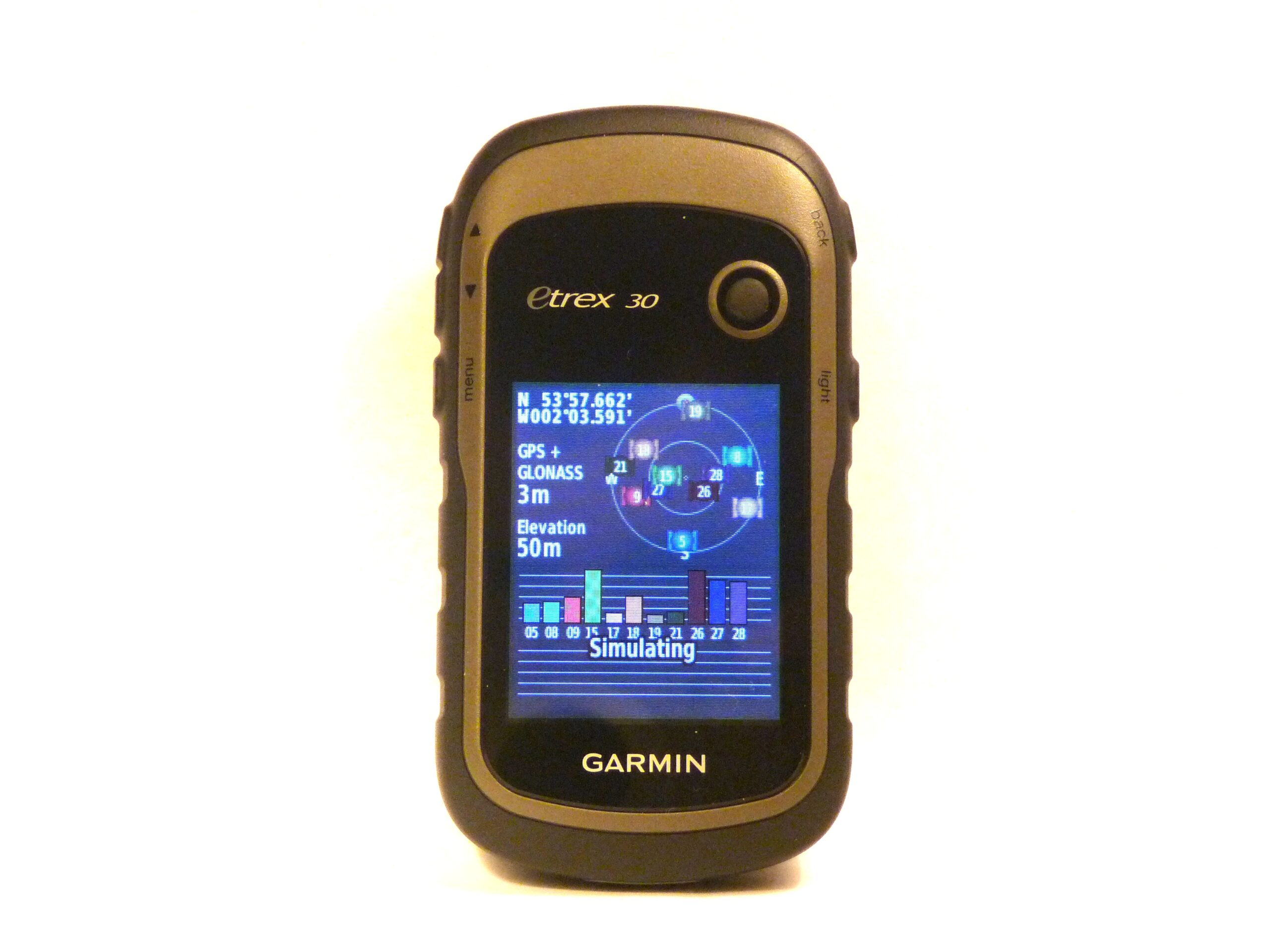

Garmin eTrex 30 — original model, not 30x
Best for: Legacy waypoint navigation where expandable mapping, compass heading and elevation readings are useful.
Manufacturer specifications: Garmin’s original eTrex 30 has a 2.2-inch color display, GPS/GLONASS, microSD mapping support, tilt-compensated three-axis compass, barometric altimeter and two AA batteries (manufacturer rated up to 25 hours).
Buyer comparison: Compared with eTrex 10, it adds a color map display, expandable mapping, compass and altimeter. It predates Garmin’s 30x and modern multi-band receivers; do not confuse an eTrex 30 listing with 30x or current models.
ASIN B00542NVS2 · Media Library #69407 · Manufacturer information; not hands-on tested. Price, seller, stock and package are not verified.
Affiliate disclosure: As an Amazon Associate, USA Rockhounding earns from qualifying purchases. Check exact model, configuration, seller and current offer before buying. Pocket knives and multi-tools are for permitted utility tasks, not rock striking or excavation; follow collecting rules.
Garmin eTrex 20: original color-mapping GPS, not 20x
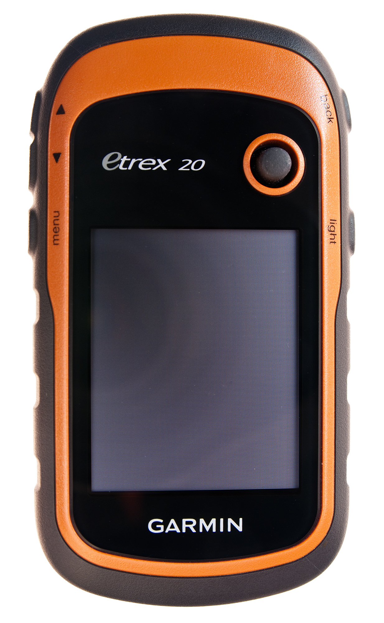

Garmin eTrex 20 — original model
Best for: Saving coordinates and navigating back to legal rockhounding access points with offline maps on a dedicated GPS.
Manufacturer specifications: 2.2-inch color display (176 × 220), GPS and GLONASS, 2,000 waypoints, microSD map expansion, IPX7 rating and two AA batteries. Garmin’s historical battery rating was up to 25 hours under its stated conditions.
Buyer comparison: Unlike the monochrome eTrex 10, the original eTrex 20 supports detailed mapping on its color display. Unlike eTrex 30, it lacks a three-axis electronic compass and barometric altimeter. It predates eTrex 20x and current-generation receivers, and Garmin lists it as discontinued. Verify exact model and condition before purchasing.
ASIN B00542NVDW · Media #69416 · Manufacturer specifications; no hands-on test or current stock, seller or price claim. Carry an offline backup map and check land access independently.
Affiliate disclosure: As an Amazon Associate, USA Rockhounding earns from qualifying purchases.
More handheld GPS models: multi-band versus legacy AA navigation
For rockhounding trips, a dedicated GPS helps record parking locations, permitted trail junctions and return routes. A saved coordinate does not prove public access. Compare power supply, map support and the exact model rather than relying on an old product-family name.
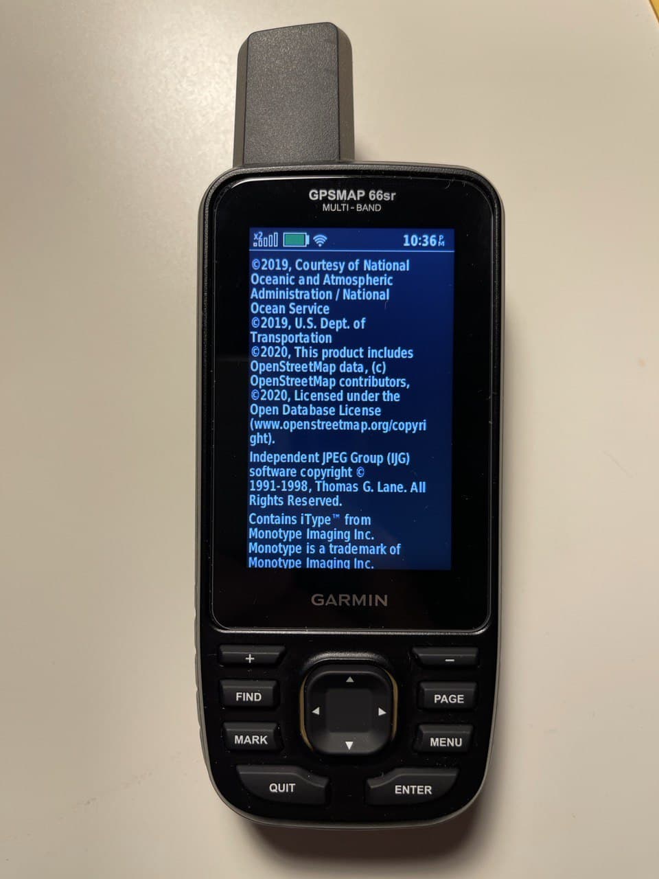

Garmin GPSMAP 66sr — multi-band handheld GPS
Manufacturer specifications: 3-inch color display, multi-band GNSS, electronic compass and barometric altimeter; built-in rechargeable lithium-ion battery. Garmin rates battery life up to 36 hours in default GPS mode and up to 450 hours in expedition mode; IPX7 water resistance.
Buyer comparison: Unlike the GPSMAP 65s, which uses replaceable AA batteries, the 66sr uses an internal rechargeable battery and has a larger display. Unlike the GPSMAP 66i, the 66sr does not provide built-in inReach satellite SOS or messaging. Multi-band reception is useful for difficult terrain, but cannot establish land access or guarantee position accuracy. Garmin’s GPSMAP 67 is a newer generation with a longer manufacturer-rated battery life; compare it before buying a 66sr, particularly if seeking a new device.
ASIN B08HR5JZCY · WordPress Media #69421 · Specifications are manufacturer-published; no hands-on testing, price, stock, seller or performance claim.
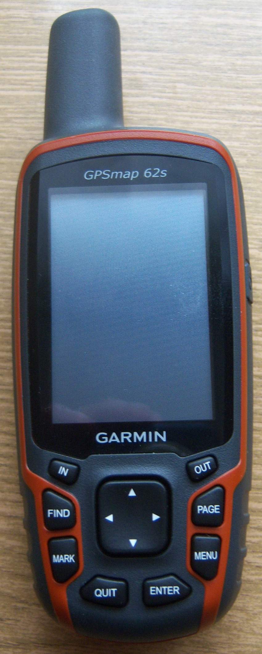

Garmin GPSMAP 62s — older AA-powered GPS
Manufacturer specifications: 2.6-inch color display, three-axis tilt-compensated compass, barometric altimeter, 2 AA batteries, microSD map expansion and IPX7 water resistance. Garmin’s original stated battery life was up to 20 hours under specified conditions.
Buyer comparison: The 62s is a legacy alternative for collectors who want replaceable AA batteries and basic waypoint/track navigation. The 62st was the preloaded-topographic-map version; the newer 66sr adds multi-band reception and an internal rechargeable battery. This 62s is discontinued, so check battery contacts, map support, software compatibility and listing condition.
ASIN B003IHV6YG · WordPress Media #69422 · Specifications are manufacturer-published; no hands-on testing, price, stock, seller or performance claim.
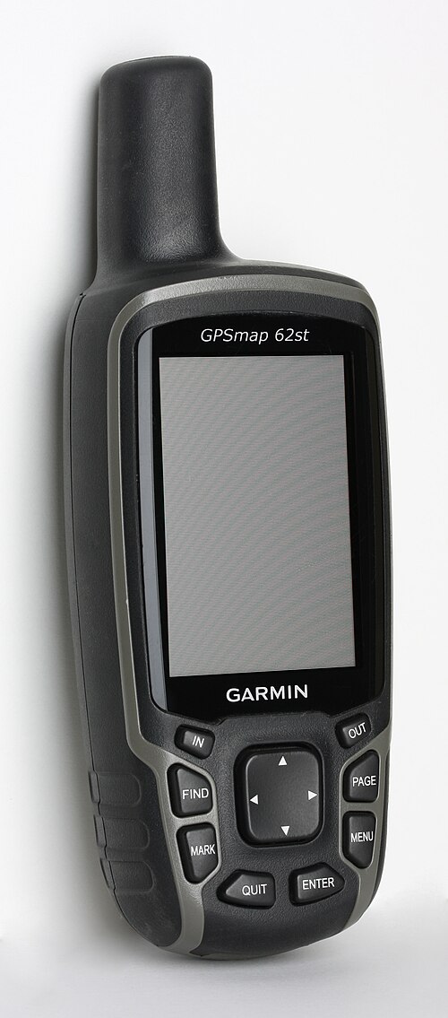

Garmin GPSMAP 62st — legacy topographic-map model
Manufacturer specifications: 2.6-inch color display, three-axis electronic compass, barometric altimeter and two AA batteries. Garmin originally supplied U.S. 100K topographic maps with the U.S. 62st variant; regional mapping and included content can differ by unit.
Buyer comparison: Compared with the 62s, the 62st’s key original distinction was bundled topographic mapping, not newer satellite reception. Against the GPSMAP 66sr, it lacks multi-band GNSS and uses older hardware; verify that any used device still has the maps you need and that its condition is acceptable. Discontinued model, not a current-generation recommendation.
ASIN B003IHV6Z0 · WordPress Media #69423 · Specifications are manufacturer-published; no hands-on testing, price, stock, seller or performance claim.
Affiliate disclosure: As an Amazon Associate, USA Rockhounding earns from qualifying purchases. Confirm the exact model, included maps, condition and seller on Amazon. Carry a paper/offline backup and check access rules before field travel.
Garmin GPSMAP 64st: legacy GPS with bundled U.S. topo maps
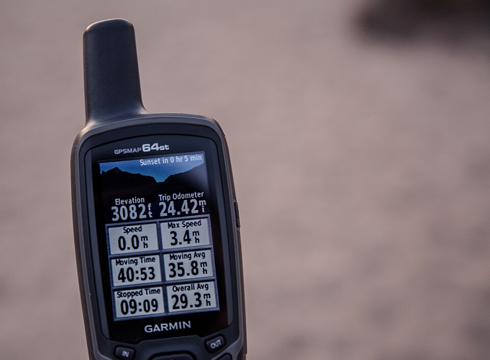

Garmin GPSMAP 64st — U.S. TOPO 100K variant
Best for: Saving waypoints, recording routes and navigating rockhounding trips with replaceable AA batteries.
Manufacturer specifications: 2.6-inch transflective color screen, GPS/GLONASS, three-axis compass, barometric altimeter, 8 GB internal memory, microSD slot, IPX7 water resistance and two AA batteries (manufacturer-rated up to 16 hours). The U.S. 64st originally included TOPO U.S. 100K mapping.
Buyer comparison: The 64s shares the display and sensors but originally had 4 GB and did not include the 64st’s U.S. topo-map bundle. Newer GPSMAP 65s/66sr devices add multi-band satellite reception. This 64st is an older-generation model: verify included maps, firmware, battery contacts and listing condition rather than assuming legacy map subscriptions still work.
ASIN B00HWL9BQ4 · WordPress Media #69428 · Manufacturer specifications only; no hands-on testing or verified current stock, price or seller.
Affiliate disclosure: As an Amazon Associate, USA Rockhounding earns from qualifying purchases. Check the exact model and included maps before buying; carry an offline navigation backup.
Garmin Oregon 550 handheld GPS
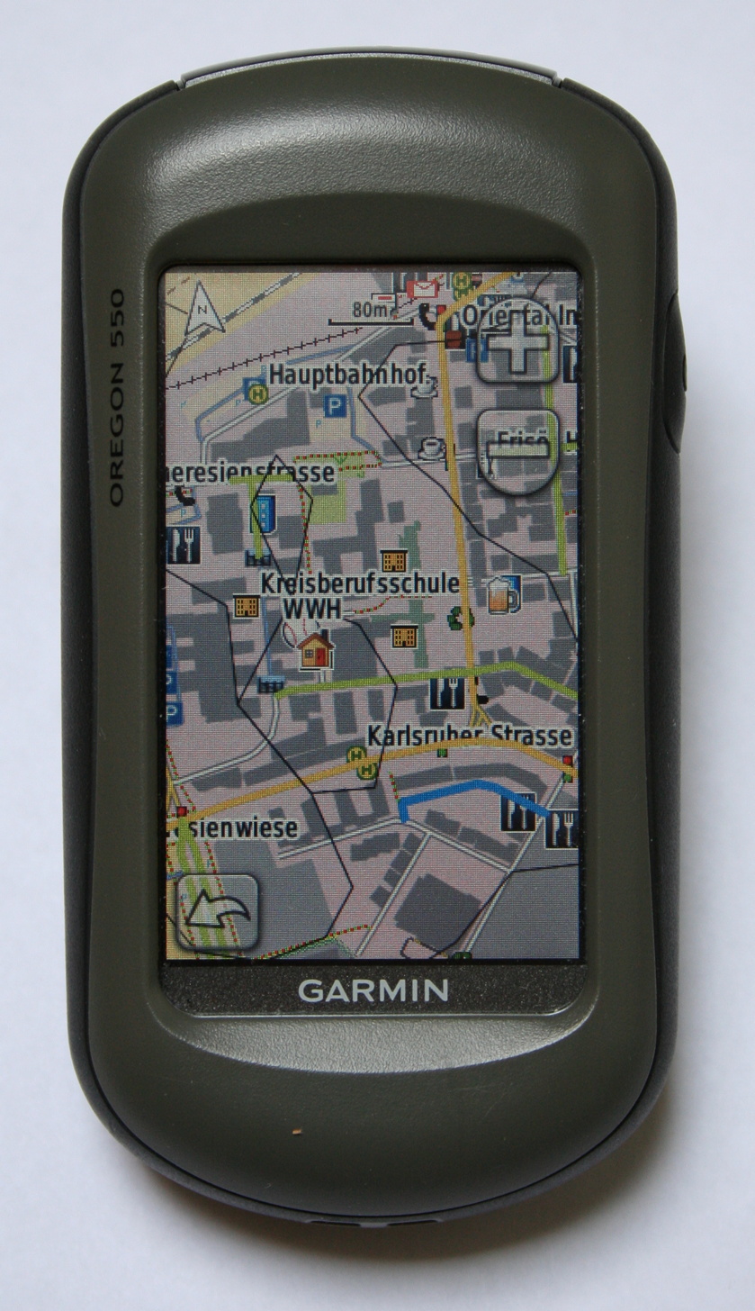

What it is: The Oregon 550 is an older-generation 3-inch touchscreen GPS with a built-in 3.2 MP geotagging camera, three-axis compass, barometric altimeter, microSD support and replaceable AA batteries. Garmin originally rated battery life at up to 16 hours; this is a historical specification, not a test of used devices.
Buyer comparison: Compared with the Oregon 550t, the standard 550 did not originally include the 550t’s preloaded U.S. TOPO 100K maps. Compared with an eTrex 30, the Oregon adds a larger touch interface and camera, but it is older equipment with potentially limited map and software compatibility. Confirm the exact model, included maps, condition and accessories before purchase.
ASIN B0029LL5IY · Media Library #69434. Manufacturer information only; no hands-on testing or confirmed current price, stock or seller.
Affiliate disclosure: As an Amazon Associate, USA Rockhounding earns from qualifying purchases.
Four original Garmin eTrex handhelds: which older model fits field navigation?
These are legacy GPS receivers, not current-generation recommendations. For rockhounding, prioritize usable offline maps, battery condition, saved waypoints and a paper-map backup. All four pictured devices are the named models, but Amazon listings can change condition or bundled accessories.
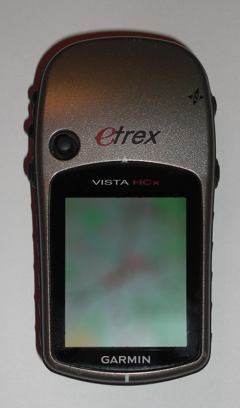

Garmin eTrex Vista HCx
Manufacturer features: Color mapping receiver with high-sensitivity GPS, electronic compass, barometric altimeter, microSD map storage and two AA batteries. Garmin’s legacy HC-series manual specifies a 176 × 220 color display and up to 25 hours for HCx devices (historical rating).
Buyer comparison: Compared with Legend HCx, adds the electronic compass and barometric altimeter. Compared with Vista Cx, its high-sensitivity HCx receiver is the main generation change. Best considered only if its older map/software compatibility suits your workflow.
ASIN B000PDR1LS · Media #69439. No hands-on testing or current seller, stock, price or performance verification.
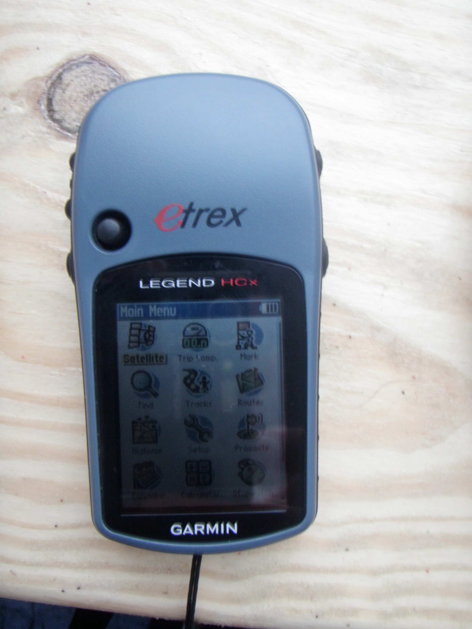

Garmin eTrex Legend HCx
Manufacturer features: High-sensitivity GPS receiver with color map display, microSD map expansion, waypoint/track navigation and replaceable AA batteries. Unlike Vista HCx, the Legend HCx does not include an electronic compass or barometric altimeter.
Buyer comparison: Choose Legend HCx over Vista HCx only if you do not need a stationary electronic heading or barometric elevation; both are older microSD/Garmin-mode units. The monochrome Legend H is a different, simpler model.
ASIN B000PDR27G · Media #69440. No hands-on testing or current seller, stock, price or performance verification.
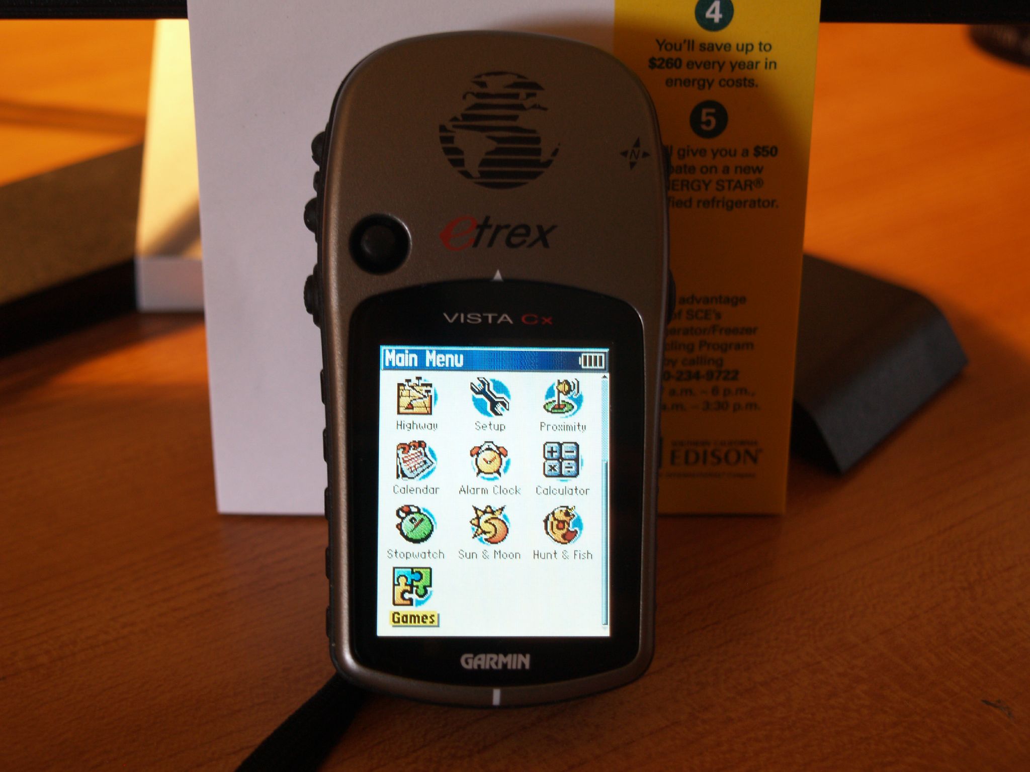

Garmin eTrex Vista Cx
Manufacturer features: Earlier color-screen eTrex with an electronic compass, barometric altimeter, microSD mapping and AA battery power. Garmin’s original color-series documentation lists a 176 × 220 pixel display and IPX7 water-resistance rating.
Buyer comparison: The Vista Cx predates Vista HCx’s high-sensitivity receiver. It offers more navigation sensors than the monochrome Legend H, but all three are legacy choices requiring map-card and software checks.
ASIN B000CSQNL0 · Media #69441. No hands-on testing or current seller, stock, price or performance verification.
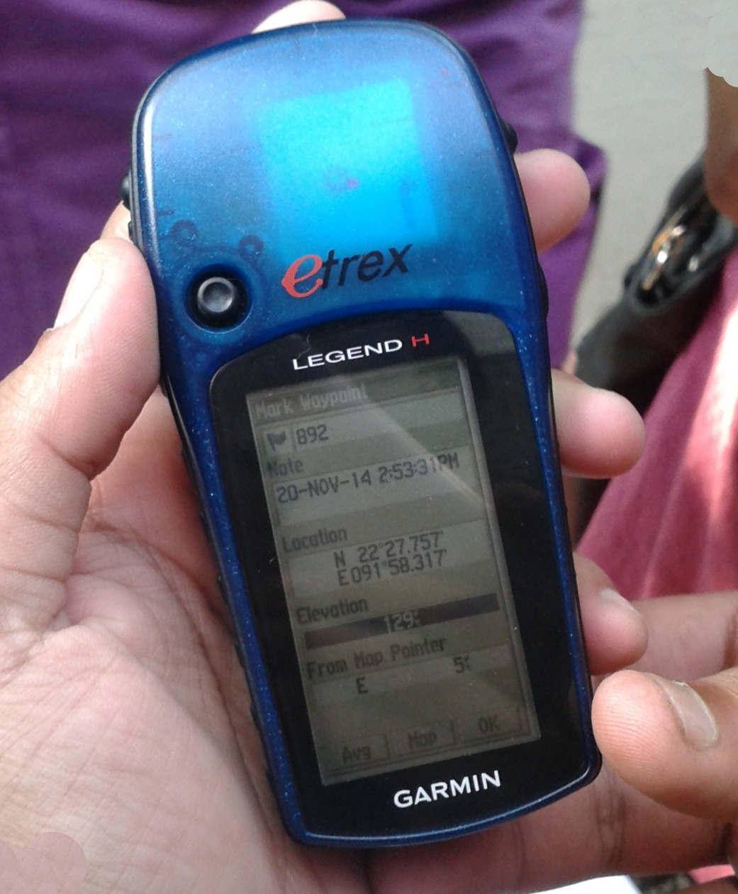

Garmin eTrex Legend H
Manufacturer features: High-sensitivity, button-operated handheld GPS with a 2.4-inch grayscale display and built-in regional basemap. Unlike Legend HCx, this H model is not a color microSD map receiver.
Buyer comparison: Use for basic waypoint and track navigation rather than detailed map layers; Legend HCx adds color and expandable mapping, while Vista HCx adds compass and altimeter sensors. Confirm device condition and map limitations before choosing a used unit.
ASIN B001OMGVJW · Media #69442. No hands-on testing or current seller, stock, price or performance verification.
Affiliate disclosure: As an Amazon Associate, USA Rockhounding earns from qualifying purchases. Check exact model, map compatibility, seller, condition and included accessories before ordering. These models predate modern multi-band GPS; do not rely on an aging receiver as your only navigation method.
Three older Garmin GPSMAP receivers: 76CS vs 76S vs 78
These are legacy, exact-model navigation receivers, not recommendations for current-generation performance. For rockhounding, compare the ability to save field waypoints, read maps and carry spare batteries; check whether older maps, cables and firmware suit your workflow before buying. A paper map and independent emergency plan remain important.
Garmin GPSMAP 76CS
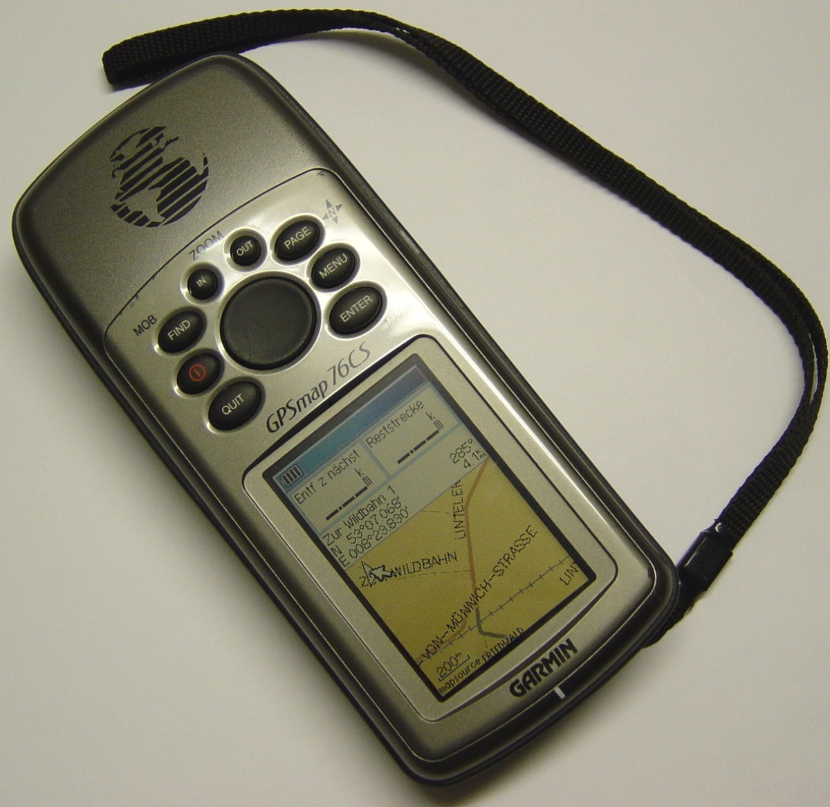

Published specifications: 256-color 160 × 240 display; electronic compass and barometric altimeter; approximately 115 MB internal map storage; two AA batteries. Garmin’s historical specification lists up to 20 hours of battery life.
Buyer comparison: Compared with the grayscale 76S, the 76CS adds a color display and more internal map capacity. Unlike modern GPSMAP 65s receivers, it is an older-generation unit with legacy map and cable compatibility to check.
ASIN B0001MHL0O · Media #69444. No hands-on test, current seller, stock, price or actual performance verification.
Garmin GPSMAP 76S
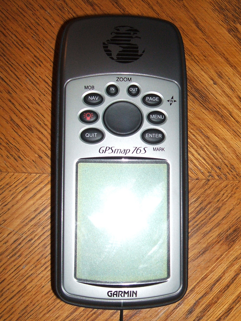

Published specifications: Four-level grayscale 180 × 240 display; electronic compass and barometric altimeter; 24 MB internal map storage; two AA batteries. Garmin lists up to 16 hours of battery life.
Buyer comparison: The 76S offers basic waypoint navigation and heading/elevation instruments, but its small fixed storage and monochrome screen are substantial tradeoffs versus the 76CS and newer handheld GPS models.
ASIN B00006662D · Media #69445. No hands-on test, current seller, stock, price or actual performance verification.
Garmin GPSMAP 78 (base model)
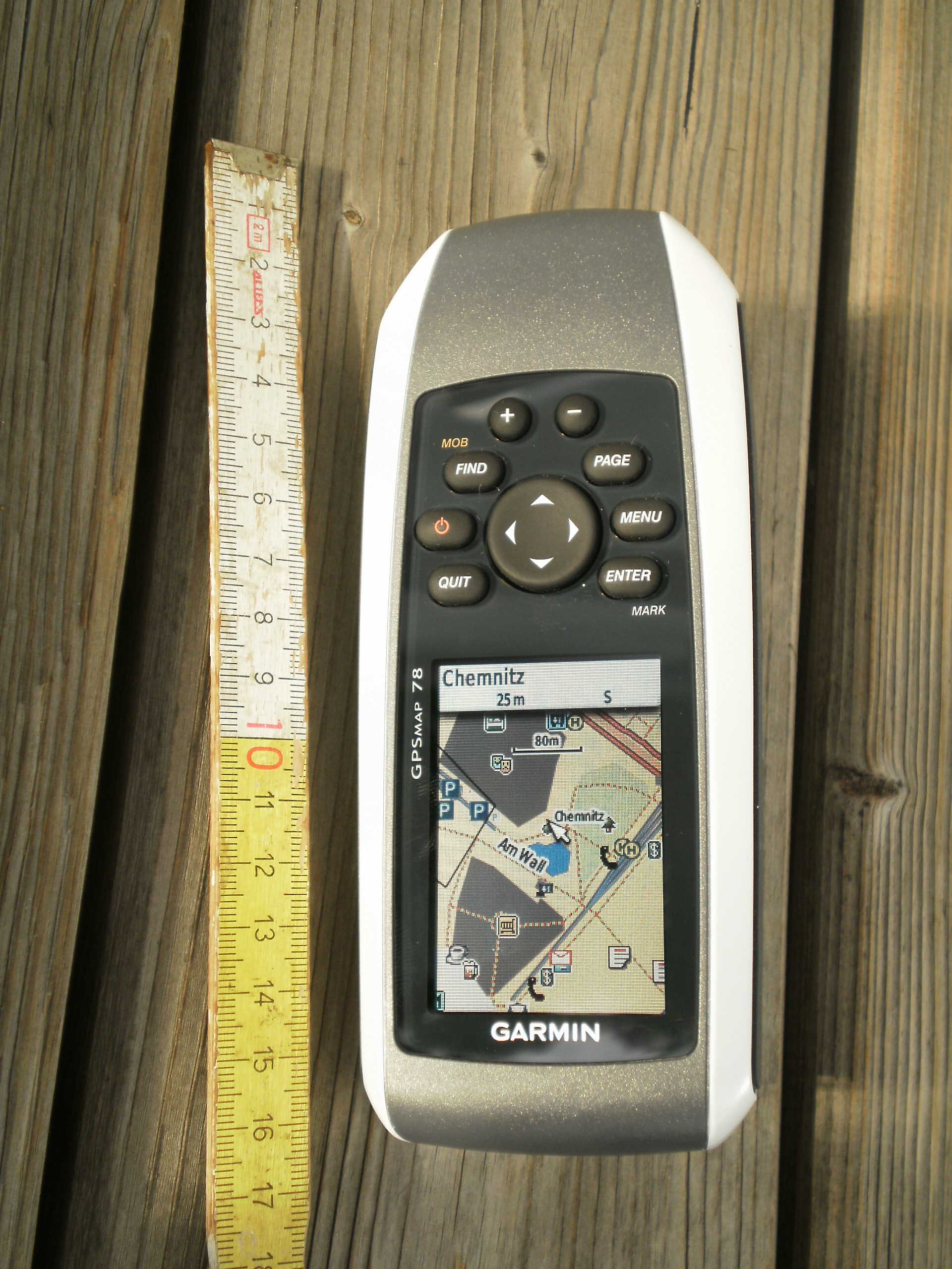

Published specifications: 2.6-inch 160 × 240 color display; 1.7 GB internal storage; IPX7 water resistance and floating body; two AA batteries. Garmin lists up to 20 hours of battery life.
Buyer comparison: Compared with the 76S and 76CS, the 78 provides a larger color screen and more internal storage, but the base 78 does not include the electronic compass or barometric altimeter found on the 76S/76CS. Do not confuse it with the 78s or 78sc variants.
ASIN B003I86PIM · Media #69446. No hands-on test, current seller, stock, price or actual performance verification.
Affiliate disclosure: As an Amazon Associate, we earn from qualifying purchases. Links above are affiliate links. Specifications are based on Garmin’s published documentation, not hands-on testing. Older models may appear through third-party or used sellers; seller, condition, compatibility and availability are unverified. Reference: Garmin 76CS specifications, Garmin 76S specifications, Garmin 78 specifications.
Garmin GPSMAP 60CS: compact legacy GPS with compass and altimeter
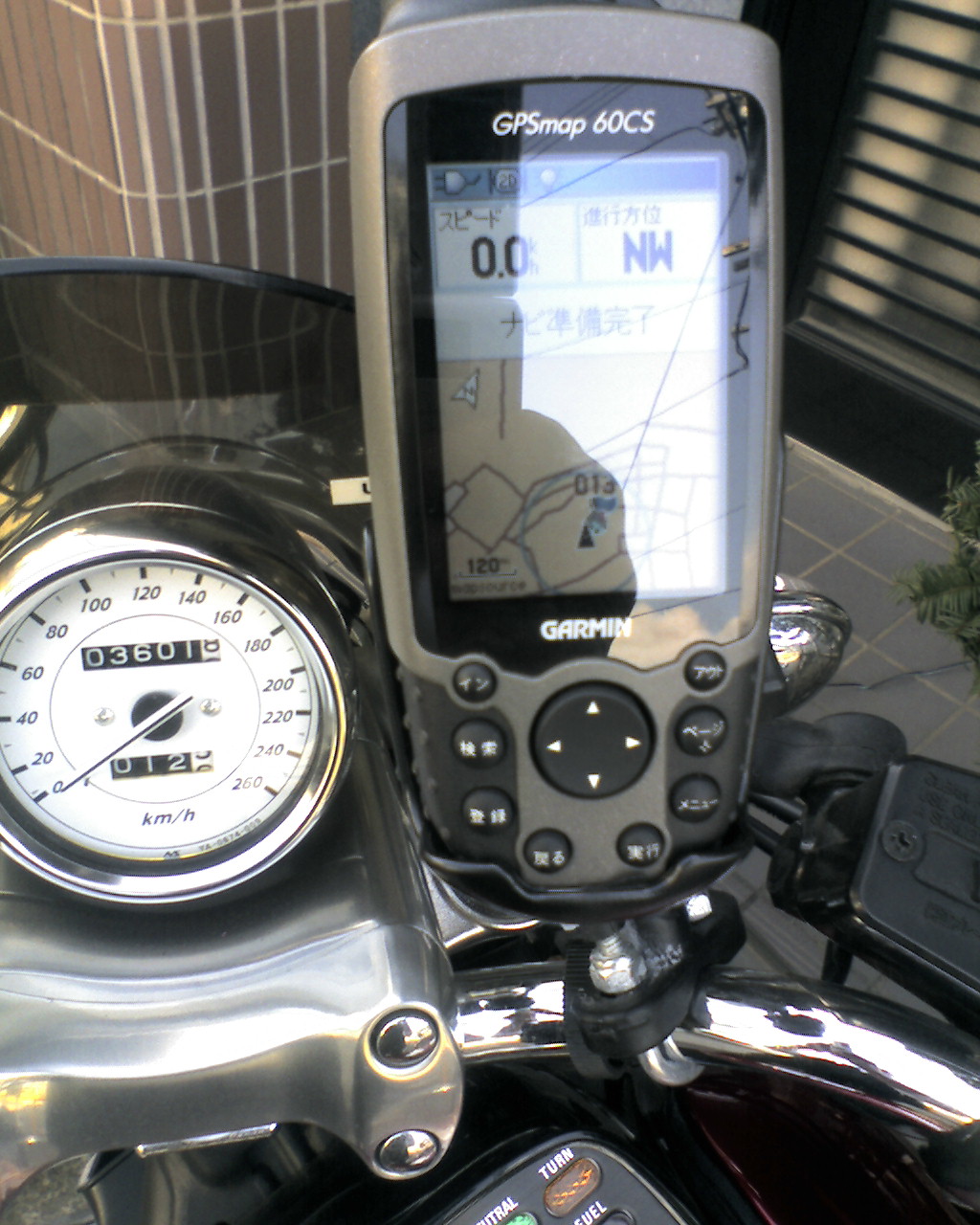

Published specifications: 160 × 240-pixel color display, electronic compass, barometric altimeter, about 56 MB internal map storage, two AA batteries and a manufacturer-listed battery life of up to 20 hours. IPX7-rated enclosure.
Buyer comparison: The GPSMAP 60CS has a different button layout and smaller fixed map memory than the 76CS (115 MB) and 78 (1.7 GB). Unlike newer multi-band GPSMAP units, it is an older-generation receiver with map software, connection and battery-contact condition to check before purchasing. It is useful to compare as a legacy waypoint device, not as a current-generation navigation or emergency communication system.
View exact GPSMAP 60CS on Amazon
ASIN B000189W8M · Media #69448. Manufacturer specifications only; no hands-on testing, current availability, seller, price or actual performance verification.
Affiliate disclosure: As an Amazon Associate, we earn from qualifying purchases. Reference: Garmin GPSMAP 60CS owner’s manual.
Early eTrex handhelds: eTrex H versus the original eTrex Legend
Both are legacy GPS receivers, not substitutes for a modern mapping GPS, a paper map or emergency communications. For rockhounding trips, their main historical use is saving a collecting-area waypoint and navigating back to it. These exact models have different map support: the yellow eTrex H does not display downloadable terrain or street maps, while the original blue eTrex Legend has a monochrome basemap and limited internal map storage. They should not be confused with later Legend H/HCx or eTrex 10/20/30 generations.
Garmin eTrex H — yellow, non-mapping model
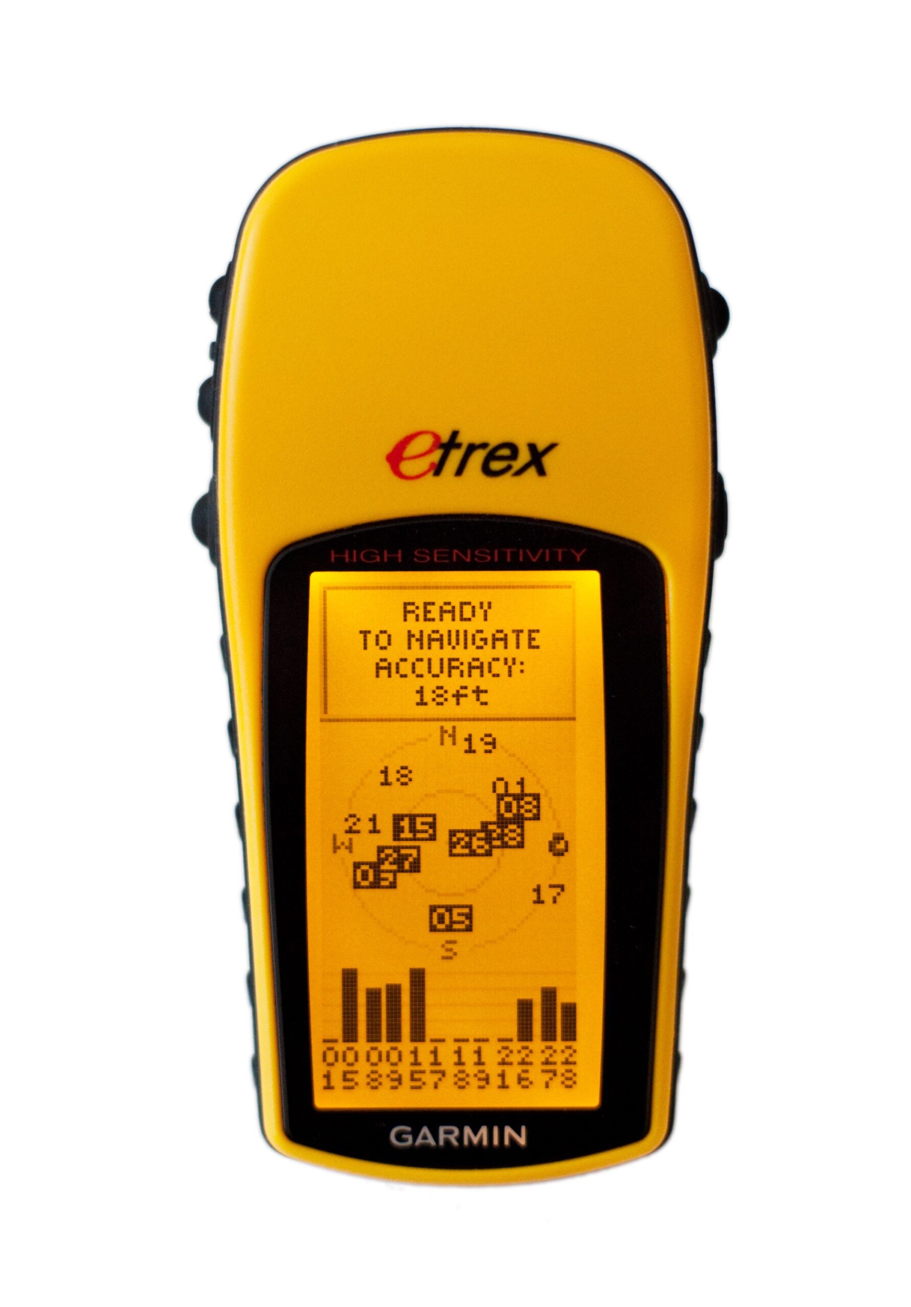

Garmin-published specifications: high-sensitivity GPS, 500 waypoints, 20 routes, 10,000-point track log, up to 17 hours with two AA batteries, and IPX7-rated water resistance. No basemap, map-card slot, electronic compass or barometric altimeter.
Buyer comparison: Choose only if you specifically need simple coordinate/waypoint navigation and understand its non-mapping screen. Compared with the original Legend, it lacks a basemap and downloadable map storage. Compared with current-generation GPS receivers, expect limited navigation and connection features. Check the serial interface, battery compartment, buttons and actual unit condition.
ASIN B000PDV0CE · Media #69450. Historical manufacturer specs; no hands-on testing or verification of Amazon price, stock, seller or condition.
Garmin eTrex Legend — original blue monochrome model
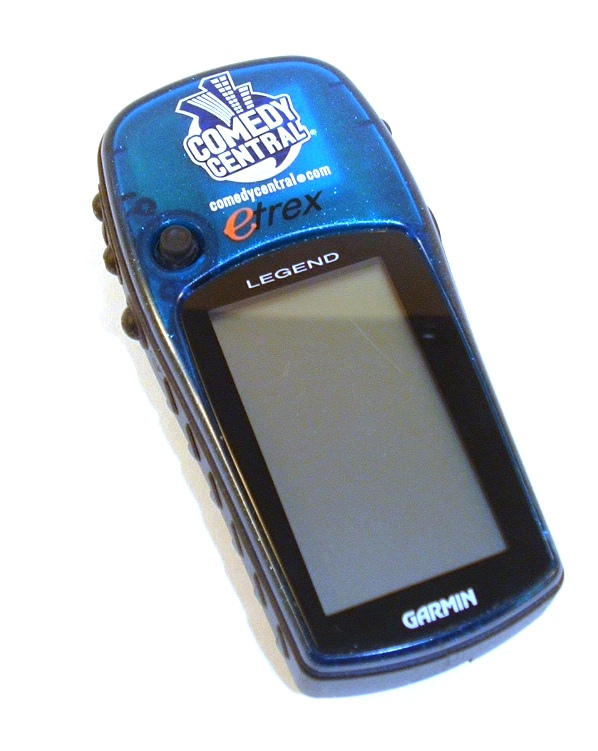

Garmin-published specifications: four-level grayscale display, built-in basemap, 8 MB internal map storage, 500 waypoints and 20 routes. Uses two AA batteries; historical manufacturer rating is up to 18 hours. It has neither an electronic compass nor a barometric altimeter.
Buyer comparison: Its basemap and limited downloadable map memory are advantages over the non-mapping eTrex H, but the older serial interface, small storage and monochrome display are major drawbacks versus eTrex 20/30-series or modern multi-GNSS models. Confirm whether the necessary legacy map software and cables are included.
View exact original eTrex Legend on Amazon
ASIN B000058BCQ · Media #69451. Historical manufacturer specs; no hands-on testing or verification of Amazon price, stock, seller or condition.
Affiliate disclosure: As an Amazon Associate, we earn from qualifying purchases. Both links above are affiliate links. These legacy GPS devices should not be used as a sole means of remote-area navigation. References: Garmin eTrex H owner’s manual and Garmin original eTrex Legend owner’s manual.
Garmin Foretrex 301 — wrist-mounted waypoint and track navigator (retired model)
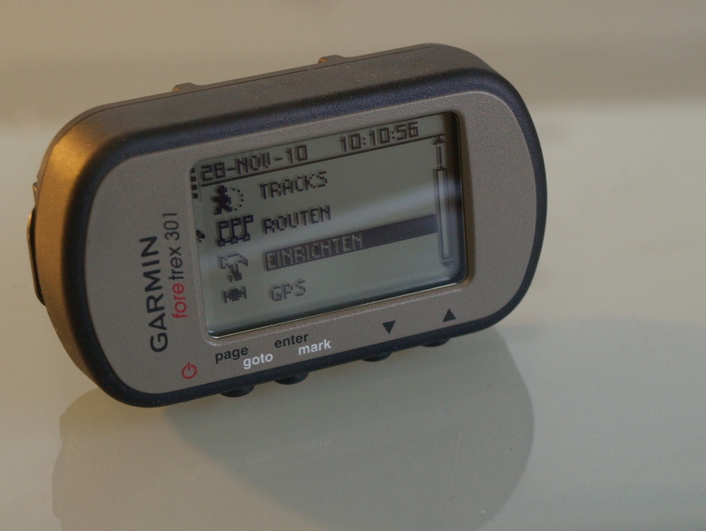

Field role: Hands-free GPS position, waypoints and a breadcrumb track for returning from a collecting area. The Foretrex 301 is a discontinued, older-generation navigator; it is not a topographic-map viewer, collecting-permission database or substitute for a paper map and independent navigation backup.
Documented specifications: Garmin part 010-00776-00; wrist strap; 100 × 64 monochrome display; 500 waypoints; 20 routes; 10,000 track-log points and 10 saved tracks; 2 replaceable AAA batteries; IPX7 water rating; USB connection; approximately 87 g with batteries. Garmin’s Japanese product documentation explicitly lists no electronic compass and no barometric altimeter. Runtime figures vary between regional publications and are not represented as measured performance.
Compare before buying: The Foretrex 301 provides compact wrist navigation, whereas the Foretrex 401 below adds a compass and barometric altimeter. Compared with the site’s Garmin eTrex 10 and GPSMAP handheld options, the Foretrex 301 prioritizes wrist mounting and basic breadcrumb/waypoint use over a larger handheld screen. Confirm device condition, battery contacts, USB operation, accessories and seller details for this retired model.
Check exact Garmin Foretrex 301 listing on Amazon
Affiliate disclosure: As an Amazon Associate, USA Rockhounding earns from qualifying purchases. Manufacturer-reported specifications are not independent field-test results. Price, seller, stock and condition have not been verified.
Garmin Foretrex 401 — wrist GPS with electronic compass and barometric altimeter (retired model)
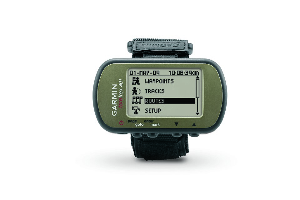

Field role: Wrist-based route and waypoint logging while carrying samples or field tools. The Foretrex 401 is an older, discontinued GPS model, not a modern multi-band mapping receiver. A saved track does not establish that a route is safe, open or legally accessible.
Manufacturer specifications: Garmin part 010-00777-00; electronic compass; barometric altimeter; 500 waypoints; 20 routes; 10,000 track-log points; monochrome 100 × 64 display; IPX7 rating; 2 AAA batteries; USB; up to 17 hours in GPS mode under Garmin’s stated conditions. It also supports compatible-device waypoint/track sharing. Check actual battery and sensor condition when considering used or old stock.
Compare before buying: Versus the Foretrex 301, the 401 adds heading information when stationary and pressure-based altitude information. Both are compact non-topographic wrist navigators; a current GPSMAP or eTrex device may be more appropriate when a larger display, map detail or newer GNSS features matter. For rockhounding, neither confirms land ownership or collecting rights.
Check exact Garmin Foretrex 401 listing on Amazon
Affiliate disclosure: As an Amazon Associate, USA Rockhounding earns from qualifying purchases. Specifications are manufacturer-reported, not independently tested. Current price, seller, stock and condition are unverified.
Bushnell BackTrack Point-5 (360200): simple return-to-waypoint GPS
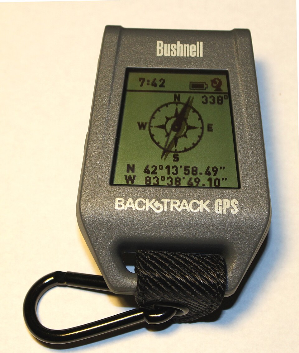

Best suited to: A basic return-to-camp or parked-vehicle backup for a rockhounding outing, when five stored points are enough. This is an older GPS model; Amazon seller, condition and availability have not been verified.
Manufacturer-documented features: Bushnell BackTrack Point-5, model 360200, stores up to five location markers; shows the direction and distance to a saved location; displays air temperature, altitude and a compass heading; uses two AAA batteries. The manual requires outdoor satellite reception and advises horizontal positioning and compass recalibration.
Buyer comparison: Compared with the Garmin Foretrex 301/401 on this guide, the Point-5 is a simpler five-location return navigator rather than a device for detailed track logs and waypoint libraries. It is not a replacement for a map-capable Garmin GPSMAP/eTrex when you need terrain mapping, route planning or many waypoints. It cannot determine property boundaries or whether mineral collecting is permitted.
Before purchasing: Confirm model 360200, functioning GPS reception, battery compartment condition, display, compass calibration and whether the seller includes a manual. Do not assume a current manufacturer warranty for an older unit.
View exact Bushnell Point-5 model on Amazon
Affiliate disclosure: As an Amazon Associate, USA Rockhounding earns from qualifying purchases. This is a specification-based comparison, not a hands-on test. Current prices, sellers, stock and condition are unverified.
Reference: Bushnell BackTrack Point >5 manufacturer manual.
Garmin eTrex 22x with USB adapter cube — GPS bundle comparison
Exact package: Amazon ASIN B08NQ4ZVW3 describes an eTrex 22x handheld GPS receiver sold with a USB adapter cube. The adapter is an additional package item, not a GPS performance upgrade. Confirm the adapter’s electrical specification, plug type, device condition and included map region before ordering.
Manufacturer specifications: The eTrex 22x has a 2.2-inch color screen, GPS/GLONASS reception, 8 GB internal memory with microSD expansion, IPX7 water resistance and uses two AA batteries. Garmin’s stated battery life is up to 25 hours under specified conditions, not a guaranteed field runtime. The eTrex 22x does not include the eTrex 32x’s barometric altimeter and three-axis electronic compass.
Buyer comparison: Compared with the standard eTrex 22x ASIN B07RTD2PMT already covered on this page, the receiver is the same model; the meaningful difference is the USB adapter bundle. Compared with GPSMAP 65s, the eTrex 22x lacks multi-band GNSS and dedicated ABC sensors, but is smaller and simpler for waypoint and track recording. A handheld GPS does not verify land ownership, public access or mineral-collecting rules.
Before buying: Verify that the added adapter is genuinely useful rather than paying extra for a common USB power accessory. Bring paper-map backup and spare AA batteries; check local map licensing. No live seller, stock, price, or hands-on accuracy claim is made. Garmin eTrex model comparison.
View exact eTrex 22x USB-adapter bundle on Amazon
Affiliate disclosure: As an Amazon Associate, USA Rockhounding earns from qualifying purchases.
Garmin GPSMAP 65s + 1-Year CPS Enhanced Protection Pack (ASIN B08KTVCL9C)
What this ASIN identifies: A seller bundle pairing the Garmin GPSMAP 65s (manufacturer part 010-02451-10) with a separately described one-year CPS Enhanced Protection Pack. The protection plan is not an upgraded GPS receiver, additional map license or Garmin-manufactured accessory. Check the exact protection terms, eligibility and seller documentation before choosing this bundle.
Device specifications: Garmin identifies the GPSMAP 65s as a multi-band, multi-GNSS button-operated handheld with a 2.6-inch color screen, barometric altimeter and three-axis compass. Its manual lists two AA batteries, up to 16 hours of battery life under stated conditions and IPX7 water resistance. These are manufacturer specifications, not independently tested performance claims.
Buyer comparison: Compared with the standard GPSMAP 65s listing on this guide, this ASIN adds a third-party protection-plan offer, not additional navigation functions. Compared with an eTrex 22x, the GPSMAP 65s offers multi-band reception and dedicated ABC sensors; the eTrex 22x remains an option for simpler waypoint and track navigation. Neither device verifies land access, mineral rights or collecting permissions.
Buying check: Compare the final bundle terms with the standalone GPSMAP 65s and Garmin’s own warranty. Do not assume accidental-damage coverage, international validity, current stock or any particular price without reading the live seller offer.
Affiliate disclosure: As an Amazon Associate, USA Rockhounding earns from qualifying purchases. Garmin GPSMAP 65s manufacturer information · Garmin device specifications.