Research6.1 mi
Arkansas Smoky Quartz Occurrences
smoky quartz
Core atlasARKANSAS LOCAL FIELD REGION
Quartz-rich Ouachita geology around Hot Springs, including protected park land and nearby commercial digs.
LOCAL INTERACTIVE MAP
Explore nearby Arkansas records without leaving this hub. Status, coordinate precision and access evidence determine whether a pin is a realistic field destination.
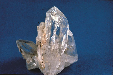
Reference photograph used for rock and mineral identification. It is not from this exact location or a guarantee that collecting is permitted.
The records below may represent collecting sites, managed programs, protected resources or research-only geology. Their individual status is more important than proximity.
smoky quartz
Core atlasquartz crystals and industrial silica
Core atlasMineral resource occurrence
USGS ResearchMineral resource occurrence
USGS ResearchVanadium
USGS ResearchMolybdenum
USGS ResearchBarite
USGS ResearchMolybdenum, Vanadium
USGS ResearchVanadium
USGS ResearchMineral resource occurrence
USGS ResearchMineral resource occurrence
USGS ResearchBarite
USGS ResearchMineral resource occurrence
USGS ResearchMineral resource occurrence
USGS ResearchMineral resource occurrence
USGS Researchnovaculite/whetstone geology
Core atlasMineral resource occurrence
USGS ResearchMercury, Antimony
USGS ResearchMercury, Antimony
USGS ResearchMercury
USGS ResearchMercury
USGS ResearchMercury
USGS ResearchMercury
USGS ResearchMercury
USGS ResearchMercury
USGS ResearchMercury
USGS ResearchMercury
USGS ResearchMercury
USGS ResearchMercury
USGS ResearchMercury
USGS ResearchMercury
USGS ResearchMercury
USGS ResearchMercury
USGS ResearchMercury
USGS ResearchMercury
USGS ResearchMineral resource occurrence
USGS ResearchMercury
USGS ResearchMercury
USGS ResearchMineral resource occurrence
USGS ResearchMercury
USGS ResearchMercury, Antimony
USGS ResearchMercury, Antimony
USGS ResearchMercury
USGS ResearchMercury
USGS ResearchMercury
USGS ResearchNickel
USGS ResearchMercury
USGS ResearchAluminum
USGS ResearchMineral resource occurrence
USGS ResearchMercury
USGS Research