Research11.5 mi
Arnold and American Eagle
Gold
USGS ResearchCOLORADO LOCAL FIELD REGION
Amazonite, smoky quartz, topaz and granitic pegmatite research around the Pikes Peak batholith.
LOCAL INTERACTIVE MAP
Explore nearby Colorado records without leaving this hub. Status, coordinate precision and access evidence determine whether a pin is a realistic field destination.
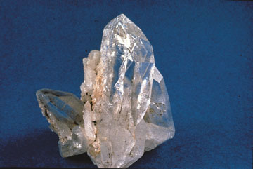
Reference photograph used for rock and mineral identification. It is not from this exact location or a guarantee that collecting is permitted.
The records below may represent collecting sites, managed programs, protected resources or research-only geology. Their individual status is more important than proximity.
Gold
USGS ResearchTungsten
USGS ResearchRare earth elements, Beryllium
USGS ResearchMineral resource occurrence
USGS ResearchBeryllium
USGS ResearchRare earth elements
USGS ResearchAgate and jasper occurrence patterns
Core atlasGarnet occurrences
Core atlasTourmaline occurrences
Core atlasTurquoise occurrences
Core atlasZircon and sapphire occurrences
Core atlasTungsten, Rare earth elements
USGS ResearchBeryllium
USGS ResearchSilver, Copper, Gold
USGS ResearchSilver, Gold, Lead, Zinc, Copper
USGS ResearchAmazonite, smoky quartz, fluorite and pegmatite minerals
Core atlasAmazonite, smoky quartz and pegmatite minerals
Core atlasRare earth elements
USGS ResearchTungsten, Copper
USGS ResearchUranium
USGS ResearchRare earth elements
USGS ResearchRare earth elements
USGS ResearchBeryllium
USGS ResearchUranium
USGS ResearchUranium
USGS ResearchRare earth elements
USGS ResearchUranium
USGS ResearchRare earth elements
USGS ResearchGold, Copper
USGS ResearchAluminum, Potash
USGS ResearchAluminum, Potash, Silver, Gold, Lead, Zinc
USGS ResearchMolybdenum
USGS ResearchGold, Silver
USGS ResearchBeryllium
USGS ResearchGold, Silver
USGS ResearchSilver, Gold, Copper, Zinc
USGS ResearchSilver, Gold, Copper, Lead, Zinc
USGS ResearchSilver, Copper, Lead, Tungsten, Zinc, Manganese, Fluorite, Gold
USGS ResearchSilver, Lead, Zinc, Gold, Copper
USGS ResearchLead, Silver, Zinc
USGS ResearchMolybdenum
USGS ResearchUranium, Copper
USGS ResearchSilver, Lead, Zinc
USGS ResearchBeryllium
USGS ResearchSilver, Lead, Gold, Zinc, Copper
USGS ResearchUranium
USGS ResearchGold, Silver, Uranium
USGS ResearchSilver, Gold, Copper, Uranium
USGS ResearchSilver
USGS ResearchUranium, Iron
USGS Research