KANSAS INTERACTIVE FIELD MAP
Inspect places, geology, access evidence and nearby context
The map keeps collecting leads, protected places and research occurrences visually distinct.
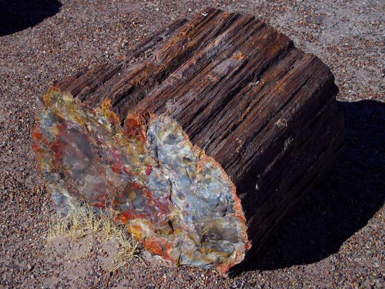
Rock and mineral reference images for Kansas
These are real reference photographs from the site media library, not photographs of the exact mapped sites. Always confirm mineral identity and collection permissions separately.


EXPLORE KANSAS LOCALLY
Rockhounding near Kansas cities
Move from statewide discovery into nearby field regions and then into individual location guides. City pages rank nearby records by evidence status and distance instead of treating every geological occurrence as an open collecting site.
Kansas rockhounding regions and local areas
Regional pages group related geology and field opportunities without turning every mineral occurrence into a separate destination page.
Kansas location directory preview
Start with the current inventory, then open the complete searchable directory for all 345 records.
Allen County — Geology & Rockhounding Research Context
county geology, mineral occurrences, fossil/bedrock/surficial context and mapped resources · Allen
Anderson County — Geology & Rockhounding Research Context
county geology, mineral occurrences, fossil/bedrock/surficial context and mapped resources · Anderson
Atchison County — Geology & Rockhounding Research Context
county geology, mineral occurrences, fossil/bedrock/surficial context and mapped resources · Atchison
Northeast Kansas Glacial Erratics Research
glacial erratics and Pleistocene deposits · Atchison / Brown / Doniphan / Nemaha / Marshall
Barber County — Geology & Rockhounding Research Context
county geology, mineral occurrences, fossil/bedrock/surficial context and mapped resources · Barber
Medicine Lodge Gypsum & Red Beds Research
gypsum, selenite and red-bed sedimentary geology · Barber
Red Hills Gypsum Research
gypsum, selenite and Permian red-bed geology · Barber / Comanche / Clark
Barton County — Geology & Rockhounding Research Context
county geology, mineral occurrences, fossil/bedrock/surficial context and mapped resources · Barton
Bourbon County — Geology & Rockhounding Research Context
county geology, mineral occurrences, fossil/bedrock/surficial context and mapped resources · Bourbon
Brown County — Geology & Rockhounding Research Context
county geology, mineral occurrences, fossil/bedrock/surficial context and mapped resources · Brown
Walter’s Farm Pumpkinfest 2026 — Gem & Fossil Sluice Mining
operator-provided gems and fossils · Butler
Butler County — Geology & Rockhounding Research Context
county geology, mineral occurrences, fossil/bedrock/surficial context and mapped resources · Butler
Carlile Shale Research
Cretaceous shale, concretions and marine fossil context · Central / Western Kansas
Greenhorn Limestone Fossil Research
Cretaceous limestone, oysters and other marine invertebrate fossils · Central / Western Kansas
Dakota Formation Research
sandstone, ironstone, concretions, plant fossil and sedimentary context · Central Kansas
Chase County — Geology & Rockhounding Research Context
county geology, mineral occurrences, fossil/bedrock/surficial context and mapped resources · Chase
Flint Hills Chert & Limestone Research
Permian limestone, chert/flint and fossils · Chase / Morris / Wabaunsee / Greenwood / Butler
Chautauqua County — Geology & Rockhounding Research Context
county geology, mineral occurrences, fossil/bedrock/surficial context and mapped resources · Chautauqua
Cherokee County — Geology & Rockhounding Research Context
county geology, mineral occurrences, fossil/bedrock/surficial context and mapped resources · Cherokee
Southeast Kansas Lead-Zinc District Research
galena, sphalerite, calcite and historic Tri-State mineralization · Cherokee
Cherokee Basin Mineral & Coal Research
coal measures, shale, limestone and mineralization context · Cherokee / Crawford / Labette
Cheyenne County — Geology & Rockhounding Research Context
county geology, mineral occurrences, fossil/bedrock/surficial context and mapped resources · Cheyenne
Clark County — Geology & Rockhounding Research Context
county geology, mineral occurrences, fossil/bedrock/surficial context and mapped resources · Clark
Clay County — Geology & Rockhounding Research Context
county geology, mineral occurrences, fossil/bedrock/surficial context and mapped resources · Clay
TRIP-READY SHORTLIST
Best-supported rockhounding sites in Kansas
This ranking favors current evidence, usable coordinates, navigation context and field readiness. It is not a popularity ranking and Conditional records still require verification.
Deanna Rose Children’s Farmstead — Gemstone Mining
operator-provided gemstone mining material
Great Wolf Lodge Kansas City — Oliver’s Mining Co.
operator-provided gemstone pay dirt
Kansas City West / Lawrence KOA Holiday — Kaw Valley Gem Mining
operator-provided gemstones and fossils
Salina Campground — Gem Mining Station
operator-provided gemstones
Adventure Tours of Kansas — Fossil & Mineral Hunt
fossils and minerals at operator-selected private sites
KC Pumpkin Patch — Gemstone Mining Sluice
operator-provided gemstones and minerals
Kansas Private-Land Fossil & Mineral Collecting — Permission Required
fossils, calcite, geodes, selenite, galena, sphalerite and common rocks
Kansas Quarry / Pit / Roadcut Collecting Context
limestone, chert, gypsum, fossils, aggregate and mineral specimens
Walter’s Farm Pumpkinfest 2026 — Gem & Fossil Sluice Mining
operator-provided gems and fossils
KANSAS MATERIAL DISCOVERY
What can you find rockhounding in Kansas?
Counts come from the live state inventory. They describe records mentioning a material, not guaranteed legal collecting sites.
Marine & Cretaceous Fossils
139 recordsCompare the strongest current examples, then open the individual guide for access and evidence status.
Lead & Zinc Districts
56 recordsCompare the strongest current examples, then open the individual guide for access and evidence status.
River Gravel & Silica
20 recordsCompare the strongest current examples, then open the individual guide for access and evidence status.
Limestone & Carbonate Rocks
16 recordsCompare the strongest current examples, then open the individual guide for access and evidence status.
Gypsum & Selenite
9 recordsCompare the strongest current examples, then open the individual guide for access and evidence status.
Flint Hills Chert
7 recordsCompare the strongest current examples, then open the individual guide for access and evidence status.
Managed Gem & Fossil Sluices
6 recordsCompare the strongest current examples, then open the individual guide for access and evidence status.
Quartz, Agate & Chalcedony
1 recordsCompare the strongest current examples, then open the individual guide for access and evidence status.
LAND, CLAIMS & PERMISSION
Who controls the land matters more than the mineral pin
The state map’s land-status and claim layers are planning aids. Exact ownership, claims, protected-resource rules and current manager guidance still control field use.
Protected fossil landmarks
Monument Rocks, Castle Rock, Little Jerusalem and other sensitive landscapes should be treated according to their exact current manager rules; public viewing does not imply fossil or rock removal.
Private land and quarries
Much Kansas fossil and mineral ground is private or industrial. Obtain explicit permission before entering quarries, pits, ranchland or private exposures.
Managed visitor programs
Gem and fossil sluices operate under site-specific hours, fees, supplied material and retention rules. Their permission does not extend beyond the managed activity.
Roadcuts and rights-of-way
Roadside geology can create traffic, trespass and right-of-way hazards. Never assume a visible exposure is safe or lawful to collect.
Fossils and cultural resources
Scientific fossils and archaeological material can have separate protections. The individual guide status and manager rule control.
WHEN TO GO
Kansas rockhounding seasonal planner
Winter research season
Cold, wind, ice and short daylight can make exposed western sites difficult even when roads remain open.
Spring field window
Milder temperatures favor fossil and prairie geology trips, with thunderstorms, mud and high water as key constraints.
Heat and storm planning
Heat, severe thunderstorms and limited shade require conservative field schedules.
Strong fall season
Cooler weather and lower vegetation often improve fossil, river and prairie field observation.
KANSAS FIELD KIT
A practical field kit for Kansas
Match equipment to the site and collecting method rather than carrying heavy tools by default.
Identification kit
Hand lens, magnet, notebook, scale, specimen bags and labels help preserve context and reduce guesswork.
River / gravel kit
Use sturdy footwear, gloves and eye protection. Check water level, access and disturbance rules before entering a stream or shoreline.
Geode / hard-rock kit
Eye protection and small hand tools are more useful than heavy equipment. Never enter mine workings or unstable cuts.
Fossil kit
Camera, scale, notebook and protective wrapping allow documentation without assuming removal is legal.
Panning kit
A basic pan, classifier and vial are enough for many recreational contexts; powered equipment can trigger different rules.
Navigation & safety
Carry offline mapping, water, weather layers and an emergency plan appropriate to remoteness and season.
COMMUNITY FIELD INTELLIGENCE
Recent Kansas field reports
Approved visitor reports add current observations without automatically changing a location’s legal or access status.
Open any location guide and use Share Your Story & Photos. Reports remain pending until admin approval.