Conditional52.8 mi
Kisatchie National Forest — Casual Rock/Mineral Collecting Context
small personal-use amounts of common rocks, semi-precious stones and minerals where locally allowed
Core atlasLOUISIANA LOCAL FIELD REGION
Petrified palmwood, agate and gravel research where collecting is strongly dependent on exact land rights.
LOCAL INTERACTIVE MAP
Explore nearby Louisiana records without leaving this hub. Status, coordinate precision and access evidence determine whether a pin is a realistic field destination.
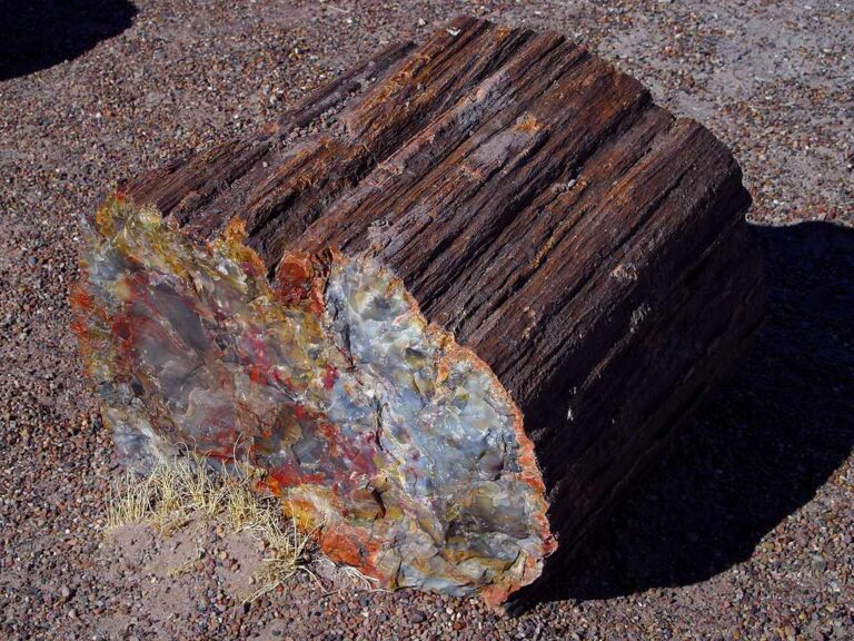
Reference photograph used for rock and mineral identification. It is not from this exact location or a guarantee that collecting is permitted.
The records below may represent collecting sites, managed programs, protected resources or research-only geology. Their individual status is more important than proximity.
small personal-use amounts of common rocks, semi-precious stones and minerals where locally allowed
Core atlashand panning/prospecting or low-disturbance mineral searching where rights and local rules allow
Core atlasLouisiana agate, chert, jasper, quartz gravel and petrified palmwood
Core atlasreworked fossils, petrified wood, chert and gravel specimens
Core atlasMineral resource occurrence
USGS ResearchMineral resource occurrence
USGS ResearchCatahoula Formation sandstone, silicified material and sedimentary geology
Core atlasMineral resource occurrence
USGS ResearchMineral resource occurrence
USGS ResearchMineral resource occurrence
USGS ResearchMineral resource occurrence
USGS ResearchMineral resource occurrence
USGS ResearchMineral resource occurrence
USGS ResearchMineral resource occurrence
USGS ResearchMineral resource occurrence
USGS ResearchMineral resource occurrence
USGS ResearchMineral resource occurrence
USGS ResearchMineral resource occurrence
USGS ResearchMineral resource occurrence
USGS ResearchMineral resource occurrence
USGS ResearchMineral resource occurrence
USGS Researchnear-surface lignite and Wilcox-group resource context
Core atlasMineral resource occurrence
USGS ResearchMineral resource occurrence
USGS ResearchMineral resource occurrence
USGS Researchloess, silt and Pleistocene terrace geology
Core atlasagate, chalcedony, jasper and quartz-bearing gravel
Core atlasclay and ceramic/industrial mineral resources
Core atlaspetrified palmwood, the official state fossil
Core atlasMineral resource occurrence
USGS ResearchMineral resource occurrence
USGS ResearchMineral resource occurrence
USGS Researcharchaeological, prehistoric and historic resources
Core atlasrocks, minerals, fossils and other natural park features
Core atlasarchaeological sites, artifacts and cultural materials
Core atlasrocks, fossils, shells and natural objects on LDWF lands
Core atlas