MICHIGAN INTERACTIVE FIELD MAP
Inspect places, geology, access evidence and nearby context
The map keeps collecting leads, protected places and research occurrences visually distinct.
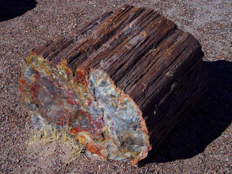
Rock and mineral reference images for Michigan
These are real reference photographs from the site media library, not photographs of the exact mapped sites. Always confirm mineral identity and collection permissions separately.


TRIP-READY SHORTLIST
Best-supported rockhounding sites in Michigan
This ranking favors current evidence, usable coordinates, navigation context and field readiness. It is not a popularity ranking and Conditional records still require verification.
Crystal Mountain — Gem Mining
operator-provided paydirt, gems and collectible stones
Jellystone Grayling — Gem Mining
operator-provided gems and fossils
Jellystone South Haven — Gem Mining
operator-provided gems and fossils
Northern Mining Company — Mighty Sluice
operator-provided gemstones, fossils and arrowheads
TreeRunner Rochester — Gem Mining
operator-provided paydirt and precious stones
Michigan Great Lakes Shoreline — Rock / Fossil / Agate Context
Petoskey stones, Charlevoix stones, Lake Superior agates, Yooperlites, fossils and beach cobbles
Michigan National Forests — Casual Rock / Mineral / Fossil Collecting Context
common rocks, minerals, invertebrate fossils and hand-panned gold context
Michigan Private Mine / Quarry / Mineral Club Field Trips
native copper, datolite, calcite, iron minerals, fossils and quarry minerals
Michigan State Land — Recreational Gold Panning / Sluicing Context
placer gold and heavy-mineral concentrates
Michigan State-Owned / Public-Trust Land — Hobby Rockhounding Context
rocks, minerals and invertebrate fossils
MICHIGAN MINERAL DISCOVERY
What can you find rockhounding in Michigan?
The atlas mixes visitor programs, stronger collecting leads, protected environments and geological research. Material record counts are not promises that collecting is allowed. Verify the exact location and manager before taking anything.
Identify Michigan rocks, minerals and fossils →
Petoskey Stones & Fossil Coral
4 recordsHexagonaria fossil corals are especially associated with northwest Lower Peninsula beaches; their distinctive corallite pattern helps distinguish them from ordinary limestone. Confirm beach ownership and removal rules.
Lake Superior Agates & Chalcedony
6 recordsBanded agate can be found in Great Lakes glacial cobbles and shores, but pin locations are not guarantees of available or lawful specimens.
Native Copper & Keweenaw Minerals
94 recordsKeweenaw native copper and associated minerals reflect historic mining geology. Mine dumps, spoil and active claims commonly need owner permission.
Chlorastrolite (Greenstone)
3 recordsMichigan's distinctive greenstone is associated with Lake Superior geology. Some localities are protected; assess precise site permissions.
Devonian Fossils & Crinoids
105 recordsMarine fossils and crinoid stems occur in Michigan limestone and beach material. Fossil occurrences may lie in protected park or private sites.
Fluorescent Sodalite-bearing Rocks
2 recordsUV-fluorescent sodalite-bearing syenite pebbles occur on some Great Lakes beaches; a UV reaction is a clue, not proof of identity or access.
Quartz, Jasper & Glacial Pebbles
87 recordsGlacially transported stones can differ from local bedrock; use hardness, fracture and mineral texture alongside the source geology.
Iron Formation & Lake Superior Geology
156 recordsUpper Peninsula iron formations and historic mines offer research context but not unrestricted collection.
LAND, CLAIMS & PERMISSION
Who controls the land matters more than the mineral pin
The state map’s land-status and claim layers are planning aids. Exact ownership, claims, protected-resource rules and current manager guidance still control field use.
State parks & protected shores
Michigan state parks and protected areas can limit or prohibit removal of natural materials. Check current unit-specific rules and property boundaries.
Lake Superior coast & islands
Beach access, ownership and special protections vary. Isle Royale National Park is not a casual rock-collecting destination.
Historic mines
Keweenaw and iron-district dumps, mines and tailings can be unstable, private or restricted. Never enter mine workings.
Public trust & private shore
Public waters do not automatically grant removal rights from adjoining private land or regulated beaches.
UV and specimen methods
Observe without disturbing protected habitat; do not trespass on beaches or mining property to use UV lights or tools.
WHEN TO GO
Michigan rockhounding seasonal planner
Winter research & frozen shoreline
Snow, ice, lake-effect weather and waves make many beach and mine localities unsafe.
Spring thaw field checks
Shore access varies with ice-out, storms and park reopening. Avoid fragile wet shoreline habitats.
Primary Great Lakes field window
Longer days aid shoreline identification; check beach crowding, weather and lake conditions.
Cool-weather shore research
Storms can change cobble exposures but high surf and cold water require caution.
MICHIGAN FIELD KIT
A practical field kit for Michigan
Match equipment to the site and collecting method rather than carrying heavy tools by default.
Identification kit
Hand lens, magnet, notebook, scale, specimen bags and labels help preserve context and reduce guesswork.
River / gravel kit
Use sturdy footwear, gloves and eye protection. Check water level, access and disturbance rules before entering a stream or shoreline.
Geode / hard-rock kit
Eye protection and small hand tools are more useful than heavy equipment. Never enter mine workings or unstable cuts.
Fossil kit
Camera, scale, notebook and protective wrapping allow documentation without assuming removal is legal.
Panning kit
A basic pan, classifier and vial are enough for many recreational contexts; powered equipment can trigger different rules.
Navigation & safety
Carry offline mapping, water, weather layers and an emergency plan appropriate to remoteness and season.
COMMUNITY FIELD INTELLIGENCE
Recent Michigan field reports
Approved visitor reports add current observations without automatically changing a location’s legal or access status.
Open any location guide and use Share Your Story & Photos. Reports remain pending until admin approval.
EXPLORE MICHIGAN LOCALLY
Rockhounding near Michigan cities
Move from statewide discovery into nearby field regions and then into individual location guides. City pages rank nearby records by evidence status and distance instead of treating every geological occurrence as an open collecting site.
Michigan rockhounding regions and local areas
Regional pages group related geology and field opportunities without turning every mineral occurrence into a separate destination page.
Michigan location directory preview
Start with the current inventory, then open the complete searchable directory for all 371 records.
Alcona County — Rock, Mineral & Fossil Research Matrix
county-scale bedrock, glacial, mineral-resource and fossil geology · Alcona
Pictured Rocks Natural-Object Firewall
rocks, beach stones and fossils · Alger
Pictured Rocks National Lakeshore — Beach Stones & Natural Objects Protected
Lake Superior beach stones, sandstone, fossils and natural objects · Alger
Alger County — Rock, Mineral & Fossil Research Matrix
county-scale bedrock, glacial, mineral-resource and fossil geology · Alger
Allegan County — Rock, Mineral & Fossil Research Matrix
county-scale bedrock, glacial, mineral-resource and fossil geology · Allegan
Alpena County — Rock, Mineral & Fossil Research Matrix
county-scale bedrock, glacial, mineral-resource and fossil geology · Alpena
Michigan Septarian Concretion Research
septarian concretions, calcite and sedimentary structures · Alpena / Presque Isle / Arenac / Bay
Alpena / Thunder Bay Devonian Fossil Research
Devonian corals, brachiopods, stromatoporoids and limestone fossils · Alpena / Presque Isle / Montmorency
Antrim County — Rock, Mineral & Fossil Research Matrix
county-scale bedrock, glacial, mineral-resource and fossil geology · Antrim
Arenac County — Rock, Mineral & Fossil Research Matrix
county-scale bedrock, glacial, mineral-resource and fossil geology · Arenac
Baraga County — Rock, Mineral & Fossil Research Matrix
county-scale bedrock, glacial, mineral-resource and fossil geology · Baraga
Barry County — Rock, Mineral & Fossil Research Matrix
county-scale bedrock, glacial, mineral-resource and fossil geology · Barry
Bay County — Rock, Mineral & Fossil Research Matrix
county-scale bedrock, glacial, mineral-resource and fossil geology · Bay
Crystal Mountain — Gem Mining
operator-provided paydirt, gems and collectible stones · Benzie
Benzie County — Rock, Mineral & Fossil Research Matrix
county-scale bedrock, glacial, mineral-resource and fossil geology · Benzie
Berrien County — Rock, Mineral & Fossil Research Matrix
county-scale bedrock, glacial, mineral-resource and fossil geology · Berrien
Branch County — Rock, Mineral & Fossil Research Matrix
county-scale bedrock, glacial, mineral-resource and fossil geology · Branch
Calhoun County — Rock, Mineral & Fossil Research Matrix
county-scale bedrock, glacial, mineral-resource and fossil geology · Calhoun
Cass County — Rock, Mineral & Fossil Research Matrix
county-scale bedrock, glacial, mineral-resource and fossil geology · Cass
Charlevoix County — Rock, Mineral & Fossil Research Matrix
county-scale bedrock, glacial, mineral-resource and fossil geology · Charlevoix
Charlevoix Stone Research
Favosites fossil coral / Charlevoix stones · Charlevoix / Emmet / Antrim
Cheboygan County — Rock, Mineral & Fossil Research Matrix
county-scale bedrock, glacial, mineral-resource and fossil geology · Cheboygan
Northern Mining Company — Mighty Sluice
operator-provided gemstones, fossils and arrowheads · Chippewa
Chippewa County — Rock, Mineral & Fossil Research Matrix
county-scale bedrock, glacial, mineral-resource and fossil geology · Chippewa