MINNESOTA INTERACTIVE FIELD MAP
Inspect places, geology, access evidence and nearby context
The map keeps collecting leads, protected places and research occurrences visually distinct.
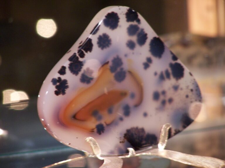
Rock and mineral reference images for Minnesota
These are real reference photographs from the site media library, not photographs of the exact mapped sites. Always confirm mineral identity and collection permissions separately.


TRIP-READY SHORTLIST
Best-supported rockhounding sites in Minnesota
This ranking favors current evidence, usable coordinates, navigation context and field readiness. It is not a popularity ranking and Conditional records still require verification.
Ferguson’s Minnesota Harvest — Ferguson’s Mining Co. Gem Mining
operator-provided gem-mining bags and gems
Lilli Putt — Lilli Creek Mining
operator-provided gemstones and fossils
Niagara Cave — Gemstone & Fossil Mining
operator-provided gemstones and fossils
Pinehaven Farm — Gem Mining
operator-provided gems and minerals
Putt N Pets Mini Golf — Gemstone Mining
operator-provided gemstones/mining rough
Minnesota Lake Superior Shoreline — Agate / Beach-Rock Context
Lake Superior agates, basalt, rhyolite, amygdaloids and beach cobbles
Minnesota National Forests — Casual Rock / Mineral / Fossil / Gold Context
common rocks, minerals, invertebrate fossils and hand-panned gold context
Minnesota Private Quarry / Gravel Pit / Club Field Trips
agates, jasper, quartz, calcite, fossils and quarry minerals
Minnesota State Forests / DNR-Managed Lands — Rock & Mineral Context
rocks, minerals and geologic specimens
Minnesota State-Owned Stream / River / Lake Beds — Recreational Hand Gold Panning
placer gold and heavy-mineral concentrates
MINNESOTA MINERAL DISCOVERY
What can you find rockhounding in Minnesota?
The atlas mixes visitor programs, stronger collecting leads, protected environments and geological research. Material record counts are not promises that collecting is allowed. Verify the exact location and manager before taking anything.
Identify Minnesota rocks, minerals and fossils →
Lake Superior Agates
7 recordsLake Superior agate is Minnesota's official state gemstone. Banded silica cobbles occur in glacial deposits and some gravel/shore contexts, subject to current property rules.
Thomsonite & North Shore Zeolites
2 recordsThomsonite forms in basalt cavities along parts of the North Shore; protected shore access and shoreline ownership require careful verification.
Basalt, Rhyolite & Volcanic Rock
4 recordsLake Superior's rift rocks host amygdules, volcanic textures and mineral veins; texture, not color alone, helps identification.
Hematite, Magnetite & Iron Ranges
2 recordsIron-rich deposits in the Mesabi and Vermilion regions are major industrial geology, but working mines and dumps are not open by default.
Ordovician Fossils & Limestone
105 recordsPaleozoic fossil-bearing strata are important in southeastern Minnesota. Park and quarry rules can restrict collection.
Quartz, Jasper & Chalcedony
12 recordsHard silica materials occur in gravels, North Shore lavas and glacial deposits. Distinguish jasper from iron-stained rhyolite.
Pipestone & Cultural Resources
6 recordsPipestone has protected cultural and Indigenous significance. Pipestone National Monument is not a public rockhounding quarry.
Gold & Heavy-mineral Research
13 recordsHistoric gold reports do not establish hobby-panning permissions. Separate geology from current stream rights.
LAND, CLAIMS & PERMISSION
Who controls the land matters more than the mineral pin
The state map’s land-status and claim layers are planning aids. Exact ownership, claims, protected-resource rules and current manager guidance still control field use.
State parks and recreational areas
Minnesota state park resource-removal rules generally protect rocks, fossils and natural objects. Check the specific current park unit regulation.
Pipestone cultural sites
Pipestone National Monument protects sensitive cultural resources. Do not treat mapped pipestone occurrences as public collecting opportunities.
Lake Superior shoreline
Access and collection depend on shoreline ownership, municipal restrictions and protected areas.
Iron mines
Industrial mines and historic workings can be hazardous or restricted. Obtain operator/landowner authorization where required.
Managed gem experiences
Visitor sluices provide different permissions from natural rockhounding. Verify current schedules, fees and retention terms.
WHEN TO GO
Minnesota rockhounding seasonal planner
Winter geology research
Deep freeze, snow and ice limit shoreline and quarry access.
Thaw and spring runoff
Ice breakup changes shorelines; monitor water levels, muddy roads and seasonal closures.
North Shore field season
Generally better coastal access, though fog, storms and strong lake waves remain concerns.
Fall identification season
Cool weather and lower vegetation help field observation; lake storms increase.
MINNESOTA FIELD KIT
A practical field kit for Minnesota
Match equipment to the site and collecting method rather than carrying heavy tools by default.
Identification kit
Hand lens, magnet, notebook, scale, specimen bags and labels help preserve context and reduce guesswork.
River / gravel kit
Use sturdy footwear, gloves and eye protection. Check water level, access and disturbance rules before entering a stream or shoreline.
Geode / hard-rock kit
Eye protection and small hand tools are more useful than heavy equipment. Never enter mine workings or unstable cuts.
Fossil kit
Camera, scale, notebook and protective wrapping allow documentation without assuming removal is legal.
Panning kit
A basic pan, classifier and vial are enough for many recreational contexts; powered equipment can trigger different rules.
Navigation & safety
Carry offline mapping, water, weather layers and an emergency plan appropriate to remoteness and season.
COMMUNITY FIELD INTELLIGENCE
Recent Minnesota field reports
Approved visitor reports add current observations without automatically changing a location’s legal or access status.
Open any location guide and use Share Your Story & Photos. Reports remain pending until admin approval.
EXPLORE MINNESOTA LOCALLY
Rockhounding near Minnesota cities
Move from statewide discovery into nearby field regions and then into individual location guides. City pages rank nearby records by evidence status and distance instead of treating every geological occurrence as an open collecting site.
Minnesota rockhounding regions and local areas
Regional pages group related geology and field opportunities without turning every mineral occurrence into a separate destination page.
Minnesota location directory preview
Start with the current inventory, then open the complete searchable directory for all 375 records.
Aitkin County — Rock, Mineral & Fossil Research Matrix
county-scale bedrock, glacial, mineral-resource and fossil geology · Aitkin
Lilli Putt — Lilli Creek Mining
operator-provided gemstones and fossils · Anoka
Anoka County — Rock, Mineral & Fossil Research Matrix
county-scale bedrock, glacial, mineral-resource and fossil geology · Anoka
Becker County — Rock, Mineral & Fossil Research Matrix
county-scale bedrock, glacial, mineral-resource and fossil geology · Becker
Beltrami County — Rock, Mineral & Fossil Research Matrix
county-scale bedrock, glacial, mineral-resource and fossil geology · Beltrami
Benton County — Rock, Mineral & Fossil Research Matrix
county-scale bedrock, glacial, mineral-resource and fossil geology · Benton
Big Stone County — Rock, Mineral & Fossil Research Matrix
county-scale bedrock, glacial, mineral-resource and fossil geology · Big Stone
Blue Earth County — Rock, Mineral & Fossil Research Matrix
county-scale bedrock, glacial, mineral-resource and fossil geology · Blue Earth
Brown County — Rock, Mineral & Fossil Research Matrix
county-scale bedrock, glacial, mineral-resource and fossil geology · Brown
Carlton County — Rock, Mineral & Fossil Research Matrix
county-scale bedrock, glacial, mineral-resource and fossil geology · Carlton
Carver County — Rock, Mineral & Fossil Research Matrix
county-scale bedrock, glacial, mineral-resource and fossil geology · Carver
Cass County — Rock, Mineral & Fossil Research Matrix
county-scale bedrock, glacial, mineral-resource and fossil geology · Cass
Chippewa County — Rock, Mineral & Fossil Research Matrix
county-scale bedrock, glacial, mineral-resource and fossil geology · Chippewa
Pinehaven Farm — Gem Mining
operator-provided gems and minerals · Chisago
Chisago County — Rock, Mineral & Fossil Research Matrix
county-scale bedrock, glacial, mineral-resource and fossil geology · Chisago
Clay County — Rock, Mineral & Fossil Research Matrix
county-scale bedrock, glacial, mineral-resource and fossil geology · Clay
Clearwater County — Rock, Mineral & Fossil Research Matrix
county-scale bedrock, glacial, mineral-resource and fossil geology · Clearwater
Putt N Pets Mini Golf — Gemstone Mining
operator-provided gemstones/mining rough · Cook
Cook County — Rock, Mineral & Fossil Research Matrix
county-scale bedrock, glacial, mineral-resource and fossil geology · Cook
Minnesota Lake Superior Shoreline — Agate / Beach-Rock Context
Lake Superior agates, basalt, rhyolite, amygdaloids and beach cobbles · Cook / Lake / St. Louis
Lake Superior Shoreline Manager Gate
agates, beach rocks and minerals · Cook / Lake / St. Louis
North Shore Keweenawan Volcanic Research
basalt, rhyolite, amygdaloids, agates and volcanic minerals · Cook / Lake / St. Louis
North Shore Thomsonite & Zeolite Research
thomsonite, stilbite, prehnite and basalt-cavity zeolites · Cook / Lake / St. Louis
Lake Superior Agate Research
Lake Superior agates, chalcedony and jasper · Cook / Lake / St. Louis / statewide glacial deposits