MISSOURI INTERACTIVE FIELD MAP
Inspect places, geology, access evidence and nearby context
The map keeps collecting leads, protected places and research occurrences visually distinct.
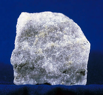
Rock and mineral reference images for Missouri
These are real reference photographs from the site media library, not photographs of the exact mapped sites. Always confirm mineral identity and collection permissions separately.


TRIP-READY SHORTLIST
Best-supported rockhounding sites in Missouri
This ranking favors current evidence, usable coordinates, navigation context and field readiness. It is not a popularity ranking and Conditional records still require verification.
Sheffler Rock Shop & Geode Mine
Keokuk-area geodes with quartz/calcite and related cavity minerals
Branson Mountain Gem Mining
commercial paydirt gemstones and fossils
Cedar Creek / Moon Loop Rockhounding Context
chert, quartz, carbonate and general rockhounding observations
Haunted Ridge Rocks
druzy quartz, lace agate/chert and associated minerals
Mark Twain National Forest Recreational Collecting
common rocks, minerals and common invertebrate/plant fossils
MISSOURI MINERAL DISCOVERY
What can you find rockhounding in Missouri?
The atlas mixes visitor programs, stronger collecting leads, protected environments and geological research. Material record counts are not promises that collecting is allowed. Verify the exact location and manager before taking anything.
Identify Missouri rocks, minerals and fossils →
Drusy Quartz & Crystal-coated Rock
44 recordsFine quartz crystal coatings occur in parts of southeastern Missouri. Distinguish natural druse from rough weathering and check quarry/private land rights.
Barite and Missouri Mineral Districts
31 recordsHeavy barite is associated with Missouri mineral districts; many deposits are private or historic mining research locations.
Galena, Sphalerite & Lead-Zinc Ores
69 recordsTri-State and Viburnum mining belts contain lead-zinc resources. Never enter old workings or assume mine dumps are open.
Geodes and Silica Nodules
12 recordsGeode-like nodules and mineral cavities vary with limestone and other host settings. Rock-breakage and land access require permission.
Crinoids & Paleozoic Marine Fossils
135 recordsCarbonate formations record marine fossils; protected parks and roadcuts may be viewing-only.
Chert, Flint & Jasper
105 recordsOzark chert is widespread and historically significant. Do not disturb archaeological artifacts or cultural sites.
Agate & Chalcedony Gravel
5 recordsSilica nodules and rounded gravel specimens require careful material identification and site-specific access.
St. Francois Igneous Rocks
3 recordsPrecambrian igneous rocks are a distinct southeastern Missouri field-identification theme; many exposures are protected or privately owned.
LAND, CLAIMS & PERMISSION
Who controls the land matters more than the mineral pin
The state map’s land-status and claim layers are planning aids. Exact ownership, claims, protected-resource rules and current manager guidance still control field use.
State parks and natural areas
Missouri state parks and designated natural areas may restrict collecting; verify site-specific rules.
Lead and zinc mines
Historic mining areas can expose dangerous shafts, tailings, contamination and unstable ground. Do not access without explicit authority.
Private quarries and fee sites
Permission and current operator conditions govern mineral and geode digs.
Caves and archaeological sites
Leave cave formations, cultural resources and artifacts undisturbed. Observation does not authorize removal.
River and roadcut access
Public roads and watercourses are not universal collection permits; confirm safe access and material-removal authority.
WHEN TO GO
Missouri rockhounding seasonal planner
Low-vegetation research
Cold weather favors some observation but icing and wet slopes raise risk.
Spring Ozarks field window
Comfortable temperatures offset by high creek flow and muddy roads.
Hot and humid conditions
Heat, ticks, snakes and thunderstorms require conservative scheduling.
Strong fall mineral field window
Cooler weather and reduced vegetation help geology research.
MISSOURI FIELD KIT
A practical field kit for Missouri
Match equipment to the site and collecting method rather than carrying heavy tools by default.
Identification kit
Hand lens, magnet, notebook, scale, specimen bags and labels help preserve context and reduce guesswork.
River / gravel kit
Use sturdy footwear, gloves and eye protection. Check water level, access and disturbance rules before entering a stream or shoreline.
Geode / hard-rock kit
Eye protection and small hand tools are more useful than heavy equipment. Never enter mine workings or unstable cuts.
Fossil kit
Camera, scale, notebook and protective wrapping allow documentation without assuming removal is legal.
Panning kit
A basic pan, classifier and vial are enough for many recreational contexts; powered equipment can trigger different rules.
Navigation & safety
Carry offline mapping, water, weather layers and an emergency plan appropriate to remoteness and season.
COMMUNITY FIELD INTELLIGENCE
Recent Missouri field reports
Approved visitor reports add current observations without automatically changing a location’s legal or access status.
Open any location guide and use Share Your Story & Photos. Reports remain pending until admin approval.
EXPLORE MISSOURI LOCALLY
Rockhounding near Missouri cities
Move from statewide discovery into nearby field regions and then into individual location guides. City pages rank nearby records by evidence status and distance instead of treating every geological occurrence as an open collecting site.
Missouri rockhounding regions and local areas
Regional pages group related geology and field opportunities without turning every mineral occurrence into a separate destination page.
Missouri location directory preview
Start with the current inventory, then open the complete searchable directory for all 415 records.
Adair Rockhounding & Geology Research Index
county geology, fossils, aggregates, chert, coal/industrial minerals and occurrence research · Adair
Andrew Rockhounding & Geology Research Index
county geology, fossils, aggregates, chert, coal/industrial minerals and occurrence research · Andrew
Atchison Rockhounding & Geology Research Index
county geology, fossils, aggregates, chert, coal/industrial minerals and occurrence research · Atchison
Audrain Rockhounding & Geology Research Index
county geology, fossils, aggregates, chert, coal/industrial minerals and occurrence research · Audrain
Barry Rockhounding & Geology Research Index
Ozark chert/dolomite/limestone, caves, fossils, druse and mineral occurrence research · Barry
Barton Rockhounding & Geology Research Index
county geology, fossils, aggregates, chert, coal/industrial minerals and occurrence research · Barton
Bates Rockhounding & Geology Research Index
county geology, fossils, aggregates, chert, coal/industrial minerals and occurrence research · Bates
Benton County Mozarkite Belt
Mozarkite/chert/chalcedony · Benton
Benton Rockhounding & Geology Research Index
Mozarkite, chert, Cotter Dolomite and west-central Missouri mineral occurrence research · Benton
Bollinger Rockhounding & Geology Research Index
county geology, fossils, aggregates, chert, coal/industrial minerals and occurrence research · Bollinger
Rock Bridge Memorial State Park
karst/cave/limestone geology · Boone
Boone Rockhounding & Geology Research Index
county geology, fossils, aggregates, chert, coal/industrial minerals and occurrence research · Boone
Cedar Creek / Moon Loop Rockhounding Context
chert, quartz, carbonate and general rockhounding observations · Boone / Callaway
Buchanan Rockhounding & Geology Research Index
county geology, fossils, aggregates, chert, coal/industrial minerals and occurrence research · Buchanan
Butler Rockhounding & Geology Research Index
county geology, fossils, aggregates, chert, coal/industrial minerals and occurrence research · Butler
Caldwell Rockhounding & Geology Research Index
county geology, fossils, aggregates, chert, coal/industrial minerals and occurrence research · Caldwell
Callaway Rockhounding & Geology Research Index
county geology, fossils, aggregates, chert, coal/industrial minerals and occurrence research · Callaway
Ha Ha Tonka State Park
karst, dolomite, caves · Camden
Camden Rockhounding & Geology Research Index
county geology, fossils, aggregates, chert, coal/industrial minerals and occurrence research · Camden
Ha Ha Tonka Karst & Dolomite Geology
dolomite, karst, caves and springs · Camden
Cape Girardeau Rockhounding & Geology Research Index
county geology, fossils, aggregates, chert, coal/industrial minerals and occurrence research · Cape Girardeau
Carroll Rockhounding & Geology Research Index
county geology, fossils, aggregates, chert, coal/industrial minerals and occurrence research · Carroll
Carter Rockhounding & Geology Research Index
Ozark chert/dolomite/limestone, caves, fossils, druse and mineral occurrence research · Carter
Cass Rockhounding & Geology Research Index
county geology, fossils, aggregates, chert, coal/industrial minerals and occurrence research · Cass