Research5.1 mi
Torrence Mine 1880
Silver, Gold, Lead, Zinc, Copper, Barite, Manganese, Fluorite, Vanadium, Molybdenum, Arsenic
USGS ResearchNEW MEXICO LOCAL FIELD REGION
Volcanic glass, tuffs and faulting; exact public land rules required.
LOCAL INTERACTIVE MAP
Explore nearby New Mexico records without leaving this hub. Status, coordinate precision and access evidence determine whether a pin is a realistic field destination.
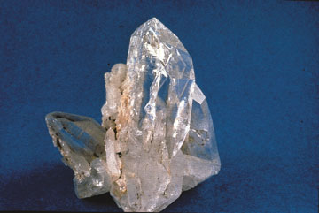
Reference photograph used for rock and mineral identification. It is not from this exact location or a guarantee that collecting is permitted.
The records below may represent collecting sites, managed programs, protected resources or research-only geology. Their individual status is more important than proximity.
Silver, Gold, Lead, Zinc, Copper, Barite, Manganese, Fluorite, Vanadium, Molybdenum, Arsenic
USGS ResearchLead, Zinc, Copper, Silver, Gold, Barite, Fluorite
USGS ResearchManganese, Tungsten, Barite
USGS ResearchSilver, Gold, Copper
USGS ResearchManganese, Tungsten
USGS ResearchCopper
USGS ResearchLead, Barite
USGS ResearchCopper, Fluorite
USGS ResearchFluorite, Barite
USGS ResearchLead, Zinc, Copper
USGS ResearchLead, Zinc, Copper, Silver, Gold
USGS ResearchLead, Zinc, Copper, Silver
USGS ResearchCopper, Iron
USGS ResearchSilver, Gold, Lead, Copper
USGS ResearchFluorite
USGS ResearchSilver, Gold, Copper
USGS ResearchFluorite, Copper
USGS ResearchSilver, Gold, Copper
USGS ResearchManganese, Tungsten
USGS ResearchCopper
USGS ResearchSilver, Copper, Gold, Lead
USGS ResearchSilver, Copper, Gold, Lead
USGS ResearchLead, Fluorite, Copper, Vanadium, Zinc, Barite, Molybdenum
USGS ResearchFluorite, Copper
USGS ResearchFluorite
USGS ResearchSilver, Copper, Gold
USGS ResearchLead, Vanadium, Fluorite, Barite, Molybdenum
USGS ResearchSilver, Copper, Gold, Lead, Zinc
USGS ResearchFluorite, Barite, Lead
USGS Research