TEXAS INTERACTIVE FIELD MAP
Inspect places, geology, access evidence and nearby context
The map keeps collecting leads, protected places and research occurrences visually distinct.
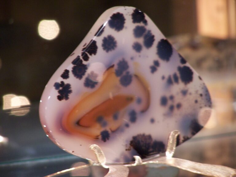
Rock and mineral reference images for Texas
These are real reference photographs from the site media library, not photographs of the exact mapped sites. Always confirm mineral identity and collection permissions separately.



TRIP-READY SHORTLIST
Best-supported rockhounding sites in Texas
This ranking favors current evidence, usable coordinates, navigation context and field readiness. It is not a popularity ranking and Conditional records still require verification.
Mineral Wells Fossil Park — Designated Fossil Collecting Area
Pennsylvanian marine invertebrate fossils including crinoids, brachiopods and related small fossils
Cross Bar Management Area — Texas BLM Surface Estate Rockhounding Conditional
common rocks/mineral specimens under BLM rules if exact surface/mineral rights and subarea restrictions clear
Ladonia Fossil Park — North Sulphur River Designated Public Fossil Park
Cretaceous marine fossils and fossil-hunting material exposed in the North Sulphur River
Mason County September 2026 Private Topaz & Crystal Hunt
Texas topaz and crystals; artifact claims are excluded from mineral authorization
TEXAS MINERAL DISCOVERY
What can you find rockhounding in Texas?
The atlas mixes visitor programs, stronger collecting leads, protected environments and geological research. Material record counts are not promises that collecting is allowed. Verify the exact location and manager before taking anything.
Identify Texas rocks, minerals and fossils →
Mineral Wells & Pennsylvanian Fossils
79 recordsThe City of Mineral Wells operates a designated fossil park for personal surface collecting. Other fossil areas have their own restrictions.
Mason County Topaz
5 recordsTexas blue topaz and clear topaz have a historic Mason County mineral association, usually accessed via private-ranch programs.
Agate, Jasper & West Texas Silica
9 recordsWest Texas desert and volcanic rock contains agate/jasper but land is predominantly private and park collections prohibited.
Quartz, Amethyst & Pegmatite
10 recordsCentral Texas and the Llano Uplift include hard-rock pegmatites; visit only with verified authorization.
Calcite, Geodes & Limestone
17 recordsCarbonate areas across central and northern Texas include fossils and crystal research without universal collecting rights.
Shark Teeth & Cretaceous Marine Fossils
22 recordsCoastal Plain and North Texas fossil beds include marine fossils with specific river/park/owner rules.
Alibates Flint & Protected Cultural Stone
2 recordsAlibates Flint Quarries National Monument preserves cultural resource material and is not a rock-collection site.
Historic Mineral Districts
348 recordsIndustrial and historic Texas ore/mineral occurrences are not public collecting destinations without permission.
LAND, CLAIMS & PERMISSION
Who controls the land matters more than the mineral pin
The state map’s land-status and claim layers are planning aids. Exact ownership, claims, protected-resource rules and current manager guidance still control field use.
Texas state parks
Texas Parks & Wildlife rules prohibit taking rocks, minerals, fossils and geological deposits in state parks except with an authorized permit.
Mineral Wells designated fossil park
The City of Mineral Wells offers personal-use fossil collecting inside its designated fossil area, with surface-collection and tool restrictions; current park instructions control.
Mason private ranches and mines
Topaz/ranch mineral collecting depends on individual landowner authorization, opening status, fees and allowed tools.
Fossil rivers and submerged areas
North Sulphur River and other fossil beds may involve changing access and environmental rules; no broad collecting guarantee.
Cultural resources and protected parks
Alibates Flint Quarries National Monument, Big Bend National Park and archaeological sites are not collecting destinations.
WHEN TO GO
Texas rockhounding seasonal planner
Winter Texas rockhounding
Lower temperatures suit desert and fossil visits but icy roads and northers can intervene.
Prime spring collecting
Comfortable temperatures, but spring rain raises river and flash-flood risks.
Heat and hurricane season
West Texas exposure can be extreme; Gulf storms and floods disrupt travel.
Autumn field season
Cooler weather generally supports approved dig visits; verify owner schedules.
TEXAS FIELD KIT
A practical field kit for Texas
Match equipment to the site and collecting method rather than carrying heavy tools by default.
Identification kit
Hand lens, magnet, notebook, scale, specimen bags and labels help preserve context and reduce guesswork.
River / gravel kit
Use sturdy footwear, gloves and eye protection. Check water level, access and disturbance rules before entering a stream or shoreline.
Geode / hard-rock kit
Eye protection and small hand tools are more useful than heavy equipment. Never enter mine workings or unstable cuts.
Fossil kit
Camera, scale, notebook and protective wrapping allow documentation without assuming removal is legal.
Panning kit
A basic pan, classifier and vial are enough for many recreational contexts; powered equipment can trigger different rules.
Navigation & safety
Carry offline mapping, water, weather layers and an emergency plan appropriate to remoteness and season.
COMMUNITY FIELD INTELLIGENCE
Recent Texas field reports
Approved visitor reports add current observations without automatically changing a location’s legal or access status.
Open any location guide and use Share Your Story & Photos. Reports remain pending until admin approval.
EXPLORE TEXAS LOCALLY
Rockhounding near Texas cities
Move from statewide discovery into nearby field regions and then into individual location guides. City pages rank nearby records by evidence status and distance instead of treating every geological occurrence as an open collecting site.
Texas rockhounding regions and local areas
Regional pages group related geology and field opportunities without turning every mineral occurrence into a separate destination page.
Texas location directory preview
Start with the current inventory, then open the complete searchable directory for all 363 records.
Texas BLM General Rockhounding Rule
common rocks/mineral specimens · BLM-administered surface estate
Bastrop County Geode / Sedimentary Mineral Context
geodes, quartz/calcite and sedimentary minerals · Bastrop
South Texas Coastal Plain Fossil Context
fossils and sedimentary rocks · Bee / Goliad / Victoria
Belton Lake — USACE Natural Resource No-Removal Control
fossils and mineral deposits · Bell
Bell County Cretaceous Fossil Context
Cretaceous marine fossils · Bell
Government Canyon State Natural Area
dinosaur tracks and natural geology · Bexar
Bexar County Cretaceous Fossil Context
Cretaceous marine fossils · Bexar
Pedernales Falls State Park
riverbed limestone/geology · Blanco
Blanco County Granite / Hill Country Mineral Context
granite-related minerals and quartz · Blanco
Pedernales River Rock/Gravel Mineral Context
river-worn quartz and Hill Country rocks · Blanco / Gillespie
Brazos River Gravel / Fossil Context
river gravels and fossils · Brazos / Robertson / Burleson
Big Bend National Park
rocks, minerals and fossils · Brewster
Alpine / Brewster County Agate Context
agate, chalcedony and jasper · Brewster
Christmas Mountains Mineral Context
volcanic/mineral occurrences · Brewster
Glass Mountains Fossil/Geology Context
Permian fossils and carbonate geology · Brewster
Marathon Basin Fossil/Geology Context
Paleozoic fossils and structural geology · Brewster
Terlingua Mercury / Cinnabar Mining District
cinnabar, calcite and historic mercury minerals · Brewster
Woodward Ranch Agate Historic Locality
agate, plume agate and chalcedony · Brewster
Big Bend Region Rock/Agate Context Outside NPS Units
agate, volcanic rocks and desert minerals · Brewster / Presidio
Caprock Canyons State Park
canyon geology and fossils · Briscoe
Caprock Escarpment Regional Geology Outside State Park
sedimentary rocks, gypsum and regional fossils · Briscoe / Floyd / Crosby
Whiskey Bridge / Brazos River Fossil Context
Eocene marine fossils · Burleson
Longhorn Cavern State Park
karst/cave geology · Burnet
Burnet County Pegmatite & Granite Mineral Context
pegmatite minerals, quartz, feldspar, mica · Burnet