LOUISIANA INTERACTIVE FIELD MAP
Inspect places, geology, access evidence and nearby context
The map keeps collecting leads, protected places and research occurrences visually distinct.
Rock and mineral reference images for Louisiana
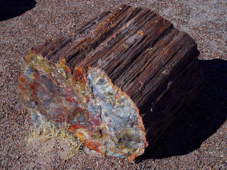
These are real reference photographs from the site media library, not photographs of the exact mapped sites. Always confirm mineral identity and collection permissions separately.


EXPLORE LOUISIANA LOCALLY
Rockhounding near Louisiana cities
Move from statewide discovery into nearby field regions and then into individual location guides. City pages rank nearby records by evidence status and distance instead of treating every geological occurrence as an open collecting site.
Louisiana rockhounding regions and local areas
Regional pages group related geology and field opportunities without turning every mineral occurrence into a separate destination page.
Louisiana location directory preview
Start with the current inventory, then open the complete searchable directory for all 353 records.
Acadia Parish Geology and Rock/Fossil Research
surface/subsurface geology, terrace and stream gravel, fossils, ironstone, lignite, salt-dome or industrial-mineral context as locally applicable · Acadia
Allen Parish Geology and Rock/Fossil Research
surface/subsurface geology, terrace and stream gravel, fossils, ironstone, lignite, salt-dome or industrial-mineral context as locally applicable · Allen
Ascension Parish Geology and Rock/Fossil Research
surface/subsurface geology, terrace and stream gravel, fossils, ironstone, lignite, salt-dome or industrial-mineral context as locally applicable · Ascension
Assumption Parish Geology and Rock/Fossil Research
surface/subsurface geology, terrace and stream gravel, fossils, ironstone, lignite, salt-dome or industrial-mineral context as locally applicable · Assumption
Avoyelles Parish Geology and Rock/Fossil Research
surface/subsurface geology, terrace and stream gravel, fossils, ironstone, lignite, salt-dome or industrial-mineral context as locally applicable · Avoyelles
Alva Lee Mining Company — CM Farms
purchased gemstone-mining rough in managed farm attraction · Beauregard
CM Farms Seasonal Calendar Gate
managed seasonal gemstone mining · Beauregard
Beauregard Parish Geology and Rock/Fossil Research
surface/subsurface geology, terrace and stream gravel, fossils, ironstone, lignite, salt-dome or industrial-mineral context as locally applicable · Beauregard
Bienville Parish Geology and Rock/Fossil Research
surface/subsurface geology, terrace and stream gravel, fossils, ironstone, lignite, salt-dome or industrial-mineral context as locally applicable · Bienville
Kisatchie National Forest — Casual Rock/Mineral Collecting Context
small personal-use amounts of common rocks, semi-precious stones and minerals where locally allowed · Bienville / Claiborne / Grant / Natchitoches / Rapides / Vernon / Webster / Winn
Central-North Louisiana Iron Ore District Research
brown and green iron ore / ironstone districts · Bienville / Claiborne / Jackson / Lincoln / Ouachita / Webster
Bossier Parish Geology and Rock/Fossil Research
surface/subsurface geology, terrace and stream gravel, fossils, ironstone, lignite, salt-dome or industrial-mineral context as locally applicable · Bossier
Shreveport Aquarium Treasure Mine Non-Bleed
managed attraction material · Caddo
Red River Treasure Mine — Shreveport Aquarium
operator-provided gemstones, fossils, shark teeth and marine specimens; take-home finds · Caddo
Caddo Parish Geology and Rock/Fossil Research
surface/subsurface geology, terrace and stream gravel, fossils, ironstone, lignite, salt-dome or industrial-mineral context as locally applicable · Caddo
Red River Gravel & Alluvial Geology Research
river gravel, chert, quartz and alluvial deposits · Caddo / Bossier / Red River / Natchitoches
Calcasieu Parish Geology and Rock/Fossil Research
surface/subsurface geology, terrace and stream gravel, fossils, ironstone, lignite, salt-dome or industrial-mineral context as locally applicable · Calcasieu
Louisiana Historic Sulphur & Salt-Dome Mining Research
historic sulphur mining and caprock geology · Calcasieu / Cameron / Iberia / St. Mary / coastal dome districts
Caldwell Parish Geology and Rock/Fossil Research
surface/subsurface geology, terrace and stream gravel, fossils, ironstone, lignite, salt-dome or industrial-mineral context as locally applicable · Caldwell
Cameron Parish Geology and Rock/Fossil Research
surface/subsurface geology, terrace and stream gravel, fossils, ironstone, lignite, salt-dome or industrial-mineral context as locally applicable · Cameron
Catahoula Parish Geology and Rock/Fossil Research
surface/subsurface geology, terrace and stream gravel, fossils, ironstone, lignite, salt-dome or industrial-mineral context as locally applicable · Catahoula
Catahoula Parish Jackson Eocene Fossil Research
Eocene foraminifera, ostracods and marine fossil research context · Catahoula
Louisiana Pleistocene Terrace Gravel Research
terrace gravel, chert, quartz and reworked fossil material · Central / north Louisiana
Catahoula Formation Sandstone/Silica Research
Catahoula Formation sandstone, silicified material and sedimentary geology · Central and west Louisiana
TRIP-READY SHORTLIST
Best-supported rockhounding sites in Louisiana
This ranking favors current evidence, usable coordinates, navigation context and field readiness. It is not a popularity ranking and Conditional records still require verification.
Jungle George’s Good Timing Gem Mining — Zoosiana
operator-provided gem-mining material and take-home treasures
Lost Treasure Mining Company — Timber Ridge Adventure Park
operator-provided gemstones, minerals and fossils from mining rough; take-home finds
Red River Treasure Mine — Shreveport Aquarium
operator-provided gemstones, fossils, shark teeth and marine specimens; take-home finds
Alva Lee Mining Company — CM Farms
purchased gemstone-mining rough in managed farm attraction
Kisatchie National Forest — Casual Rock/Mineral Collecting Context
small personal-use amounts of common rocks, semi-precious stones and minerals where locally allowed
Kisatchie National Forest — Low-Disturbance Prospecting Context
hand panning/prospecting or low-disturbance mineral searching where rights and local rules allow
Louisiana Gravel Agate & Petrified Palmwood — Rights-Gated Context
Louisiana agate, chert, jasper, quartz gravel and petrified palmwood
Louisiana Stream/Gravel Fossil Hunting — Rights-Gated Context
reworked fossils, petrified wood, chert and gravel specimens
LOUISIANA MATERIAL DISCOVERY
What can you find rockhounding in Louisiana?
Counts come from the live state inventory. They describe records mentioning a material, not guaranteed legal collecting sites.
River Gravel & Alluvial Geology
87 recordsCompare the strongest current examples, then open the individual guide for access and evidence status.
Eocene & Oligocene Fossils
85 recordsCompare the strongest current examples, then open the individual guide for access and evidence status.
Salt Dome, Gypsum & Sulphur Geology
81 recordsCompare the strongest current examples, then open the individual guide for access and evidence status.
Iron-Rich Geology
65 recordsCompare the strongest current examples, then open the individual guide for access and evidence status.
Catahoula Sandstone & Silica
5 recordsCompare the strongest current examples, then open the individual guide for access and evidence status.
Managed Gem-Mining Attractions
5 recordsCompare the strongest current examples, then open the individual guide for access and evidence status.
Petrified Palmwood & Wood
4 recordsCompare the strongest current examples, then open the individual guide for access and evidence status.
Agate & Chalcedony
2 recordsCompare the strongest current examples, then open the individual guide for access and evidence status.
LAND, CLAIMS & PERMISSION
Who controls the land matters more than the mineral pin
The state map’s land-status and claim layers are planning aids. Exact ownership, claims, protected-resource rules and current manager guidance still control field use.
Land and mineral rights
Louisiana gravel, stream and petrified-wood occurrences can sit on private or rights-controlled land. A geological occurrence never establishes collecting permission.
Kisatchie National Forest
Use the exact forest-unit guidance for casual rock/mineral collection or prospecting. Archaeological and historic resources remain protected.
Streams, bars and waterways
Water access, bank ownership, navigability and mineral rights are separate questions. Verify the exact reach before removing material.
Industrial salt, sulphur and quarry sites
Salt domes, mines, pits and industrial material sites are research contexts unless the operator explicitly authorizes entry.
Managed attractions
Aquarium, park and farm mining sluices use supplied material under current operator rules; do not generalize that permission to nearby natural ground.
WHEN TO GO
Louisiana rockhounding seasonal planner
Cool-season fieldwork
Lower heat and humidity improve many forest and gravel trips, though wet ground and high water remain possible.
Spring transition
Comfortable temperatures can be offset by heavy rain, thunderstorms and flooding.
Heat, storms and tropical-weather season
Heat, humidity, lightning, flooding and tropical systems can make fieldwork unsafe with little notice.
Return to field season
Cooling weather can improve forest and gravel observation while hurricane-season impacts may linger.
LOUISIANA FIELD KIT
A practical field kit for Louisiana
Match equipment to the site and collecting method rather than carrying heavy tools by default.
Identification kit
Hand lens, magnet, notebook, scale, specimen bags and labels help preserve context and reduce guesswork.
River / gravel kit
Use sturdy footwear, gloves and eye protection. Check water level, access and disturbance rules before entering a stream or shoreline.
Geode / hard-rock kit
Eye protection and small hand tools are more useful than heavy equipment. Never enter mine workings or unstable cuts.
Fossil kit
Camera, scale, notebook and protective wrapping allow documentation without assuming removal is legal.
Panning kit
A basic pan, classifier and vial are enough for many recreational contexts; powered equipment can trigger different rules.
Navigation & safety
Carry offline mapping, water, weather layers and an emergency plan appropriate to remoteness and season.
COMMUNITY FIELD INTELLIGENCE
Recent Louisiana field reports
Approved visitor reports add current observations without automatically changing a location’s legal or access status.
Open any location guide and use Share Your Story & Photos. Reports remain pending until admin approval.