NEW MEXICO INTERACTIVE FIELD MAP
Inspect places, geology, access evidence and nearby context
The map keeps collecting leads, protected places and research occurrences visually distinct.
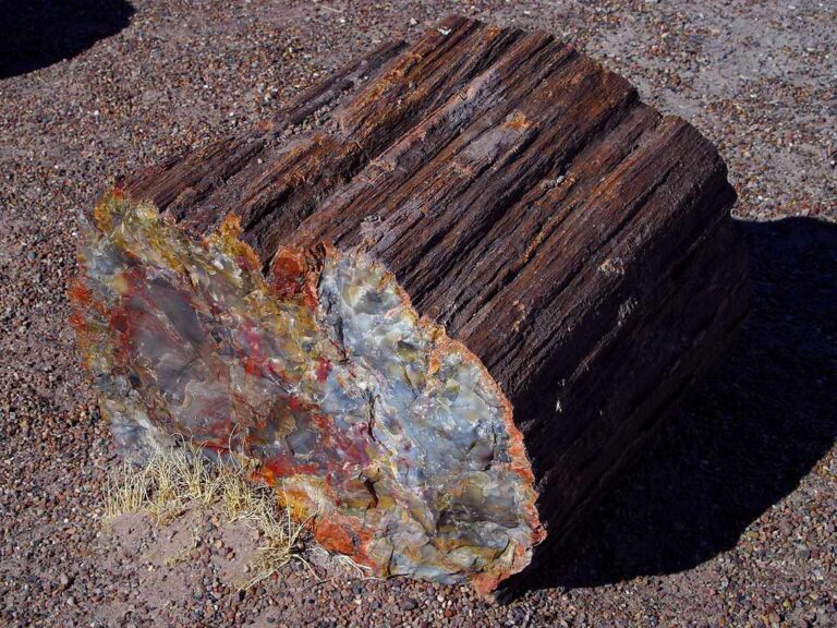
Rock and mineral reference images for New Mexico
These are real reference photographs from the site media library, not photographs of the exact mapped sites. Always confirm mineral identity and collection permissions separately.


TRIP-READY SHORTLIST
Best-supported rockhounding sites in New Mexico
This ranking favors current evidence, usable coordinates, navigation context and field readiness. It is not a popularity ranking and Conditional records still require verification.
Rockhound State Park — Designated Rockhound Unit
Thundereggs, geodes, jasper, onyx, agate, rhyolite, obsidian/Apache tears, quartz
Harding Pegmatite Mine — UNM Managed Collecting Locality
Pegmatite minerals including spodumene, lepidolite, muscovite, apatite and related rare-element minerals
Ah-Shi-Sle-Pah Wilderness — BLM Rule / Fossil-Class Conditional
Common rocks/minerals under BLM rules; vertebrate fossils and cultural objects protected
Angel Peak Scenic Area — BLM Rockhounding / Developed-Site Conditional
Common rocks/mineral specimens under BLM rules outside developed-site and other excluded footprints
Bisti/De-Na-Zin Wilderness — Material-Class Conditional Rockhounding
Common rocks/minerals under BLM rules; petrified wood specifically prohibited; vertebrate fossils/cultural objects protected
NEW MEXICO MINERAL DISCOVERY
What can you find rockhounding in New Mexico?
The atlas mixes visitor programs, stronger collecting leads, protected environments and geological research. Material record counts are not promises that collecting is allowed. Verify the exact location and manager before taking anything.
Identify New Mexico rocks, minerals and fossils →
Agate, Chalcedony & Jasper
2 recordsSouthwestern New Mexico has notable agate and jasper research areas. BLM boundaries, claims, withdrawals and private ranch land must be checked.
Geodes & Thundereggs
2 recordsMineral-filled nodules occur in some volcanic terrains. Confident identification needs a natural break, host context and safe collection authority.
Turquoise & Copper Minerals
144 recordsTurquoise and other copper minerals are associated with historic mines; famous deposits are generally private, claimed or operator-controlled.
Obsidian, Perlite & Volcanic Glass
4 recordsDark glassy rocks from volcanic flows can be natural, but collecting them at archaeological or protected sites is restricted.
Quartz, Amethyst & Crystals
7 recordsQuartz pockets and silica are widespread across mountains and volcanic ranges; not all quartz occurrences are public digs.
Petrified Wood & Fossils
3 recordsFossil wood and paleontology locations are often protected. Separate plant-fossil rules from vertebrate fossil protections.
Marine Fossils & Paleozoic Limestone
30 recordsPaleozoic fossils in limestone are significant in mountain ranges; land-manager and fossil-class rules apply.
Gold, Silver & Historic Mining Districts
170 recordsHistorical mining and USGS occurrences are research data, not automatic recreational prospecting leads.
LAND, CLAIMS & PERMISSION
Who controls the land matters more than the mineral pin
The state map’s land-status and claim layers are planning aids. Exact ownership, claims, protected-resource rules and current manager guidance still control field use.
BLM collecting
BLM casual rockhounding may be allowed in appropriate areas, but mining claims, withdrawals, wilderness, archaeological sites and local offices determine exact rights.
Rockhound State Park
Use current New Mexico State Parks rules for collecting allowance, amounts, boundaries and tools; do not generalize park allowances elsewhere.
Federal/tribal lands
Tribal lands require tribal authorization and protected federal areas can forbid removal. Land-management boundaries matter greatly.
Mining claims & historic shafts
Claims and owner/operator rights restrict mining districts; old workings and tailings can be dangerous.
Protected fossil/cultural resources
Do not take vertebrate fossils, petrified wood or cultural objects from protected sites without the proper permits/authority.
WHEN TO GO
New Mexico rockhounding seasonal planner
Mild desert, cold highlands
Low desert elevations can be pleasant; mountain access may be snow-limited.
Prime spring desert field window
Cooler temperatures help outdoor trips; wind, dust and land-use restrictions matter.
Heat and monsoon season
Extreme heat, lightning and flash flooding require conservative route planning.
Autumn desert field window
More comfortable temperatures but short days, freeze risk at altitude and flash storms remain.
NEW MEXICO FIELD KIT
A practical field kit for New Mexico
Match equipment to the site and collecting method rather than carrying heavy tools by default.
Identification kit
Hand lens, magnet, notebook, scale, specimen bags and labels help preserve context and reduce guesswork.
River / gravel kit
Use sturdy footwear, gloves and eye protection. Check water level, access and disturbance rules before entering a stream or shoreline.
Geode / hard-rock kit
Eye protection and small hand tools are more useful than heavy equipment. Never enter mine workings or unstable cuts.
Fossil kit
Camera, scale, notebook and protective wrapping allow documentation without assuming removal is legal.
Panning kit
A basic pan, classifier and vial are enough for many recreational contexts; powered equipment can trigger different rules.
Navigation & safety
Carry offline mapping, water, weather layers and an emergency plan appropriate to remoteness and season.
COMMUNITY FIELD INTELLIGENCE
Recent New Mexico field reports
Approved visitor reports add current observations without automatically changing a location’s legal or access status.
Open any location guide and use Share Your Story & Photos. Reports remain pending until admin approval.
EXPLORE NEW MEXICO LOCALLY
Rockhounding near New Mexico cities
Move from statewide discovery into nearby field regions and then into individual location guides. City pages rank nearby records by evidence status and distance instead of treating every geological occurrence as an open collecting site.
New Mexico rockhounding regions and local areas
Regional pages group related geology and field opportunities without turning every mineral occurrence into a separate destination page.
New Mexico location directory preview
Start with the current inventory, then open the complete searchable directory for all 339 records.
Petroglyph National Monument — NPS No-Collection Control
basalt/cultural resources · Bernalillo
Albuquerque Volcanoes Sanidine Context
sanidine/feldspar in volcanic rocks · Bernalillo
Doc Long / Sandia Foothills Fluorite Context
fluorite and regional mineral occurrences · Bernalillo
Rio Puerco Concretions / Calcite-Celestite Context
calcite/celestite concretions and sedimentary minerals · Bernalillo/Sandoval/Valencia
Carson National Forest — Site/Claims/Safety Confirmation Control
rocks/minerals around historic mines/pegmatites · Carson NF
Gila Cliff Dwellings National Monument — NPS No-Collection Control
natural/cultural resources · Catron
Mogollon Mining District
quartz, silver/gold-associated minerals and volcanic-hosted ores · Catron
Pueblo Park Labradorite / Bronzite Context
labradorite and bronzite in volcanic rocks · Catron
Bottomless Lakes State Park — State Park No-General-Collecting Control
karst/evaporite geology · Chaves
El Malpais National Monument — NPS Unit — NPS No-Collection Control
lava/geologic resources · Cibola
El Morro National Monument — NPS No-Collection Control
sandstone/geologic resources · Cibola
Chain of Craters Back Country Byway — Volcanic Geology
volcanic rocks, cinder cones and lava flows · Cibola
El Malpais National Conservation Area — Volcanic Geology Explainer
basalt, lava tubes, volcanic rocks · Cibola
Laguna / Cibola County Mineral Context
anhydrite/celestite and sedimentary mineral occurrences · Cibola
West Malpais Wilderness — Lava Geology Explainer
basalt/lava geology · Cibola
Cibola National Forest — Site-Specific Authority Control
rocks/minerals · Cibola NF
Grants Uranium District — Radioactive Mineral History
uranium/vanadium minerals and mine history · Cibola/McKinley
Zuni Mountains Mineral Context
uranium-era and pegmatite/vein mineral occurrences · Cibola/McKinley
Prehistoric Trackways National Monument — Fossil Protection Control
Permian trackways, vertebrate/invertebrate fossils, petrified wood · Doña Ana
Kilbourne Hole — Peridot/Olivine Occurrence
olivine/peridot in volcanic bombs · Doña Ana
Modoc Mining District
garnet, reported corundum and skarn minerals · Doña Ana
Organ / South Canyon Garnet & Skarn District
andradite/grossular/uvarovite garnet, apatite, fluorite and skarn minerals · Doña Ana
Organ Mountains — Historic Mineral District Context
garnet, fluorite, apatite, copper/lead minerals and pegmatite/skarn occurrences · Doña Ana
Potrillo Mountains Volcanic Field — Peridot/Volcanic Context
olivine/peridot, basalt, volcanic bombs · Doña Ana
New Mexico rockhounding: designated collecting versus historic mines
New Mexico’s volcanic landscapes, pegmatites, fluorite deposits and turquoise districts provide a broad mineral reference, but ownership and collecting permission vary sharply. The interactive map distinguishes Ready destinations, Conditional access, historic mining research and protected landscapes. A mineral-bearing district is not an open quarry.
Rockhound State Park is an exception requiring its own rules
Rockhound State Park’s designated rockhound unit has a history of allowing limited specimen collection within specifically identified areas. Do not generalize that arrangement to every New Mexico state park or surrounding private land. Confirm the current designated boundary, material allowance and any posted changes with park personnel; avoid damaging vegetation, trails and sensitive formations.
Harding Mine, fluorite and the old turquoise districts
Harding Pegmatite Mine is a university-managed site where visits require the operator’s present terms rather than an assumed public entitlement. The Hansonburg/Blanchard fluorite district and Cerrillos turquoise district include old workings and mineral interests; collecting is dependent on specific property and claim permission. Never enter old shafts, exposed tailings or operating mines without authorization.
Volcanic rocks and sensitive desert resources
Jemez obsidian, volcanic glass, peridot-bearing basalt and the El Malpais lava region are geological subjects, not universal free-take locations. National monuments, cultural materials, caves and vertebrate fossils require special protection. BLM surface collection may be possible in eligible unclaimed areas under its noncommercial rules, but local restrictions and the exact mineral or fossil class control eligibility.
Field checklist: confirm manager, parcel boundaries, claims, exact safe navigation, current opening and permissible tools before collecting. For comparison of glassy obsidian, chalcedony, fluorite and feldspar, use the New Mexico identification guide.