WISCONSIN INTERACTIVE FIELD MAP
Inspect places, geology, access evidence and nearby context
The map keeps collecting leads, protected places and research occurrences visually distinct.
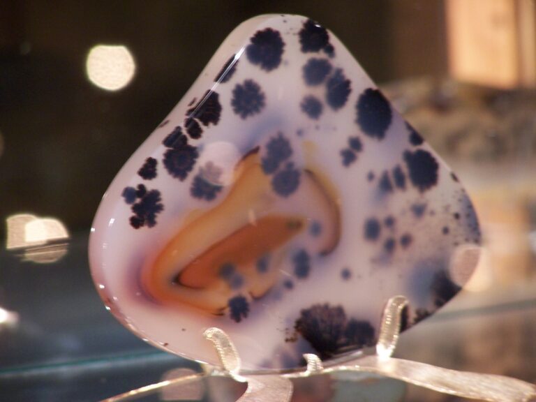
Rock and mineral reference images for Wisconsin
These are real reference photographs from the site media library, not photographs of the exact mapped sites. Always confirm mineral identity and collection permissions separately.



TRIP-READY SHORTLIST
Best-supported rockhounding sites in Wisconsin
This ranking favors current evidence, usable coordinates, navigation context and field readiness. It is not a popularity ranking and Conditional records still require verification.
Cave of the Mounds — Gem Sluice
operator-provided gems and fossils
Crystal Cave — Prospector’s Creek Gem Panning
operator-provided gems, crystals, minerals and fossils
Dells Mining Co. — Gemstone Mining
operator-provided natural gemstones
NEW Zoo & Adventure Park — Mining Sluice
operator-provided gemstones and precious stones
Treinen Farm — Gem Mine
operator-provided gems, fossils and tumbled stones
Chequamegon-Nicolet National Forest — Casual Mineral Collecting Context
common rocks, minerals and invertebrate/plant fossil context
Wisconsin DNR Land — Property-Manager Mineral Collection Permit Context
rocks, minerals and fossils on eligible DNR-managed property
Wisconsin Great Lakes Shoreline Stones — Property/Manager-Gated Context
Lake Superior agates, basalt, jasper, quartz, fossils and beach cobbles
Wisconsin Private Quarry / Mineral Club Field Trips
lead-zinc minerals, calcite, quartz, fossils, agates and quarry minerals
Wisconsin Private Stream — Hand Gold Panning Context
placer gold and heavy-mineral concentrates
WISCONSIN MINERAL DISCOVERY
What can you find rockhounding in Wisconsin?
The atlas mixes visitor programs, stronger collecting leads, protected environments and geological research. Material record counts are not promises that collecting is allowed. Verify the exact location and manager before taking anything.
Identify Wisconsin rocks, minerals and fossils →
Lake Superior Agate & Jasper
5 recordsAgate-bearing glacial gravels occur near Lake Superior but the ownership and shore managers differ from beach to beach.
Baraboo Quartzite & Silica
8 recordsPrecambrian quartzite and quartz glacial cobbles have important educational value; state natural areas protect local geology.
Ordovician Fossils & Marine Rock
96 recordsMarine sediments contain fossils in several Wisconsin regions; collection from protected sites requires authorization or is prohibited.
Galena, Sphalerite & Lead-Zinc
161 recordsThe Driftless lead-zinc district features historic ore geology; private mines and quarry access remain controlled.
Calcite, Dolomite & Limestone
9 recordsCarbonate units produce common rock/mineral identification opportunities on private and managed sites.
Native Copper & Lake Superior Rocks
73 recordsSuperior basin igneous/glacial rocks include copper-bearing context, not open collecting rights.
Stream Gold & Glacial Heavy Minerals
13 recordsRecreational stream panning requires exact landowner, waterway and conservation review.
Managed Gem Sluices & Visitor Mining
5 recordsAttractions provide purchased/preset gemstone material with rules set by the operator; this is distinct from natural rock collection.
LAND, CLAIMS & PERMISSION
Who controls the land matters more than the mineral pin
The state map’s land-status and claim layers are planning aids. Exact ownership, claims, protected-resource rules and current manager guidance still control field use.
Wisconsin DNR written permission
Wisconsin DNR says rock, mineral and fossil collection on eligible managed property requires written permission from the property manager.
Protected DNR properties
State parks, trails, recreation areas, state natural areas and specified forests prohibit or strictly restrict collecting; posted local orders take priority.
Apostle Islands and federal protection
The National Lakeshore protects rock and natural resources; National Park Service lands should be viewed, not casually collected.
Great Lakes shoreline
Public beach access, municipal ownership, tribal rights and specimen removal are different legal questions.
Mine, quarry and fossil collecting
Private quarry/industrial sites require owner consent; museum-quality fossils and archaeological artifacts need legal protection.
WHEN TO GO
Wisconsin rockhounding seasonal planner
Ice and severe cold
Frozen shorelines, lake-effect snow and icy rock slopes restrict field travel.
Spring thaw
Lake ice and high water can persist; county roads remain muddy.
Main Wisconsin shore season
Beach walks and managed dig attractions are easier, with thunderstorms and water hazards.
Lake Superior storm season
Cooler temperatures and changing pebble exposures, but severe surf must be avoided.
WISCONSIN FIELD KIT
A practical field kit for Wisconsin
Match equipment to the site and collecting method rather than carrying heavy tools by default.
Identification kit
Hand lens, magnet, notebook, scale, specimen bags and labels help preserve context and reduce guesswork.
River / gravel kit
Use sturdy footwear, gloves and eye protection. Check water level, access and disturbance rules before entering a stream or shoreline.
Geode / hard-rock kit
Eye protection and small hand tools are more useful than heavy equipment. Never enter mine workings or unstable cuts.
Fossil kit
Camera, scale, notebook and protective wrapping allow documentation without assuming removal is legal.
Panning kit
A basic pan, classifier and vial are enough for many recreational contexts; powered equipment can trigger different rules.
Navigation & safety
Carry offline mapping, water, weather layers and an emergency plan appropriate to remoteness and season.
COMMUNITY FIELD INTELLIGENCE
Recent Wisconsin field reports
Approved visitor reports add current observations without automatically changing a location’s legal or access status.
Open any location guide and use Share Your Story & Photos. Reports remain pending until admin approval.
EXPLORE WISCONSIN LOCALLY
Rockhounding near Wisconsin cities
Move from statewide discovery into nearby field regions and then into individual location guides. City pages rank nearby records by evidence status and distance instead of treating every geological occurrence as an open collecting site.
Wisconsin rockhounding regions and local areas
Regional pages group related geology and field opportunities without turning every mineral occurrence into a separate destination page.
Wisconsin location directory preview
Start with the current inventory, then open the complete searchable directory for all 359 records.
Adams County — Rock, Mineral & Fossil Research Matrix
county-scale bedrock, surficial, glacial, fossil and economic geology · Adams
Ashland County — Rock, Mineral & Fossil Research Matrix
county-scale bedrock, surficial, glacial, fossil and economic geology · Ashland
Apostle Islands National Lakeshore — Rocks & Natural Objects Protected
Lake Superior beach rocks, sandstone, driftwood and natural objects · Ashland / Bayfield
Chequamegon-Nicolet National Forest — Casual Mineral Collecting Context
common rocks, minerals and invertebrate/plant fossil context · Ashland / Bayfield / Sawyer / Price / Taylor / Vilas / Florence / Forest / Langlade / Oconto / Oneida
Penokee Iron Range Research
banded iron formation, magnetite, hematite and quartz · Ashland / Iron
Barron County — Rock, Mineral & Fossil Research Matrix
county-scale bedrock, surficial, glacial, fossil and economic geology · Barron
Bayfield County — Rock, Mineral & Fossil Research Matrix
county-scale bedrock, surficial, glacial, fossil and economic geology · Bayfield
Lake Superior Agate Research
Lake Superior agates, chalcedony and jasper · Bayfield / Ashland / Douglas / Iron
Wisconsin Great Lakes Shoreline Stones — Property/Manager-Gated Context
Lake Superior agates, basalt, jasper, quartz, fossils and beach cobbles · Bayfield / Ashland / Douglas / Iron / Door / Kewaunee / Manitowoc / Sheboygan / Ozaukee / Milwaukee / Racine / Kenosha
NEW Zoo & Adventure Park — Mining Sluice
operator-provided gemstones and precious stones · Brown
Brown County — Rock, Mineral & Fossil Research Matrix
county-scale bedrock, surficial, glacial, fossil and economic geology · Brown
Buffalo County — Rock, Mineral & Fossil Research Matrix
county-scale bedrock, surficial, glacial, fossil and economic geology · Buffalo
Burnett County — Rock, Mineral & Fossil Research Matrix
county-scale bedrock, surficial, glacial, fossil and economic geology · Burnett
Calumet County — Rock, Mineral & Fossil Research Matrix
county-scale bedrock, surficial, glacial, fossil and economic geology · Calumet
Chippewa County — Rock, Mineral & Fossil Research Matrix
county-scale bedrock, surficial, glacial, fossil and economic geology · Chippewa
Clark County — Rock, Mineral & Fossil Research Matrix
county-scale bedrock, surficial, glacial, fossil and economic geology · Clark
Dells Mining Co. — Gemstone Mining
operator-provided natural gemstones · Columbia
Treinen Farm — Gem Mine
operator-provided gems, fossils and tumbled stones · Columbia
Columbia County — Rock, Mineral & Fossil Research Matrix
county-scale bedrock, surficial, glacial, fossil and economic geology · Columbia
Crawford County — Rock, Mineral & Fossil Research Matrix
county-scale bedrock, surficial, glacial, fossil and economic geology · Crawford
Cave of the Mounds — Natural Cave Rock & Formations Protected
natural limestone, speleothems and in-cave fossils · Dane
Cave of the Mounds — Gem Sluice
operator-provided gems and fossils · Dane
Dane County — Rock, Mineral & Fossil Research Matrix
county-scale bedrock, surficial, glacial, fossil and economic geology · Dane
Natural Cave Feature Protection Gate
cave rock and formations · Dane / Pierce
Choose the right kind of Wisconsin rockhounding trip
Wisconsin has several very different activities that should not be presented as interchangeable collecting opportunities. Start with the activity you intend to do, then compare the Ready, Conditional, Research and Protected evidence shown on the map above.
1. A managed gem sluice is a visitor activity, not a natural mineral locality
Commercial sluices provide prepared material under an operator’s program. They can suit a first-time family outing, but the contents of a purchased mining bag should not be used as evidence of what naturally occurs in that Wisconsin county. Compare the recorded operating conditions at Cave of the Mounds — Gem Sluice before travel.
2. Lake Superior stones require shoreline-by-shoreline access checks
Agate, jasper, quartz, volcanic rocks and possible copper-bearing stones are identification interests around the Superior basin. A stone appearing along a shoreline does not establish that removal is allowed there. Check the specific beach or land unit, ownership, park designation and current restrictions; protected Apostle Islands settings are not general collecting destinations.
3. Driftless ore and fossil history is mainly a geology-research starting point
The lead-zinc district has important galena, sphalerite, calcite and Paleozoic fossil associations, but abandoned workings, active quarries and private property are unsuitable places to infer public access from a mineral occurrence. Favor museum, permitted club or owner-approved programs when a collecting activity is explicitly offered.
Map-data limitation: This state currently displays no specimen-level exact points in its core atlas summary. Named visitor destinations may have navigable addresses without disclosing a precise natural collecting spot. Do not substitute regional pins for collecting coordinates. Use the Wisconsin identification guide to distinguish genuine local geology from prepared sluice material.
Wisconsin on-the-ground checklist: which rock trip is actually feasible?
A first visit with children
For a hands-on gemstone activity, compare the operating details of NEW Zoo’s mining sluice, Cave of the Mounds and Crystal Cave’s Prospector’s Creek. Verify each operator’s admission, season, specimen-retention rules and supplied-gravel arrangements. The prepared stones are not proof of local natural occurrence.
A natural Great Lakes stone search
Start by distinguishing Lake Superior agate geology from confirmed public collecting authority. Wisconsin DNR lands, municipal shorelines and federal protected lands may apply different removal rules; Apostle Islands National Lakeshore is not a general take-home collecting destination. Weather, waves, slippery boulders and ice are practical barriers, even where pedestrian access is open.
Ore district research
The Driftless lead-zinc district and Flambeau copper district are useful for interpreting geological history, not an invitation to enter private pits, unstable mine workings or active industrial sites. Check permissions and safe access independently of map position.
Keep Ready, Conditional, Research-only and Protected classifications separate; do not invent specimen-level coordinates for shoreline or district-scale records.