Indiana · Clark · Protected / viewing
Falls of the Ohio Fossil Beds & River Bank — No Collecting
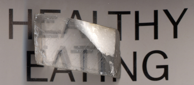 Material reference
LOCATION FIELD MAP
Local map for Falls of the Ohio Fossil Beds & River Bank — No Collecting
No exact primary coordinate is published for this record, so the map uses regional context without inventing a specimen pin.
Falls of the Ohio Fossil Beds & River Bank — No Collecting is included as a protected or viewing-focused record in Clark, Indiana. The mapped interest is Devonian fossil beds, corals, brachiopods and limestone. The recorded management context is Indiana DNR / federal-state protected fossil bed. This entry is not a collecting recommendation. Do not remove rocks, minerals, fossils or other natural material where current protections or prohibitions apply.
Can I collect at Falls of the Ohio Fossil Beds & River Bank — No Collecting?
Protected / viewing. Indiana DNR explicitly prohibits fossil collecting on the fossil beds and river bank. The quarry collecting-pile exception does not bleed into the beds.
This entry is not a collecting recommendation. Do not remove rocks, minerals, fossils or other natural material where current protections or prohibitions apply.
What rocks, minerals, fossils or collecting interests are associated with it?
The record lists Devonian fossil beds, corals, brachiopods and limestone. This description is tied to this atlas entry and should be read together with the access status below.
Who manages the place or provides the evidence context?
The recorded manager or context is Indiana DNR / federal-state protected fossil bed.
What evidence supports this status?
The record was last reviewed on 2026-08-20. Evidence and management context: Indiana DNR / federal-state protected fossil bed. Included for complete Indiana search/research coverage without weakening present owner, manager, permit, protection, access, waterway, safety, fossil-class, retention, disturbance or mineral-right requirements.
How precise is the map marker?
The map uses named-place or Clark context for navigation. Resolve the exact site and current field authority before relying on the location for collecting decisions.
Checks specific to this location
- Check fossil class, protection status and removal restrictions; viewing a fossil is different from collecting it.
- Check this protected area’s current removal and access restrictions; a recreation destination may be viewing-only.
- Check current water, weather and access conditions, including any stream-specific collecting restrictions.
- Stay out of unstable mine workings and inspect the access, ownership and safety restrictions from current official notices.
- Verify the exact destination, the land manager’s latest rules and safe travel conditions before leaving.
When was this information last checked?
The recorded review date is August 20, 2026. Treat that date as the evidence snapshot used for this classification. Conditions can change after review, so field decisions should use the newest posted rules and manager information.
Is a map pin the same as collecting permission?
No. A map pin answers a navigation or geographic-context question. The status and evidence answer the permission question. Exact coordinates, public destination addresses and approximate county or regional context are deliberately kept separate so geographic precision is not confused with legal authority.
Falls of the Ohio fossil beds: no material removal
Indiana DNR explicitly prohibits fossil collection on the exposed Devonian fossil beds and the river bank at Falls of the Ohio State Park. Visitors can examine brachiopods and fossil coral in place, but the rock surfaces are protected and must not be chipped or broken.
One narrow exception
The separately managed quarry-rock collecting piles behind the interpretive center’s parking area are the only named place at the park where removal is allowed under the posted program. The permission does not extend into the fossil beds.
LOCATION-SPECIFIC FIELD ANSWER
Falls of the Ohio Fossil Beds & River Bank — No Collecting: geology viewing and research, not a collecting recommendation
This record is classified Protected/viewing. Use the guide to understand the place and its geology; do not interpret the map marker as permission to remove specimens.
What rocks or minerals are associated with Falls of the Ohio Fossil Beds & River Bank — No Collecting?
The record associates this place with Devonian fossil beds, corals, brachiopods and limestone. That association is a field-research lead, not a guarantee that material can be found or legally collected at every point around the marker.
What should be checked before visiting?
The current manager or evidence context is Indiana DNR / federal-state protected fossil bed. Verify that authority and the exact parcel or boundary before relying on access information. This entry is not a collecting recommendation. Do not remove rocks, minerals, fossils or other natural material where current protections or prohibitions apply. The evidence snapshot was last checked 2026-08-20.
How should this record be used for “rockhounding near me”?
This record is not treated as a Ready Near Me collecting lead; use it as broader research or access context.
COMMUNITY FIELD INTELLIGENCE
Public Testimony & Field Stories
Approved visitor reports add real-world context to the official and geological evidence above. Community testimony never overrides land-manager rules, ownership, claims, closures or protected-resource law.