INDIANA INTERACTIVE FIELD MAP
Inspect places, geology, access evidence and nearby context
The map keeps collecting leads, protected places and research occurrences visually distinct.
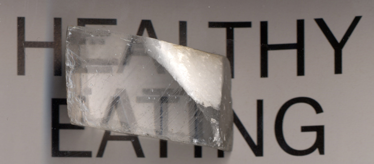
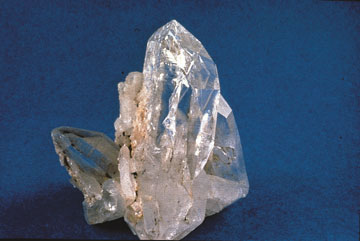
Rock and mineral reference images for Indiana
These are real reference photographs from the site media library, not photographs of the exact mapped sites. Always confirm mineral identity and collection permissions separately.

EXPLORE INDIANA LOCALLY
Rockhounding near Indiana cities
Move from statewide discovery into nearby field regions and then into individual location guides. City pages rank nearby records by evidence status and distance instead of treating every geological occurrence as an open collecting site.
Indiana rockhounding regions and local areas
Regional pages group related geology and field opportunities without turning every mineral occurrence into a separate destination page.
Indiana location directory preview
Start with the current inventory, then open the complete searchable directory for all 388 records.
Adams Rockhounding & Geology Research Index
county bedrock and Quaternary geology, glacial deposits, fossils, aggregates, chert, limestone/dolostone and occurrence research · Adams
Allen Rockhounding & Geology Research Index
county bedrock and Quaternary geology, glacial deposits, fossils, aggregates, chert, limestone/dolostone and occurrence research · Allen
Fort Wayne Glacial & Silurian Reef Context
Silurian dolostone/reef fossils, glacial drift and erratics · Allen
Bartholomew Rockhounding & Geology Research Index
glacial deposits, placer-gold research, stream gravels, limestone/geode context and property-specific access questions · Bartholomew
Geneva Dolomite Calcite & Fossil Context
calcite spar, dolomite, fossil casts and chert · Bartholomew / Decatur / Jennings
Benton Rockhounding & Geology Research Index
county bedrock and Quaternary geology, glacial deposits, fossils, aggregates, chert, limestone/dolostone and occurrence research · Benton
Blackford Rockhounding & Geology Research Index
county bedrock and Quaternary geology, glacial deposits, fossils, aggregates, chert, limestone/dolostone and occurrence research · Blackford
Boone Rockhounding & Geology Research Index
county bedrock and Quaternary geology, glacial deposits, fossils, aggregates, chert, limestone/dolostone and occurrence research · Boone
Brown Rockhounding & Geology Research Index
south-central Indiana geodes, quartz/calcite/chalcedony, Mississippian limestone/chert and stream concentration research · Brown
Southern Indiana Stream Geode Concentration Context
weathered geodes, quartz, calcite and stream gravels · Brown / Monroe / Morgan / Owen / Lawrence / Washington / Harrison
South-Central Indiana Geode Belt
geodes, quartz, calcite, chalcedony and accessory minerals · Brown / Monroe / Morgan / Owen / Putnam / Lawrence / Washington / Harrison
Carroll Rockhounding & Geology Research Index
county bedrock and Quaternary geology, glacial deposits, fossils, aggregates, chert, limestone/dolostone and occurrence research · Carroll
Cass Rockhounding & Geology Research Index
county bedrock and Quaternary geology, glacial deposits, fossils, aggregates, chert, limestone/dolostone and occurrence research · Cass
Falls of the Ohio Fossil Beds & River Bank — No Collecting
Devonian fossil beds, corals, brachiopods and limestone · Clark
Falls of the Ohio Quarry Collecting Piles
quarry-derived rocks and fossils for personal collecting · Clark
Clark Rockhounding & Geology Research Index
Ordovician-Devonian-Mississippian marine fossils, limestone/dolostone/shale and Cincinnati Arch/Ohio River geology · Clark
New Albany Shale Research
black shale, pyrite, concretions and fossil context · Clark / Floyd / Harrison / Scott / Washington
Clay Rockhounding & Geology Research Index
Pennsylvanian coal, shale/sandstone/limestone, mine geology, fossils and abandoned-mine safety research · Clay
Indiana Coalfield Geology Research
coal, shale, sandstone, limestone, pyrite and plant fossils · Clay / Daviess / Dubois / Gibson / Greene / Knox / Martin / Owen / Parke / Perry / Pike / Posey / Spencer / Sullivan / Vanderburgh / Vermillion / Vigo / Warrick
Clinton Rockhounding & Geology Research Index
county bedrock and Quaternary geology, glacial deposits, fossils, aggregates, chert, limestone/dolostone and occurrence research · Clinton
Crawford Rockhounding & Geology Research Index
south-central Indiana geodes, quartz/calcite/chalcedony, Mississippian limestone/chert and stream concentration research · Crawford
Southern Indiana Karst & Cave Geology
limestone, chert, caves, sinkholes, springs and karst features · Crawford / Harrison / Orange / Washington / Lawrence
Daviess Rockhounding & Geology Research Index
Pennsylvanian coal, shale/sandstone/limestone, mine geology, fossils and abandoned-mine safety research · Daviess
DeKalb Rockhounding & Geology Research Index
county bedrock and Quaternary geology, glacial deposits, fossils, aggregates, chert, limestone/dolostone and occurrence research · DeKalb
TRIP-READY SHORTLIST
Best-supported rockhounding sites in Indiana
This ranking favors current evidence, usable coordinates, navigation context and field readiness. It is not a popularity ranking and Conditional records still require verification.
Falls of the Ohio Quarry Collecting Piles
quarry-derived rocks and fossils for personal collecting
Hoosier National Forest Casual Rock & Mineral Collection
small amounts of common rocks and mineral specimens
Hoosier National Forest Recreational Gold Panning
glacial placer gold prospecting
Indiana State Forest Recreational Gold Panning Permit
glacial placer gold prospecting
INDIANA MATERIAL DISCOVERY
What can you find rockhounding in Indiana?
Counts come from the live state inventory. They describe records mentioning a material, not guaranteed legal collecting sites.
Marine & Plant Fossils
117 recordsCompare the strongest current examples, then open the individual guide for access and evidence status.
Salem Limestone
102 recordsCompare the strongest current examples, then open the individual guide for access and evidence status.
Chert & River Gravel
84 recordsCompare the strongest current examples, then open the individual guide for access and evidence status.
Glacial & Beach Stones
64 recordsCompare the strongest current examples, then open the individual guide for access and evidence status.
Geodes
19 recordsCompare the strongest current examples, then open the individual guide for access and evidence status.
Calcite & Dolomite
18 recordsCompare the strongest current examples, then open the individual guide for access and evidence status.
Quartz & Chalcedony
14 recordsCompare the strongest current examples, then open the individual guide for access and evidence status.
Glacial Placer Gold
13 recordsCompare the strongest current examples, then open the individual guide for access and evidence status.
LAND, CLAIMS & PERMISSION
Who controls the land matters more than the mineral pin
The state map’s land-status and claim layers are planning aids. Exact ownership, claims, protected-resource rules and current manager guidance still control field use.
Falls of the Ohio
The in-place fossil beds and river-bank resources are protected, while separate quarry-derived collecting material may be offered under site-specific rules.
State forest gold panning
Recreational panning can be permit- or site-specific. A state-forest record should not be generalized to every Indiana stream.
Indiana Dunes
National and state park natural resources are protected under their respective rules; beach access does not automatically authorize removal.
Private quarries and geode ground
Quarry-derived rocks and geodes often require explicit permission or participation in a managed program.
Karst and caves
Caves, sinkholes and springs are sensitive geological and ecological systems. Access and collection rules must be checked separately.
WHEN TO GO
Indiana rockhounding seasonal planner
Spring fossil and river season
Cooler weather can favor fossil and gravel trips, though high water may restrict river access.
Summer field season
Long daylight helps fieldwork, but heat, humidity and vegetation can reduce comfort and exposure visibility.
Fall collecting window
Cooler temperatures and lower vegetation often improve south-central geode and fossil fieldwork.
Winter constraints
Ice, frozen ground and snow can limit field access while quarry and park programs may operate on reduced schedules.
INDIANA FIELD KIT
A practical field kit for Indiana
Match equipment to the site and collecting method rather than carrying heavy tools by default.
Identification kit
Hand lens, magnet, notebook, scale, specimen bags and labels help preserve context and reduce guesswork.
River / gravel kit
Use sturdy footwear, gloves and eye protection. Check water level, access and disturbance rules before entering a stream or shoreline.
Geode / hard-rock kit
Eye protection and small hand tools are more useful than heavy equipment. Never enter mine workings or unstable cuts.
Fossil kit
Camera, scale, notebook and protective wrapping allow documentation without assuming removal is legal.
Panning kit
A basic pan, classifier and vial are enough for many recreational contexts; powered equipment can trigger different rules.
Navigation & safety
Carry offline mapping, water, weather layers and an emergency plan appropriate to remoteness and season.
COMMUNITY FIELD INTELLIGENCE
Recent Indiana field reports
Approved visitor reports add current observations without automatically changing a location’s legal or access status.
Open any location guide and use Share Your Story & Photos. Reports remain pending until admin approval.
Indiana field choices: fossil-pile exception, permit-based panning and geode research
Indiana is well known for Devonian fossil-rich limestone, south-central geodes, glacial drift and historic quarrying. State-park fossil beds, designated quarry collecting piles, a state-forest panning permit and National Forest parcels follow different rules. A mapped regional occurrence never automatically authorizes removal.
Falls of the Ohio: permitted collecting piles only
Indiana DNR says fossils and rocks may not be collected from Falls of the Ohio fossil beds or river bank. A narrow exception exists at the quarry-derived collecting piles behind the interpretive-center parking lot. The exposed fossil beds are outstanding for observing Devonian corals and other marine life, not for scraping or hammering fossils loose.
State-forest panning: two named forests and a free permit
Indiana DNR’s June 2026 guidance allows hobby gold panning on Morgan–Monroe and Yellowwood State Forests only with a free property permit. Displacing material with picks, shovels or sluices is prohibited by the stated rules. Review the state-forest panning guide and contact the appropriate forest office for specific stream permissions before entering the water.
Geodes and glacial gravels are research leads
South-central Indiana’s geode belt and Ramp Creek Formation are geological contexts, not exact public collecting spots. The Wabash gravel record raises additional ownership and waterway-access questions; a streambed may border private land.
Other protected or industrial settings
Indiana Dunes National Park protects its rocks and natural resources. The Bedford–Bloomington limestone district is a valuable historic building-stone region but does not grant public access to active quarries. Compare Indiana’s specimen identification guide before naming limestone fossils, chert or a supposed geode.