Inspect places, geology, access evidence and nearby context
The map keeps collecting leads, protected places and research occurrences visually distinct.
Evidence status
Map view
Land intelligence
Trip confidence
— mapped records shownLand and claim layers are planning aids; verify current authority before collecting.
Compare shortlist0 of 4
Rock and mineral reference images for Arkansas
These are real reference photographs from the site media library, not photographs of the exact mapped sites. Always confirm mineral identity and collection permissions separately.
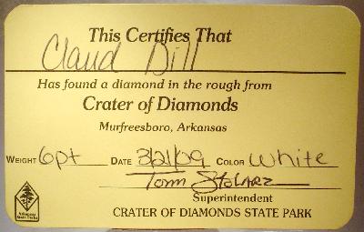
Arkansas diamond specimen
Quartz crystal specimen (general reference)
Calcite mineral reference
EXPLORE ARKANSAS LOCALLY
Rockhounding near Arkansas cities
Move from statewide discovery into nearby field regions and then into individual location guides. City pages rank nearby records by evidence status and distance instead of treating every geological occurrence as an open collecting site.
This ranking favors current evidence, usable coordinates, navigation context and field readiness. It is not a popularity ranking and Conditional records still require verification.
Who controls the land matters more than the mineral pin
The state map’s land-status and claim layers are planning aids. Exact ownership, claims, protected-resource rules and current manager guidance still control field use.
The public search opportunity is tied to the designated search field and current park rules. The rest of the surrounding geology is not automatically open for diamond collecting.
Commercial quartz mines
Many of Arkansas’s strongest crystal opportunities are private visitor digs. Current fees, dig areas, tools, hours and specimen-retention rules come from the operator.
Ouachita National Forest
Some Forest Service locations have specific rockhounding context, while other areas are simply public land. Verify the exact unit, mineral rights, claims and local restrictions.
State parks and protected sites
A state-park geology page may be included for education or viewing even when removal is not allowed. The guide status must control the trip decision.
Historic mines
Abandoned mine districts are research resources, not entry invitations. Shaft hazards, private ownership and protected historic features require conservative treatment.
Archaeological material
Artifacts and archaeological resources are not rockhounding targets. Cultural-resource protection is separate from ordinary mineral collecting.
WHEN TO GO
Arkansas rockhounding seasonal planner
December–February
Cool crystal-dig season
Cooler weather can make quartz digging comfortable, though wet clay and mine schedules may affect conditions.
March–April
Spring field season
Generally favorable temperatures with rain, storms and high river levels as the main variables.
May–August
Heat and humidity
Commercial digs may remain open, but heat, humidity and thunderstorms require shorter field sessions and more water.
September–October
Excellent transition
Cooling weather often improves quartz and diamond-search conditions after summer heat.
November
Leaf-off fieldwork begins
Cooler temperatures improve many upland trips while daylight shortens.
ARKANSAS FIELD KIT
A practical field kit for Arkansas
Match equipment to the site and collecting method rather than carrying heavy tools by default.
Identification kit
Hand lens, magnet, notebook, scale, specimen bags and labels help preserve context and reduce guesswork.
River / gravel kit
Use sturdy footwear, gloves and eye protection. Check water level, access and disturbance rules before entering a stream or shoreline.
Geode / hard-rock kit
Eye protection and small hand tools are more useful than heavy equipment. Never enter mine workings or unstable cuts.
Fossil kit
Camera, scale, notebook and protective wrapping allow documentation without assuming removal is legal.
Panning kit
A basic pan, classifier and vial are enough for many recreational contexts; powered equipment can trigger different rules.
Navigation & safety
Carry offline mapping, water, weather layers and an emergency plan appropriate to remoteness and season.
COMMUNITY FIELD INTELLIGENCE
Recent Arkansas field reports
Approved visitor reports add current observations without automatically changing a location’s legal or access status.
Crystal Vista: free quartz site, with Forest Service permit question
Conditional: confirm current Forest Service permission and tools before collecting.
Open each guide for its cited source, boundary restrictions and current visitor information.
Detailed place guides in this state
These records have enough place-specific information for a separate guide. The map still contains additional research and context records that do not need their own page.
Additional detailed records are available through the map as the atlas expands its released guide set.
What rocks, minerals or fossils are represented in Arkansas?
The structured records most often mention the following interests. These are discovery filters, not promises that a specimen is legally collectable at every mapped location.
Is rock collecting legal on public land in Arkansas?
There is no single statewide “yes” that applies to every public parcel. Rules depend on the exact land unit, land manager, resource type, collecting method, claims, closures and permits. The database therefore refuses to inherit broad permission from a state, agency or nearby parcel. Check the record’s status reason and primary blocker, then verify the current rule for the exact place before collecting.
What research-only or protected places are on the map?
Research examples
Arkansas County Rockhounding & Geology Research Index — Arkansas. The Arkansas Mineral Commodity map and geologic mapping provide authoritative occurrence/research coverage for Arkansas County. This county page is intentionally research-only: mine symbols, quarries, roadcuts, stream gravels and historical localities do not prove present ownership, mineral estate, safe access or recreational removal authority. Context: Arkansas Office of the State Geologist / parcel-specific managers.
Ashley County Rockhounding & Geology Research Index — Ashley. The Arkansas Mineral Commodity map and geologic mapping provide authoritative occurrence/research coverage for Ashley County. This county page is intentionally research-only: mine symbols, quarries, roadcuts, stream gravels and historical localities do not prove present ownership, mineral estate, safe access or recreational removal authority. Context: Arkansas Office of the State Geologist / parcel-specific managers.
Baxter County Rockhounding & Geology Research Index — Baxter. The Arkansas Mineral Commodity map and geologic mapping provide authoritative occurrence/research coverage for Baxter County. This county page is intentionally research-only: mine symbols, quarries, roadcuts, stream gravels and historical localities do not prove present ownership, mineral estate, safe access or recreational removal authority. Context: Arkansas Office of the State Geologist / parcel-specific managers.
Benton County Rockhounding & Geology Research Index — Benton. The Arkansas Mineral Commodity map and geologic mapping provide authoritative occurrence/research coverage for Benton County. This county page is intentionally research-only: mine symbols, quarries, roadcuts, stream gravels and historical localities do not prove present ownership, mineral estate, safe access or recreational removal authority. Context: Arkansas Office of the State Geologist / parcel-specific managers.
Boone County Rockhounding & Geology Research Index — Boone. The Arkansas Mineral Commodity map and geologic mapping provide authoritative occurrence/research coverage for Boone County. This county page is intentionally research-only: mine symbols, quarries, roadcuts, stream gravels and historical localities do not prove present ownership, mineral estate, safe access or recreational removal authority. Context: Arkansas Office of the State Geologist / parcel-specific managers.
Northern Arkansas Mississippi Valley-Type District — Boone / Marion / Baxter / Sharp / Lawrence. Authoritative district mapping is research evidence only; old prospects and mines remain ownership/safety gated. Context: State Geologist / parcel-specific manager.
Bradley County Rockhounding & Geology Research Index — Bradley. The Arkansas Mineral Commodity map and geologic mapping provide authoritative occurrence/research coverage for Bradley County. This county page is intentionally research-only: mine symbols, quarries, roadcuts, stream gravels and historical localities do not prove present ownership, mineral estate, safe access or recreational removal authority. Context: Arkansas Office of the State Geologist / parcel-specific managers.
Calhoun County Rockhounding & Geology Research Index — Calhoun. The Arkansas Mineral Commodity map and geologic mapping provide authoritative occurrence/research coverage for Calhoun County. This county page is intentionally research-only: mine symbols, quarries, roadcuts, stream gravels and historical localities do not prove present ownership, mineral estate, safe access or recreational removal authority. Context: Arkansas Office of the State Geologist / parcel-specific managers.
Protected / viewing examples
Hobbs State Park–Conservation Area — Benton. Conservation-area natural resources are not treated as public collecting material. Context: Arkansas State Parks.
DeGray Lake Resort State Park — Clark. Protected/viewing state-park context; no named recreational mineral-removal program. Context: Arkansas State Parks.
Petit Jean State Park — Conway. Geologic visitor interest does not create removal permission from state-park resources. Context: Arkansas State Parks.
Lake Fort Smith State Park — Crawford. Protected/viewing context; park use does not grant material removal. Context: Arkansas State Parks.
Woolly Hollow State Park — Faulkner. Visitor access is not material-removal authority. Context: Arkansas State Parks.
Mammoth Spring State Park — Fulton. Karst/geologic viewing attraction; no recreational rock/mineral removal program established. Context: Arkansas State Parks.
Why are county research records kept inside the atlas instead of becoming separate pages?
County-scale geology is valuable for discovery, but a county occurrence record is not automatically a field destination. Keeping broad research records inside the state guide and interactive map preserves their geological value without pretending that every county-level occurrence has unique public access, collecting authority or specimen-level coordinates.
Does the Arkansas map cover every county?
The current state layer reports 75 county or county-equivalent areas. County/context markers are intentionally distinguished from exact field coordinates.
126 Arkansas records are navigation-active in this release. The interactive popup can open Google Maps, Apple Maps or OpenStreetMap. Exact coordinates are shown only where the database marks them safe; otherwise the navigation destination is a named place or county/context query.
Can I use Near Me for rockhounding in Arkansas?
Yes. The current Arkansas layer has 3 Ready Near-Me records. Near Me deliberately excludes Conditional, Research-only and Protected/viewing records.
How current is this Arkansas guide?
The latest evidence check recorded for this state is August 20, 2026. Treat that as the database review date, not a guarantee that nothing has changed since then.
What do Ready, Conditional, Research and Protected mean?
Ready supports the modeled activity on current evidence. Conditional requires a stated condition to be verified. Research is useful location/geology context without established collecting authority. Protected/viewing is not a collecting recommendation. These classifications are intentionally more conservative than a simple occurrence map.
Before field use: verify current land ownership, posted rules, closures, mining claims, permit requirements, collecting limits and safe access. Directions never override those requirements.
Diamond specimen reference. Material photo, not an exact field-search coordinate.
Arkansas rockhounding: diamonds, quartz and protected parkland
Arkansas has two unusually clear paths for hands-on visitors: a designated state-park diamond search field and individually operated quartz digs in the Ouachita Mountains. The rules for these activities must not be generalized to every park, roadside or mineral occurrence.
Crater of Diamonds: one designated search field
Crater of Diamonds is a fee-based Arkansas State Parks searching program with its own posted digging methods, search-field boundary and specimen-retention rules. The separate outside-the-field protected record is not an extension of the mining area. Inspect current park operating rules and weather before arriving.
Quartz at Crystal Vista and fee-dig mines
Crystal Vista is a Forest Service trail destination with exposed quartz-bearing material and its own management context. The access route and current regulations differ from Ron Coleman Mining, Wegner Crystal Forest and other independent fee-dig operations. Confirm admission, digging tools and specimen rules individually.
Quartz regions are not all visitor mines
Mount Ida, the novaculite belt and Magnet Cove are mineral and geological research contexts. Land ownership and active mining rights must be checked before any collection. Abandoned shafts and tailings are not safe tourism shortcuts.
Arkansas park rule: no casual collection unless specifically authorized
Arkansas rule 22 CAR § 50-111 prohibits searching and removal from state park or museum properties without written permission. The designated Crater of Diamonds field is an express policy-governed exception. National Park Service sites, including Hot Springs National Park, have separate federal resource protections. Use Arkansas quartz, diamond and novaculite identification as the comparison guide.