Alaska · Kenai Peninsula · Ready
Sixmile Creek — Recreational Gold Panning Area, Alaska
 Material reference
Can you collect at Sixmile Creek?
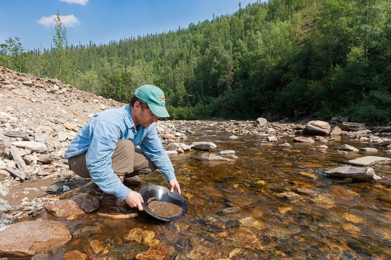
Yes. Collecting is supported at Sixmile Creek for placer gold, under the current rules of the site or land manager. Follow posted limits, fees and closures on the day you go.
- Materials: placer gold
- Managed by / source: U.S. Forest Service / Chugach National Forest
- County: Kenai Peninsula, Alaska
- Last checked:
LOCATION FIELD MAP
Local field map, land context & nearby records
This guide does not publish an exact primary coordinate. The map uses regional context and nearby mapped records without inventing a specimen pin.
Sixmile Creek — Recreational Gold Panning Area is a Ready rockhounding record in Kenai Peninsula, Alaska. The recorded activity or material is placer gold. The recorded manager or operating context is U.S. Forest Service / Chugach National Forest. Ready means the current evidence supports the modeled activity, but visitors should still recheck current posted rules, closures, hours, fees, claims, collecting limits and site-specific notices before travel.
Can I collect at Sixmile Creek — Recreational Gold Panning Area?
Ready. Current Forest Service guide identifies the withdrawn public reach of Sixmile Creek as available for recreational panning, with mechanized/suction dredging subject to separate seasonal permit rules.
Ready means the current evidence supports the modeled activity, but visitors should still recheck current posted rules, closures, hours, fees, claims, collecting limits and site-specific notices before travel.
Recorded destination: Sixmile Creek, Hope Highway, Alaska
What rocks, minerals, fossils or collecting interests are associated with it?
The record lists placer gold. This description is tied to this atlas entry and should be read together with the access status below.
Who manages the place or provides the evidence context?
The recorded manager or context is U.S. Forest Service / Chugach National Forest.
What evidence supports this status?
The record was last reviewed on 2026-08-30. Evidence and management context: U.S. Forest Service / Chugach National Forest. Current named Alaska collecting area passes the cited authority/access gates within its defined footprint.
Source verification: This guide names the recorded evidence or land-manager context but does not provide a direct document-level link establishing collecting permission. Before collecting, confirm the current rule and any applicable restrictions with the named authority.
How precise is the map marker?
Navigation uses the recorded public destination or address for Sixmile Creek — Recreational Gold Panning Area. The destination is a travel reference, not a specimen-level promise or a substitute for current access rules.
Checks specific to this location
- Confirm any current permit, fee, booking or operator requirements before travelling.
- Check current water, weather and access conditions, including any stream-specific collecting restrictions.
- Reconfirm openings, temporary closures and seasonal access with the land manager.
- Verify the exact destination, the land manager’s latest rules and safe travel conditions before leaving.
When was this information last checked?
The recorded review date is August 30, 2026. Treat that date as the evidence snapshot used for this classification. Conditions can change after review, so field decisions should use the newest posted rules and manager information.
Is a map pin the same as collecting permission?
No. A map pin answers a navigation or geographic-context question. The status and evidence answer the permission question. Exact coordinates, public destination addresses and approximate county or regional context are deliberately kept separate so geographic precision is not confused with legal authority.
Nearby cities: this place is about 80 miles from Anchorage, AK.
LOCATION-SPECIFIC FIELD ANSWER
Sixmile Creek — Recreational Gold Panning Area rockhounding: why this is a stronger field lead
The atlas currently classifies this record as Ready. That means the modeled activity has stronger supporting evidence than a Research-only pin, but current posted rules, claims, closures and site conditions still control the trip.
What rocks or minerals are associated with Sixmile Creek — Recreational Gold Panning Area?
The record associates this place with placer gold. That association is a field-research lead, not a guarantee that material can be found or legally collected at every point around the marker.
What should be checked before visiting?
The current manager or evidence context is U.S. Forest Service / Chugach National Forest. Verify that authority and the exact parcel or boundary before relying on access information. Ready means the current evidence supports the modeled activity, but visitors should still recheck current posted rules, closures, hours, fees, claims, collecting limits and site-specific notices before travel. The evidence snapshot was last checked 2026-08-30.
How should this record be used for “rockhounding near me”?
This record is eligible for the site’s Rockhounding Near Me planning layer because its status and geographic context meet the current eligibility rules.
COMMUNITY FIELD INTELLIGENCE
Public Testimony & Field Stories
Approved visitor reports add real-world context to the official and geological evidence above. Community testimony never overrides land-manager rules, ownership, claims, closures or protected-resource law.
Rocks, minerals and fossils from Alaska


Minerals recorded in Kenai Peninsula, Alaska
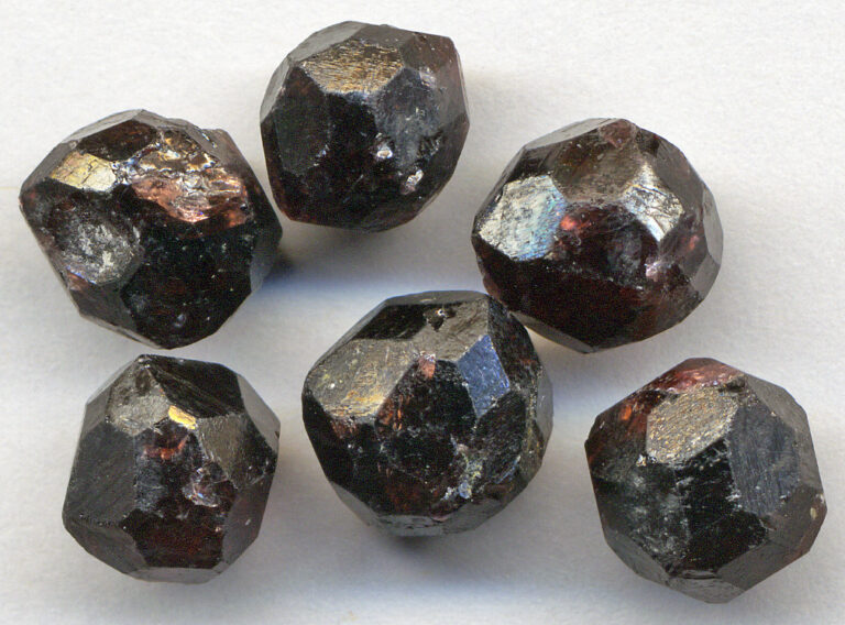
USGS topographic maps show 144 historical mine, quarry and pit features in Kenai Peninsula, mostly gravel pits, open pit mines, gravel/borrow pits. 15 of them link to a USGS Mineral Resources Data System site that names a commodity. The most common are gold, silver, lead, zinc, copper, sand and gravel.
Named USGS records in the county:
- Case Mine: gold, silver
- M.S. 31-2-398-1: sand and gravel
- Alaska Oracle: gold, lead, silver
These are historical mining and occurrence records for the county as a whole, not for this exact site. Source: USGS MRDS and USGS topographic-map mine features, compiled November 2026.