MONTANA INTERACTIVE FIELD MAP
Find Montana rockhounding sites, minerals, land context and claims
Use minerals, evidence status, coordinate precision and land/claim overlays together. A mineral occurrence is not automatically a public collecting site.
TRIP-READY SHORTLIST
Best-supported rockhounding sites in Montana
This ranking favors access evidence, exact coordinates, navigation availability, Near Me eligibility, review freshness and approved field reports. It is not a popularity ranking.
Ruby Reservoir — Garnet Shoreline
Almandine garnets
Gem Mountain Sapphire Mine
Sapphires
River of Gold — Structured Gold Panning Experience
Gold panning / educational paydirt
Gem Mountain Philipsburg — Downtown Sapphire Gravel Washing
sapphires in purchased mine gravel
Libby Creek Recreational Gold Panning Area
Gold
Terry Badlands WSA — Rock, Petrified Wood & Common Fossil Collecting
Common rocks, petrified wood, common invertebrate/plant fossils
Glendive Short Pines — BLM Rockhounding Context
Agates, common rocks and mineral specimens
Baisch’s Dinosaur Digs
Dinosaur fossils and petrified wood
Bannack State Park — Staff-Managed Education Gold Panning
Gold panning education
Crystal Park Picnic and Mineral Collection Area
Quartz, amethyst, smoky quartz crystals
MONTANA MINERAL DISCOVERY
What can you find rockhounding in Montana?
Montana’s map combines recreational collecting leads with geological research records. The sections below use the actual atlas inventory; counts describe records mentioning a material, not guaranteed legal collecting sites.
Montana sapphires
10 recordsSapphire is one of Montana’s defining gem interests. The atlas separates managed sapphire operations and stronger field leads from historic districts and research occurrences where present-day access is unresolved.
Use the map’s Sapphire filter, then compare Ready/Conditional status, manager context and coordinate precision before choosing a trip.
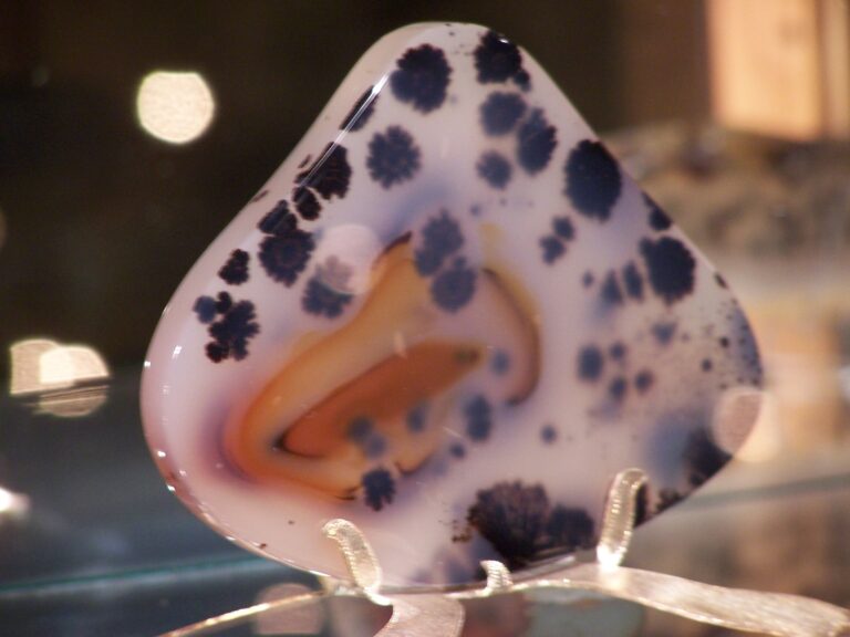
Montana moss agate & agate
7 recordsYellowstone River gravels and eastern Montana are central to Montana agate research. River access, private parcels, bridges, water level and local restrictions make exact access more important than simply locating agate-bearing geology.
Gold panning & placer gold
118 recordsMontana has extensive placer and hard-rock gold history, but historic mineralization does not equal recreational permission. Prioritize designated or managed panning opportunities and check active claims before disturbing material.
Garnet
4 recordsGarnet occurs in several southwest Montana contexts, including shoreline, metamorphic and managed collecting settings. The atlas ranks stronger access evidence ahead of general mineral occurrences.
Quartz, crystals & amethyst
6 recordsQuartz-rich districts are widespread, but mines, prospects and tailings can carry private-rights, claim, closure or safety issues. Use Exact-only and manager filters before treating a crystal lead as a field destination.
Fossils & petrified wood
16 recordsMontana is exceptionally important for paleontology, but fossil collection rules vary by land manager and fossil type. Protected parks and scientific localities should be treated as viewing/research contexts unless collecting is explicitly authorized.
LAND, CLAIMS & PERMISSION
Who controls the land matters more than the mineral pin
Use the map’s BLM Surface Management overlay and BLM MLRS non-closed mining-claims overlay as planning aids, then confirm the exact parcel, claim and current collecting rule with the responsible authority.
BLM land
BLM-managed land can support casual rockhounding in appropriate places, but withdrawals, special designations, active mining rights and local restrictions can override general expectations. Check the exact field office/unit and current claims.
National Forest / USFS
National Forest rules depend on material, amount, location and existing mineral rights. A Forest Service manager label is not automatic collecting permission; verify the specific forest/district and claim status.
Montana & state-managed land
State ownership does not by itself establish recreational collecting rights. State parks, trust lands and other state-managed parcels can have different purposes and rules.
Private / managed operations
Fee digs, guided operations and private mines are governed by operator access, season, reservation, safety and fee requirements. Use the current operator program rather than historic mine information.
NPS / protected areas
National parks and other protected units should be treated as observation/research contexts unless a current rule explicitly permits collection. Do not remove specimens merely because a mineral occurrence is mapped nearby.
Mining claims
The claims overlay shows BLM MLRS non-closed claim context. It is a screening layer, not a legal determination. Confirm current claim status, boundaries and surface ownership before collecting or prospecting.
WHEN TO GO
Montana rockhounding seasonal planner
Low-elevation shoulder season
Snowmelt, mud and closed mountain roads can limit access. Lower river valleys may open first, but runoff can make shoreline work difficult.
Spring access improves
Many lower and mid-elevation routes become usable. River levels may still be high, and thunderstorms or lingering snow affect mountain districts.
Best high-country access
High-elevation roads and collecting areas are generally most accessible, but heat, wildfire restrictions, smoke and afternoon storms become important trip factors.
Strong fall field window
Cooler temperatures and lower river levels can improve field conditions. Managed operations may begin seasonal closures and early snow can return quickly.
Winter research season
Many mountain and forest roads are snow-limited. Use winter for map research, access verification and low-elevation or managed indoor opportunities.
Montana field hazards to plan for
Remote roads, rapid weather changes, wildfire restrictions, cold water, high runoff, rattlesnakes in some lower-elevation areas and bear country in western/mountain regions all affect trip planning. Carry navigation, water, weather layers and a turnaround plan appropriate to the terrain.
MONTANA FIELD IDENTITY & KIT
Montana gems, fossils and a practical field kit
Montana recognizes agate and sapphire as official state gemstones, and Maiasaura as the state fossil. Those symbols reflect the state’s gem and paleontology reputation, but collecting legality still depends on the exact place.
River & agate kit
Use eye protection, gloves, sturdy footwear, a small hand lens, sample bags and waterproof labeling. River work also requires current water-level and access checks.
Sapphire / screening kit
For managed gravel-washing programs, follow operator equipment rules. Keep a hand lens, tweezers, secure specimen vials and good lighting for sorting concentrates.
Gold-panning kit
A pan, classifier, snuffer bottle and small vial are sufficient for many recreational settings. Mechanized tools, sluices or powered equipment can trigger different rules.
Crystal / hard-rock kit
Eye protection, gloves and hand tools matter more than heavy equipment. Never enter mine workings or assume tailings are open simply because minerals are visible.
Fossil field kit
Use a notebook, scale, camera and protective wrapping. Fossil rules vary sharply by land manager and fossil class; documentation can be more appropriate than removal.
Navigation & safety
Carry offline mapping, extra water, weather layers and emergency communication appropriate to remoteness. Save exact access points rather than relying on a mineral-occurrence pin.
COMMUNITY FIELD INTELLIGENCE
Recent Montana field reports
Approved visitor reports add current observations without automatically changing the site’s legal/access status.
Open any Montana location guide and use Share Your Story & Photos. Reports remain pending until admin approval.
EXPLORE MONTANA LOCALLY
Rockhounding near Montana cities
Use a city hub to move from statewide discovery into nearby rockhounding areas and then into individual location guides. City pages rank nearby records by status and distance while keeping USGS mineral occurrences separate from verified field leads.
Montana rockhounding regions and local areas
Regional pages group related geology and field opportunities without turning every mineral occurrence into a separate SEO page.
Montana location directory preview
Start with the strongest core records, then open the complete paginated Montana directory for all 281 records.
Bannack State Park — Staff-Managed Education Gold Panning
Gold panning education · Beaverhead
Crystal Park Picnic and Mineral Collection Area
Quartz, amethyst, smoky quartz crystals · Beaverhead
Calvert Hill Mine Area
Epidote, aquamarine, scheelite, garnet · Beaverhead
Lima Area Fossil Exposures
Marine fossils and geologic exposures · Beaverhead
Pryor Mountains / Bear Canyon — Agate Context
Bear Canyon agate, jasper and quartz context · Carbon / Big Horn
Baisch’s Dinosaur Digs
Dinosaur fossils and petrified wood · Dawson
Glendive Short Pines — BLM Rockhounding Context
Agates, common rocks and mineral specimens · Dawson
Yellowstone River Adventures — Guided Rockhounding Context
Montana moss agate / river rockhounding · Dawson
Makoshika State Park — Fossil Viewing Control
Dinosaur fossils and badlands geology · Dawson
Dry Cottonwood Creek Sapphire Context
Sapphires · Deer Lodge/Granite
Montana Agate Shack — Guided Yellowstone River Rockhounding
Montana moss agate and river gravels · Eastern Montana
Glacier National Park — Rock/Mineral Collection Control
Rocks and minerals · Flathead/Glacier
Montana Gems of Philipsburg — Flume Gem Mining
Sapphires and mixed gems · Granite
Sapphire Gallery — Indoor Sapphire Mining
Sapphires / prepared gravel · Granite
Gem Mountain Sapphire Mine
Sapphires · Granite
Rock Creek Sapphire District — Outside Structured Mine Programs
Sapphires and garnets · Granite
Cable Mountain — Historic Mineral Tailings
Scheelite and epidote · Granite/Deer Lodge
West of Georgetown Lake — Argillite/Quartzite
Argillite and quartzite · Granite/Deer Lodge
Boulder River / Bernice — Barite
Cubic barite crystals · Jefferson
Delmoe Lake Area — Quartz/Amethyst
Smoky quartz and amethyst · Jefferson
Yogo Gulch Sapphire Context
Yogo sapphires · Judith Basin
Montana Blue Jewel Mine
Sapphires · Lewis and Clark
Spokane Bar Sapphire Mine
Sapphires and associated gravel-bar gems · Lewis and Clark
Missouri River Sapphire Gravels — Helena Region
Sapphires · Lewis and Clark
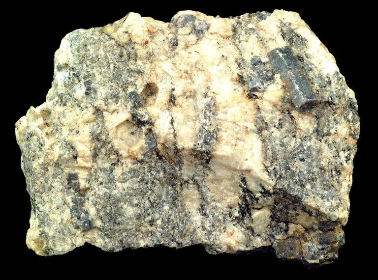
Rock and mineral reference images for
These are real reference photographs from the site media library, not photographs of the exact mapped sites. Always confirm mineral identity and collection permissions separately.