New Mexico · Sierra · Research only
Chloride / Black Range District
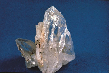 Material reference
LOCATION FIELD MAP
Local field map, land context & nearby records
No exact primary coordinate is published for this record, so the map uses regional context without inventing a specimen pin.
Chloride / Black Range District is a research-focused rockhounding record for Sierra, New Mexico. It is associated with lead/silver/manganese and associated minerals. The recorded research or management context is Gila NF/private historic mining district. Use this entry to understand locality and geological context, then resolve the exact parcel, ownership, access, mineral rights, safety and removal authority before treating any occurrence as a collecting site.
Can I collect at Chloride / Black Range District?
Research only. Abandoned mine closures and claims/safety prevent generic collecting recommendations.
Use this entry to understand locality and geological context, then resolve the exact parcel, ownership, access, mineral rights, safety and removal authority before treating any occurrence as a collecting site.
The current atlas status for Chloride / Black Range District is Research only. The record is retained because it provides useful place-specific geological, historical, mineral, fossil, or access context, but the evidence does not establish collecting authority for the exact site. The recorded explanation is: Abandoned mine closures and claims/safety prevent generic collecting recommendations. Use this entry to understand locality and geological context, then resolve the exact parcel, ownership, access, mineral rights, safety and removal authority before treating any occurrence as a collecting site. The relevant manager or evidence context is Gila NF/private historic mining district. Use this entry to identify the right parcel, manager, ownership, claim situation, access route, and current rule before deciding whether a lawful collecting opportunity exists.
What rocks, minerals, fossils or collecting interests are associated with it?
The record lists lead/silver/manganese and associated minerals. This description is tied to this atlas entry and should be read together with the access status below.
Who manages the place or provides the evidence context?
The recorded manager or context is Gila NF/private historic mining district.
What evidence supports this status?
The record was last reviewed on 2026-08-19. Evidence and management context: Gila NF/private historic mining district.
How precise is the map marker?
The map uses named-place or Sierra context for navigation. Resolve the exact site and current field authority before relying on the location for collecting decisions.
Recorded map precision: county-level context. Geographic context is not a collection-right or legal-boundary determination.
Checks specific to this location
- Stay out of unstable mine workings and inspect the access, ownership and safety restrictions from current official notices.
- Treat this record as research or viewing context unless the current authority explicitly confirms the proposed collecting activity.
- Verify the exact destination, the land manager’s latest rules and safe travel conditions before leaving.
When was this information last checked?
The recorded review date is August 19, 2026. Treat that date as the evidence snapshot used for this classification. Conditions can change after review, so field decisions should use the newest posted rules and manager information.
Is a map pin the same as collecting permission?
No. A map pin answers a navigation or geographic-context question. The status and evidence answer the permission question. Exact coordinates, public destination addresses and approximate county or regional context are deliberately kept separate so geographic precision is not confused with legal authority.
LOCATION-SPECIFIC FIELD ANSWER
What Chloride / Black Range District tells you about rockhounding in New Mexico
This is a Research record. It preserves useful geological or locality evidence while making clear that collecting authority has not been established.
What rocks or minerals are associated with Chloride / Black Range District?
The record associates this place with lead/silver/manganese and associated minerals. That association is a field-research lead, not a guarantee that material can be found or legally collected at every point around the marker.
What should be checked before visiting?
The current manager or evidence context is Gila NF/private historic mining district. Verify that authority and the exact parcel or boundary before relying on access information. Use this entry to understand locality and geological context, then resolve the exact parcel, ownership, access, mineral rights, safety and removal authority before treating any occurrence as a collecting site. The evidence snapshot was last checked 2026-08-19.
How should this record be used for “rockhounding near me”?
This record is not treated as a Ready Near Me collecting lead; use it as broader research or access context.
COMMUNITY FIELD INTELLIGENCE
Public Testimony & Field Stories
Approved visitor reports add real-world context to the official and geological evidence above. Community testimony never overrides land-manager rules, ownership, claims, closures or protected-resource law.