Conditional43.6 mi
Thermal City Gold Mine — Recreational Gold Prospecting
placer gold panning, sluicing, highbanking and managed prospecting
Core atlasNORTH CAROLINA LOCAL FIELD REGION
USFS mineral and rock research; claims, district restrictions and methods must be checked.
LOCAL INTERACTIVE MAP
Explore nearby North Carolina records without leaving this hub. Status, coordinate precision and access evidence determine whether a pin is a realistic field destination.
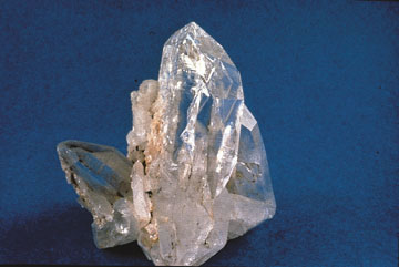
Reference photograph used for rock and mineral identification. It is not from this exact location or a guarantee that collecting is permitted.
The records below may represent collecting sites, managed programs, protected resources or research-only geology. Their individual status is more important than proximity.
placer gold panning, sluicing, highbanking and managed prospecting
Core atlasnative gems and minerals at operator-selected legal collecting localities
Core atlassmall quantities of widespread common rocks/minerals and possible low-impact prospecting
Core atlassmall quantities of widespread common rocks/minerals for personal noncommercial use
Core atlasChromium
USGS ResearchTungsten
USGS ResearchTungsten
USGS ResearchMineral resource occurrence
USGS ResearchMineral resource occurrence
USGS ResearchChromium
USGS ResearchMineral resource occurrence
USGS ResearchNickel, Chromium
USGS ResearchChromium, Nickel
USGS ResearchTungsten
USGS ResearchChromium
USGS ResearchMineral resource occurrence
USGS ResearchTungsten
USGS ResearchChromium
USGS ResearchTungsten
USGS ResearchTungsten
USGS ResearchTungsten
USGS ResearchMineral resource occurrence
USGS ResearchTungsten
USGS ResearchTungsten
USGS ResearchChromium, Nickel
USGS ResearchTungsten
USGS ResearchMineral resource occurrence
USGS ResearchMineral resource occurrence
USGS ResearchMineral resource occurrence
USGS ResearchMineral resource occurrence
USGS ResearchTungsten
USGS ResearchMineral resource occurrence
USGS ResearchMineral resource occurrence
USGS ResearchCopper, Lead, Zinc, Silver, Barite
USGS ResearchMineral resource occurrence
USGS ResearchMineral resource occurrence
USGS ResearchMineral resource occurrence
USGS ResearchMineral resource occurrence
USGS ResearchMineral resource occurrence
USGS ResearchMineral resource occurrence
USGS ResearchMineral resource occurrence
USGS ResearchMineral resource occurrence
USGS ResearchMineral resource occurrence
USGS ResearchMineral resource occurrence
USGS ResearchMineral resource occurrence
USGS ResearchMineral resource occurrence
USGS ResearchMineral resource occurrence
USGS ResearchMineral resource occurrence
USGS ResearchMolybdenum, Beryllium, Uranium
USGS ResearchMineral resource occurrence
USGS Research