Conditional25.0 mi
Rhode Island Private Quarry/Mineral Club Field Trips
quartz, feldspar, garnet, sulfides, metamorphic and quarry minerals
Core atlasRHODE ISLAND CITY ROCKHOUNDING HUB
Historic Westerly granite and southwest Rhode Island coastal geology.
LOCAL INTERACTIVE MAP
Explore nearby Rhode Island records without leaving this hub. Status, coordinate precision and access evidence determine whether a pin is a realistic field destination.
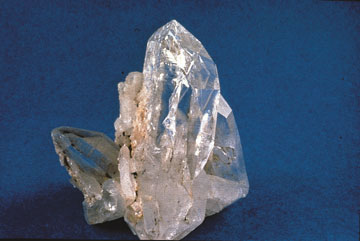
Reference photograph used for rock and mineral identification. It is not from this exact location or a guarantee that collecting is permitted.
This hub uses Westerly as a geographic base, while the material mix is calculated from the records actually mapped around it.
Records are ordered by evidence status first, then distance. Open the detailed guide before treating any pin as a trip destination.
quartz, feldspar, garnet, sulfides, metamorphic and quarry minerals
Core atlasquartz, jasper, chalcedony-like cobbles, hematite and glacial beach gravel
Core atlasMineral resource occurrence
USGS ResearchMineral resource occurrence
USGS ResearchMineral resource occurrence
USGS ResearchMineral resource occurrence
USGS ResearchMineral resource occurrence
USGS ResearchMineral resource occurrence
USGS ResearchMineral resource occurrence
USGS ResearchMineral resource occurrence
USGS ResearchMineral resource occurrence
USGS ResearchMineral resource occurrence
USGS ResearchMineral resource occurrence
USGS ResearchMineral resource occurrence
USGS ResearchMineral resource occurrence
USGS ResearchMineral resource occurrence
USGS ResearchMineral resource occurrence
USGS ResearchMineral resource occurrence
USGS ResearchMineral resource occurrence
USGS ResearchMineral resource occurrence
USGS ResearchMineral resource occurrence
USGS ResearchMineral resource occurrence
USGS ResearchMineral resource occurrence
USGS ResearchIron
USGS ResearchTitanium, Iron
USGS ResearchMineral resource occurrence
USGS ResearchMineral resource occurrence
USGS ResearchMineral resource occurrence
USGS ResearchMineral resource occurrence
USGS ResearchMineral resource occurrence
USGS ResearchMineral resource occurrence
USGS ResearchMineral resource occurrence
USGS ResearchMineral resource occurrence
USGS ResearchMineral resource occurrence
USGS ResearchMineral resource occurrence
USGS ResearchMineral resource occurrence
USGS ResearchMineral resource occurrence
USGS ResearchMineral resource occurrence
USGS ResearchMineral resource occurrence
USGS ResearchMineral resource occurrence
USGS ResearchMineral resource occurrence
USGS ResearchMineral resource occurrence
USGS Research